MyTopo
Saint Edward SW Nebraska US Topo Map
Couldn't load pickup availability
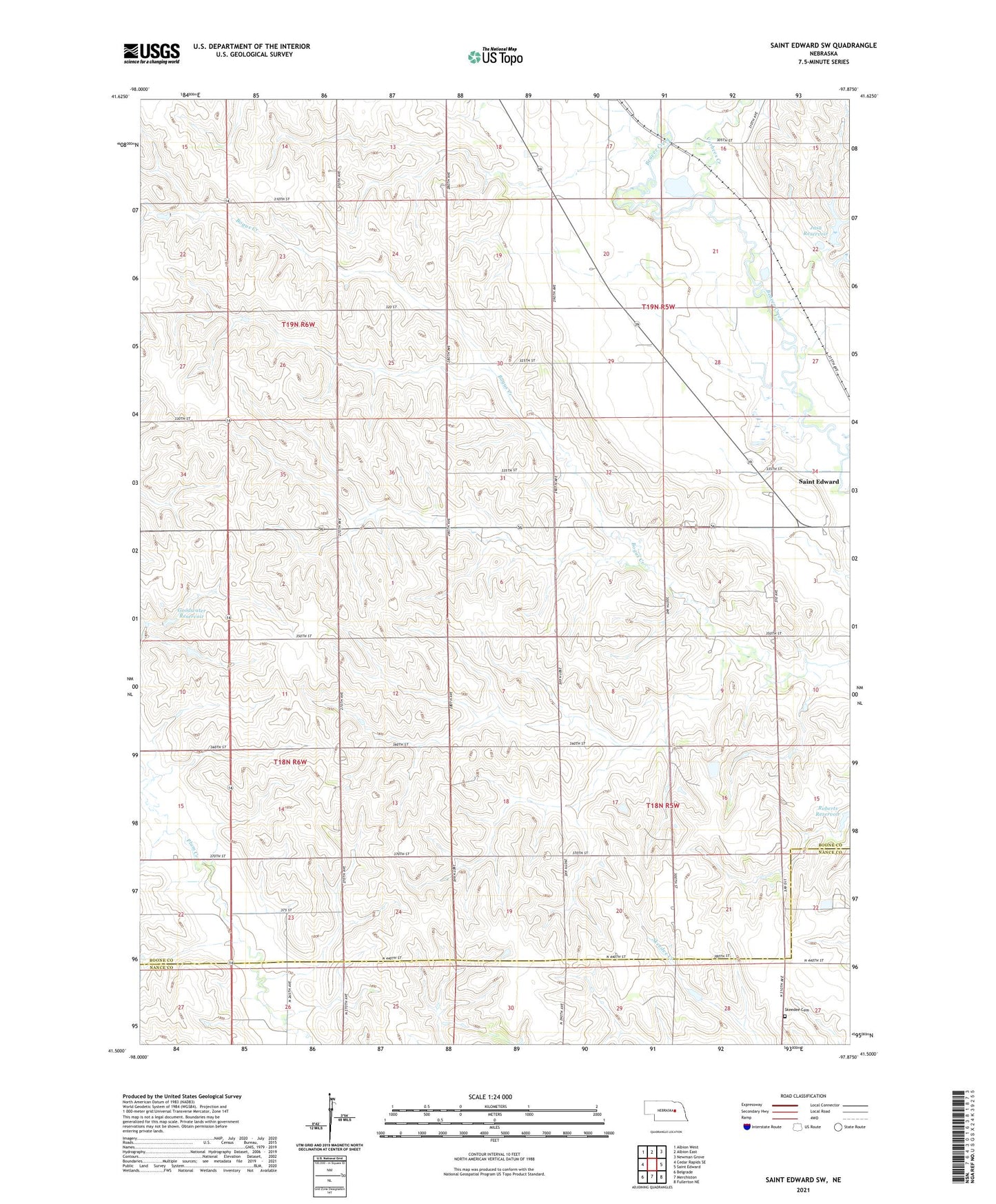
2021 topographic map quadrangle Saint Edward SW in the state of Nebraska. Scale: 1:24000. Based on the newly updated USGS 7.5' US Topo map series, this map is in the following counties: Boone, Nance. The map contains contour data, water features, and other items you are used to seeing on USGS maps, but also has updated roads and other features. This is the next generation of topographic maps. Printed on high-quality waterproof paper with UV fade-resistant inks.
Quads adjacent to this one:
West: Cedar Rapids SE
Northwest: Albion West
North: Albion East
Northeast: Newman Grove
East: Saint Edward
Southeast: Fullerton NE
South: Merchiston
Southwest: Belgrade
Contains the following named places: Beaver Bend State Wildlife Management Area, Beaver Election Precinct, Boone Election Precinct, Goodwater Dam, Goodwater Reservoir, Jasa Dam, Jasa Reservoir, Mount Echo Airport, Roberts Reservoir, School Number 26, School Number 32, School Number 5, School Number 54, School Number 66, Skeedee Cemetery, Sunnyside School, Vorhees Creek