MyTopo
Wayne Nebraska US Topo Map
Couldn't load pickup availability
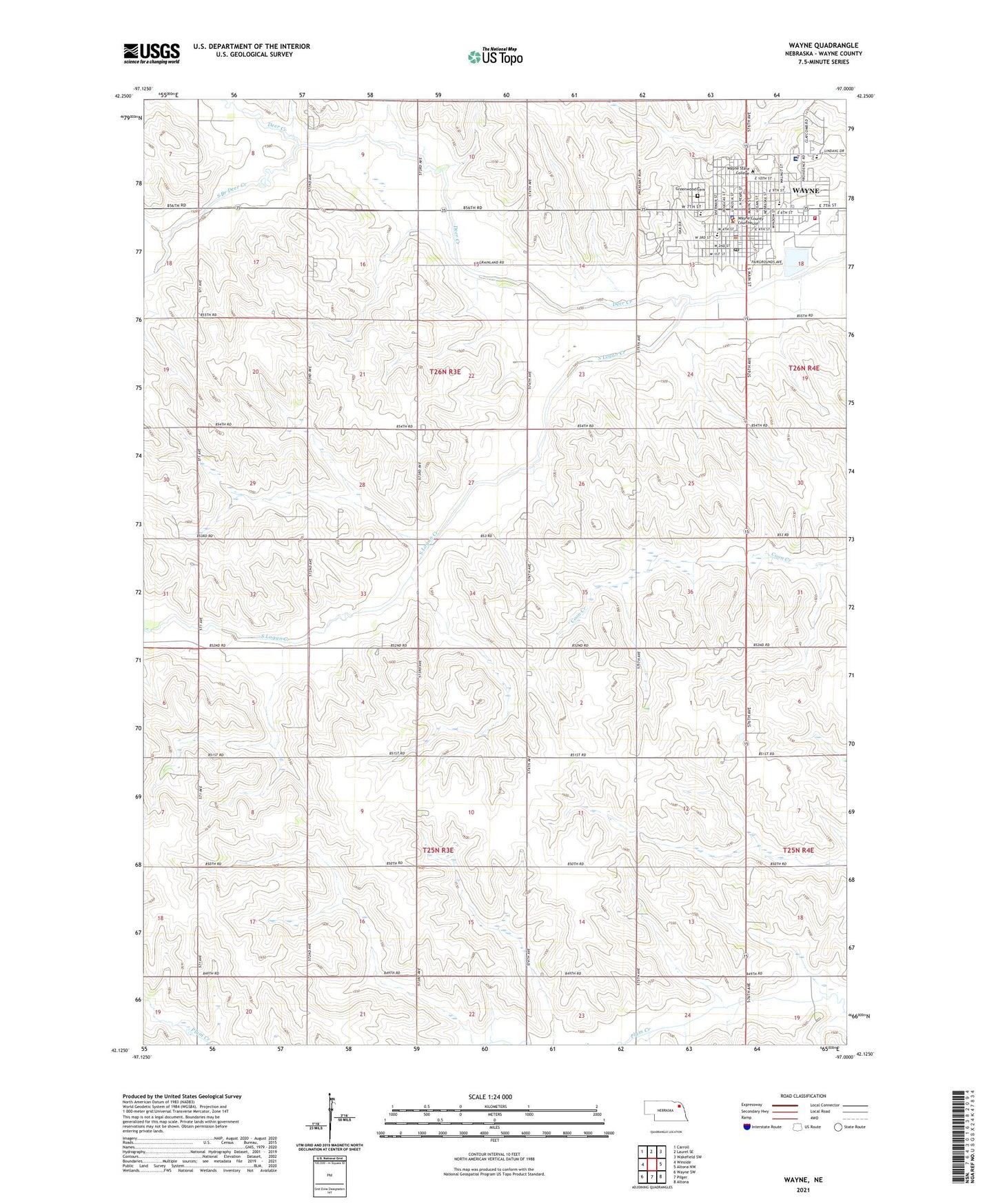
2021 topographic map quadrangle Wayne in the state of Nebraska. Scale: 1:24000. Based on the newly updated USGS 7.5' US Topo map series, this map is in the following counties: Wayne. The map contains contour data, water features, and other items you are used to seeing on USGS maps, but also has updated roads and other features. This is the next generation of topographic maps. Printed on high-quality waterproof paper with UV fade-resistant inks.
Quads adjacent to this one:
West: Winside
Northwest: Carroll
North: Laurel SE
Northeast: Wakefield SW
East: Altona NW
Southeast: Altona
South: Pilger
Southwest: Wayne SW
This map covers the same area as the classic USGS quad with code o42097b1.
Contains the following named places: Anderson Hall, Ashley Park, Benthack Hall, Berry Hall, Bowen Hall, Boy/Girl Scout Park, Brandenburg Hall, Brenna Election Precinct, Bressler Park, Calvary Bible Evangelical Free Church, Carhart Hall, Carlson Natatorium, City of Wayne, Conn Library, Connell Hall, Country Schoolhouse, Cunningham Field, Deer Creek, East Park, Faith Baptist Church, First Baptist Church, First Church of Christ, First Presbyterian Church, First United Methodist Church, Gardner Hall, Grace Lutheran Church, Greenhouse, Greenwood Cemetery, Hahn Building, Henry Victor Park, Heritage Plaza, Humanities Building, Kingdom Hall of Jehovahs Witnesses, KTCH-AM (Wayne), KTCH-FM (Wayne), KWSC-FM (Wayne), Memorial Stadium, Morey Hall, Nebraska Street Park, Neihardt Hall, Northeast Nebraska Medical Group, Old Power Plant, Our Savior Lutheran Church, Peterson Hall, Pile Hall, Praise Assembly of God Church, Providence Medical Center, Recreation Center, Rice Auditorium, Saint Marys Catholic Church, Saint Marys Elementary School, School Number 26, School Number 40, School Number 51, School Number 57, School Number 69, School Number 88, South Branch Deer Creek, Strahan Election Precinct, Student Center, Sunnyview Park, Swimming Pool and Tennis Court Park, Terrace Hall, Theophilus Church, Tower School, Township of Brenna, Township of Strahan, Victor Park Campground, Viken Park, Wayne, Wayne Care Center, Wayne County, Wayne County Courthouse, Wayne County Fairgrounds, Wayne County Museum, Wayne County Sheriff's Office, Wayne Dental Clinic, Wayne Grain and Feed Elevator, Wayne High School, Wayne Middle School, Wayne Police Department, Wayne Post Office, Wayne Public Library, Wayne Sport and Spine Clinic, Wayne State College, Wayne State College Historical Marker, Wayne Vision Center, Wayne Volunteer Fire Department, Wayne West Elementary School, Wessel and Burrows Dental Clinic, Willow Bowl, ZIP Code: 68787