MyTopo
West Point SE Nebraska US Topo Map
Couldn't load pickup availability
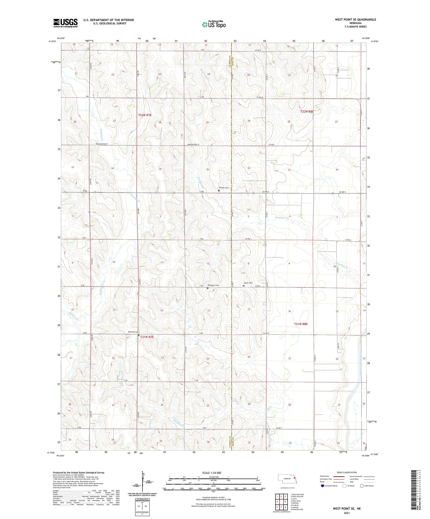
2021 topographic map quadrangle West Point SE in the state of Nebraska. Scale: 1:24000. Based on the newly updated USGS 7.5' US Topo map series, this map is in the following counties: Cuming, Burt. The map contains contour data, water features, and other items you are used to seeing on USGS maps, but also has updated roads and other features. This is the next generation of topographic maps. Printed on high-quality waterproof paper with UV fade-resistant inks.
Quads adjacent to this one:
West: West Point
Northwest: West Point NW
North: West Point NE
Northeast: Lyons
East: Oakland
Southeast: Nickerson NW
South: Uehling
Southwest: Scribner
Contains the following named places: Blomgren Cemetery, Peterson Cemetery, Peterson Creek, Pioneer Cemetery, Romberg Creek, Salem Cemetery, Salem Church, School Number 14, School Number 17, School Number 33, School Number 40, School Number 48, School Number 74, School Number 81, Township of Cuming, Township of Garfield, Township of Oakland, Township of Pershing, West Side Church, Willow Creek