MyTopo
Trail Canyon Nevada US Topo Map
Couldn't load pickup availability
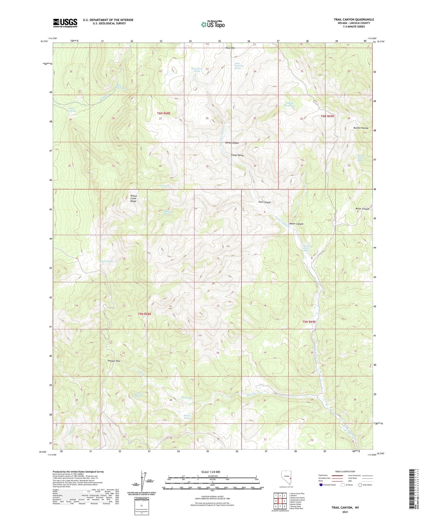
2021 topographic map quadrangle Trail Canyon in the state of Nevada. Scale: 1:24000. Based on the newly updated USGS 7.5' US Topo map series, this map is in the following counties: Lincoln. The map contains contour data, water features, and other items you are used to seeing on USGS maps, but also has updated roads and other features. This is the next generation of topographic maps. Printed on high-quality waterproof paper with UV fade-resistant inks.
Quads adjacent to this one:
West: Schoolmarm Basin
Northwest: Horse Corral Pass
North: Atlanta
Northeast: Rosencrans Knolls
East: Miller Canyon
Southeast: Buck Wash Well
South: Parsnip Peak
Southwest: Mount Wilson
This map covers the same area as the classic USGS quad with code o38114c3.
Contains the following named places: Adams Reservoir, Bailey Number Two, Bailey Springs, Big Jack Ranch, Cedarhurst, Cedarhurst Post Office, Donahue Ranch, Hammond Ranch Spring, Headwaters Spring, Horse Canyon, Lost Trail Spring, Lucky Mine, Mahogany Spring, Meadow Springs, Mullen Hollow Spring, Pine Creek, Pine Springs, Pioneer Pass, Table Mountain, Table Mountain Spring, Trail Canyon, Tunnel Spring, Vicks Spring, Water Canyon