MyTopo
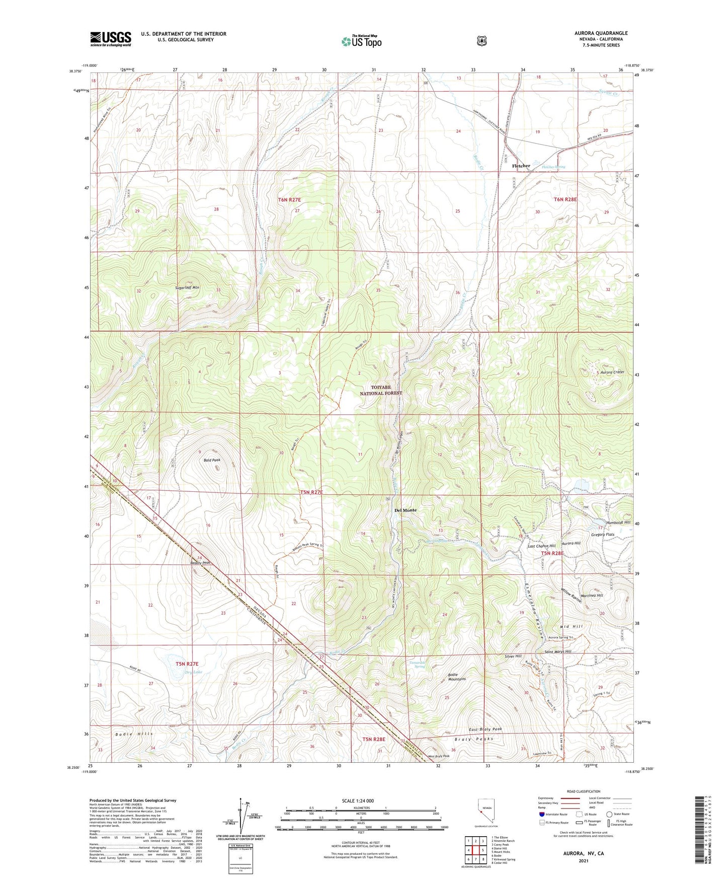
Aurora Nevada US Topo Map
Couldn't load pickup availability
2021 topographic map quadrangle Aurora in the states of California, Nevada. Scale: 1:24000. Based on the newly updated USGS 7.5' US Topo map series, this map is in the following counties: Mineral, Mono. The map contains contour data, water features, and other items you are used to seeing on USGS maps, but also has updated roads and other features. This is the next generation of topographic maps. Printed on high-quality waterproof paper with UV fade-resistant inks.
Quads adjacent to this one:
West: Dome Hill
Northwest: The Elbow
North: Ninemile Ranch
Northeast: Corey Peak
East: Mount Hicks
Southeast: Cedar Hill
South: Kirkwood Spring
Southwest: Bodie
Contains the following named places: Antelope Mill, Aurora, Aurora Crater, Aurora Creek, Aurora Hill, Aurora Mill, Aurora Post Office, Aurora Tunnel, Bald Peak, Barrel Spring, Beauty Peak, Braly Peaks, Chesco Mine, China Camp, Del Monte, Del Monte Canyon, Dry Lake, East Braly Peak, Esmeralda, Esmeralda Mill, Esmeralda Post Office, Esmeralda Ravine, Esmeralda Tunnel, Evergreen Ranch, Five Mile House, Fletcher, Fletcher Post Office, Fletcher Spring, Gibbons Mill, H Harris Mill, Horatio Tunnel, Humboldt Hill, Illinois Tunnel, Juanita Tunnel, Junction House, Last Chance Hill, Mangum, Martinez Hill, Martinez Tunnel, Middle Hill, Montezuma Tunnel, Montreal Tunnel, Moses Mill, Napa Mill, National Tunnel, Pine Creek Mill, Pioneer Mill, Popper Mine, Saint Marys Hill, Silver Hill, Spring Ranch, Sugarloaf Mountain, Sunny Side Ranch, Tamarack Spring, Teese and Company Mill, Temple Chace Ranch, Union Mill, Union Tunnel, Verdi Vista Ranch, West Braly Peak, Willow Ravine