MyTopo
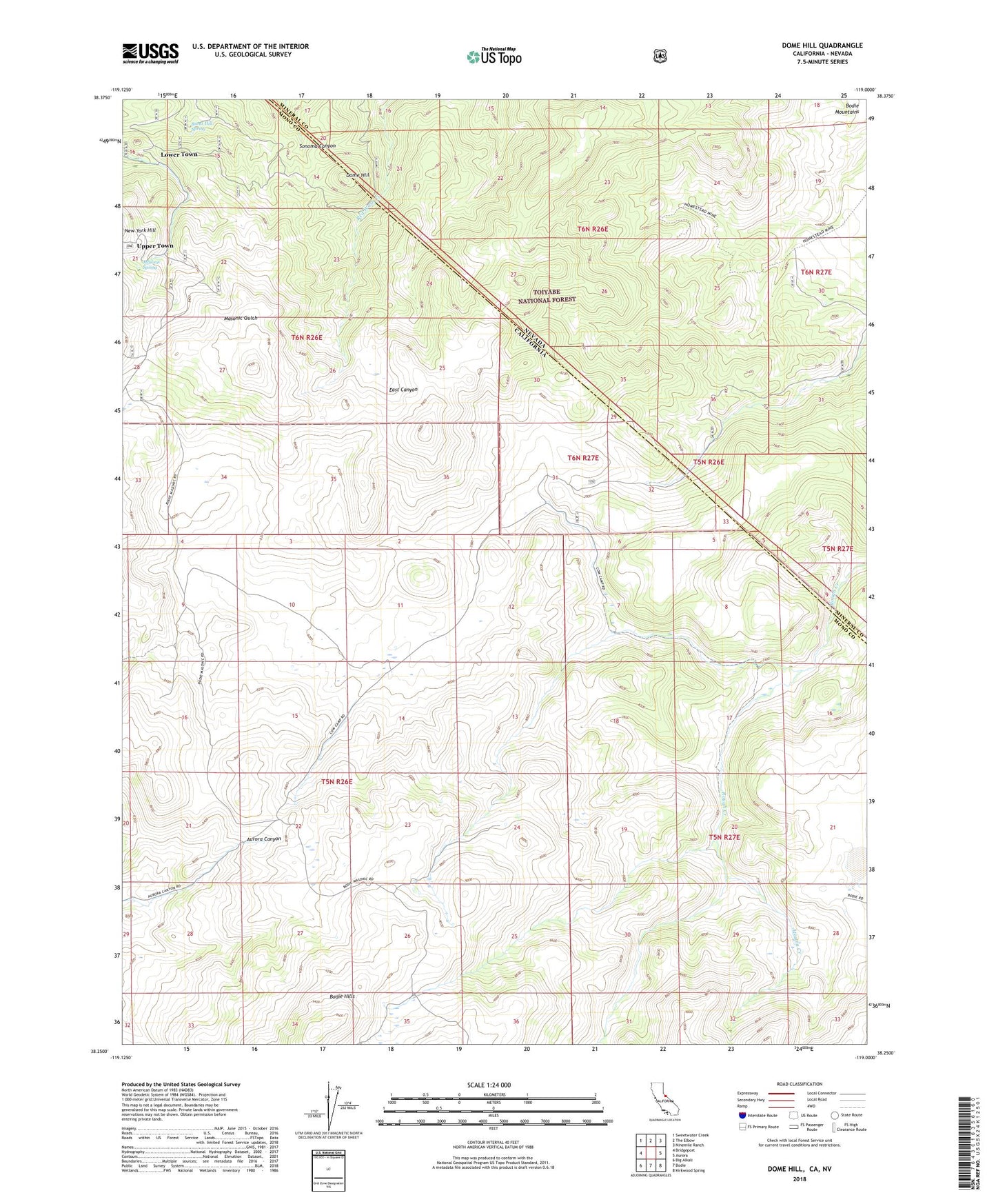
Dome Hill California US Topo Map
Couldn't load pickup availability
Also explore the Dome Hill Forest Service Topo of this same quad for updated USFS data
2021 topographic map quadrangle Dome Hill in the states of California, Nevada. Scale: 1:24000. Based on the newly updated USGS 7.5' US Topo map series, this map is in the following counties: Mono, Mineral. The map contains contour data, water features, and other items you are used to seeing on USGS maps, but also has updated roads and other features. This is the next generation of topographic maps. Printed on high-quality waterproof paper with UV fade-resistant inks.
Quads adjacent to this one:
West: Bridgeport
Northwest: Sweetwater Creek
North: The Elbow
Northeast: Ninemile Ranch
East: Aurora
Southeast: Kirkwood Spring
South: Bodie
Southwest: Big Alkali
Contains the following named places: Atastra Creek, Bridgeport Ranger District, Burnt Hill Spring, Chinese Camp, Dome Hill, Dry Lake, Halfway Camp, Hefler Tungsten Mine, Homestead Mine, Lower Town, Masonic, Masonic Spring, Maybell Mine, Mellor Mine, Paramount Mine, Perrini Mine, Pittsburg Liberty Mine, Upper Town