MyTopo
Middle Point Nevada US Topo Map
Couldn't load pickup availability
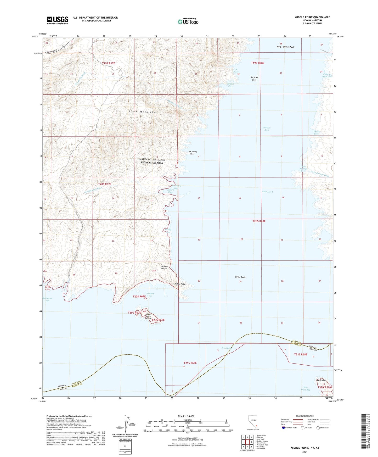
2021 topographic map quadrangle Middle Point in the states of Nevada, Arizona. Scale: 1:24000. Based on the newly updated USGS 7.5' US Topo map series, this map is in the following counties: Clark, Mohave. The map contains contour data, water features, and other items you are used to seeing on USGS maps, but also has updated roads and other features. This is the next generation of topographic maps. Printed on high-quality waterproof paper with UV fade-resistant inks.
Quads adjacent to this one:
West: Boulder Canyon
Northwest: Bitter Spring
North: Echo Bay
Northeast: Lime Wash
East: Garrett Butte
Southeast: The Temple
South: Bonelli Bay
Southwest: Petroglyph Wash
This map covers the same area as the classic USGS quad with code o36114b4.
Contains the following named places: Boathouse Cove, Bonelli Salt Mine, Bonellis House, Brine Spring, Cataract Wash, Cataract Wash Cove, Catclaw Cove, Catclaw Wash, Cleopatra Cove, Cleopatra Mine, Cleopatra Wash, Cormorant Rock, Crescent Cove, Debbies Cove, East Point, East Point Bay, Ebony cove, Horseshoe Cove, Jim Jones Reef, Jimbilnan Wilderness, Kendal Cove, Kitty Coleman Rock, Lake Mead, Manganese Wash, Middle Point, Middle Point Islands, Miners Cove, Old Bonelli Ferry, Rioville, Rioville Post Office, S Cove, Salt Well, Stone Ferry, Surprise Reef, Twin Springs Cove, Twin Springs Wash, Virgin Basin, Virgin River