MyTopo
Echo Bay Nevada US Topo Map
Couldn't load pickup availability
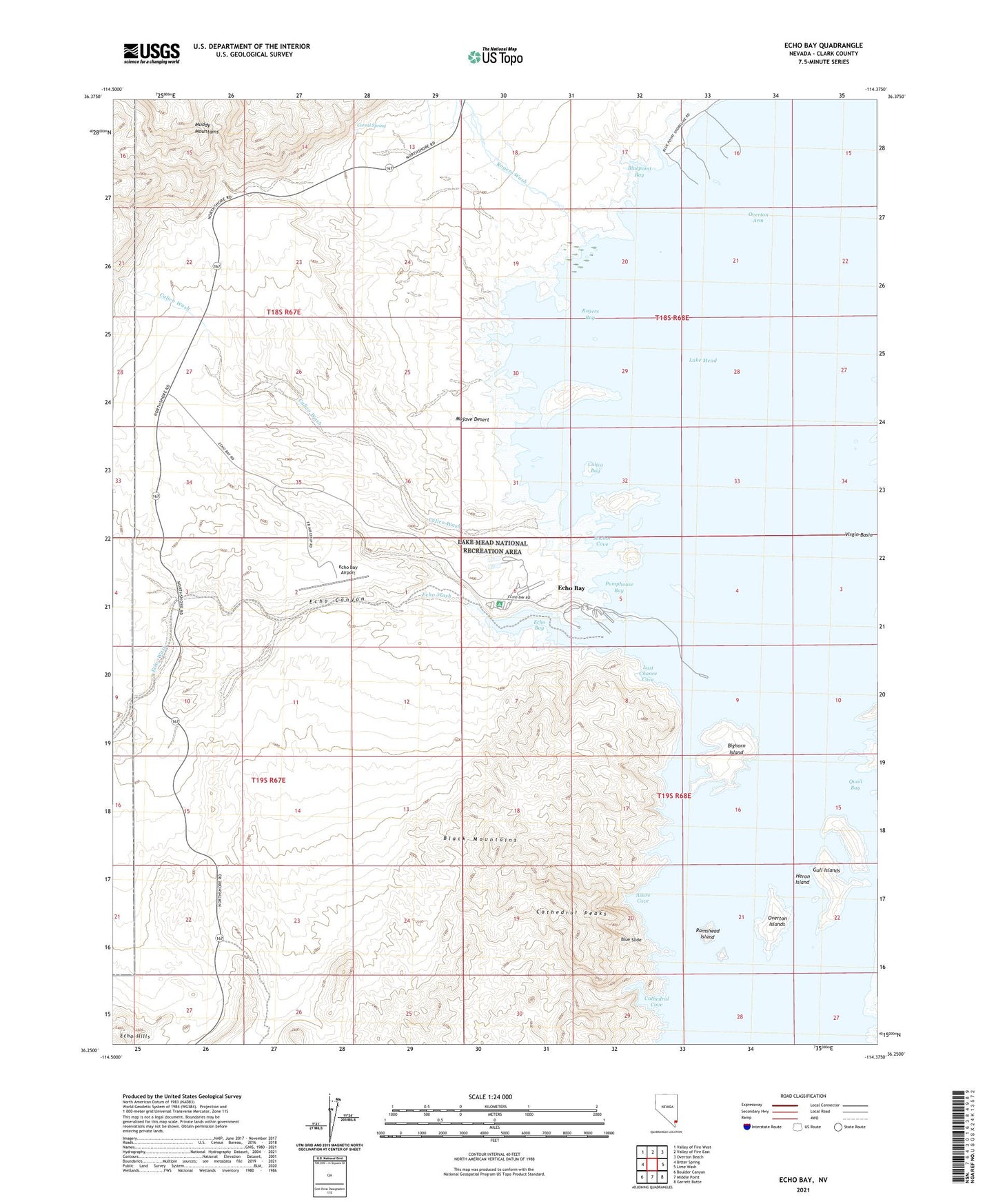
2021 topographic map quadrangle Echo Bay in the state of Nevada. Scale: 1:24000. Based on the newly updated USGS 7.5' US Topo map series, this map is in the following counties: Clark. The map contains contour data, water features, and other items you are used to seeing on USGS maps, but also has updated roads and other features. This is the next generation of topographic maps. Printed on high-quality waterproof paper with UV fade-resistant inks.
Quads adjacent to this one:
West: Bitter Spring
Northwest: Valley of Fire West
North: Valley of Fire East
Northeast: Overton Beach
East: Lime Wash
Southeast: Garrett Butte
South: Middle Point
Southwest: Boulder Canyon
This map covers the same area as the classic USGS quad with code o36114c4.
Contains the following named places: Anchor Cove, Azure Cove, Bighorn Island, Black Salt Mine, Blue Slide, Bluepoint Bay, Boulder Canyon Wild Life Refuge, Calico Bay, Calico Salt Mine, Calico Wash, Cathedral Cove, Cathedral Peaks, Corral Spring, Echo Bay, Echo Bay Airport, Echo Canyon, Echo Wash, Fairview Salt Mine, Gull Islands, Gunsight, Heron Island, Last Chance Cove, Lower Narrows, Meat Hole, Overton Arm, Overton Islands, Pumphouse Bay, Ramshead Island, Rogers Bay, Rogers Wash, Virgin River Mining District