MyTopo
Hays Canyon Nevada US Topo Map
Couldn't load pickup availability
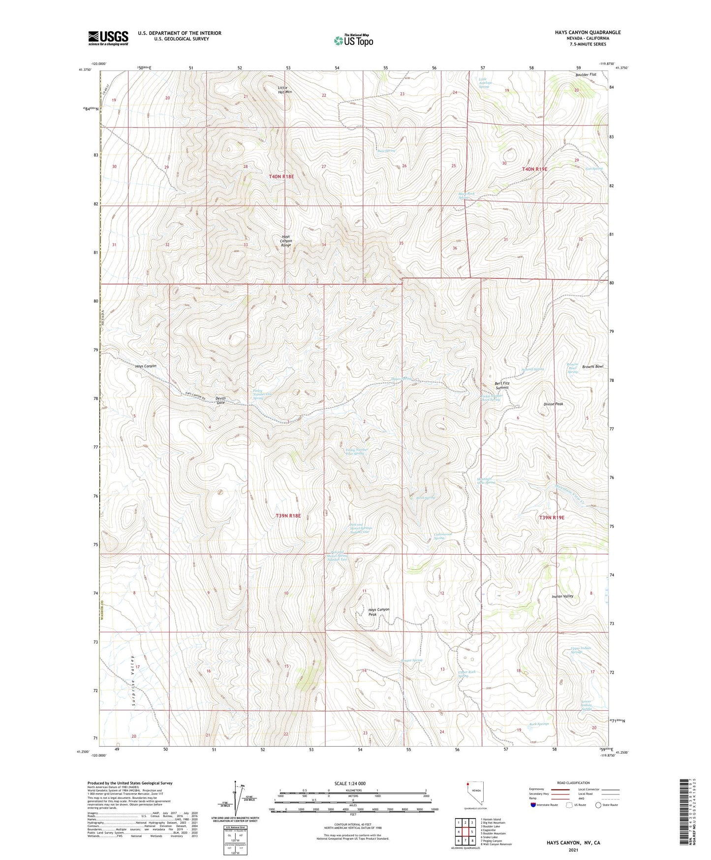
2021 topographic map quadrangle Hays Canyon in the state of Nevada. Scale: 1:24000. Based on the newly updated USGS 7.5' US Topo map series, this map is in the following counties: Washoe, Modoc. The map contains contour data, water features, and other items you are used to seeing on USGS maps, but also has updated roads and other features. This is the next generation of topographic maps. Printed on high-quality waterproof paper with UV fade-resistant inks.
Quads adjacent to this one:
West: Eagleville
Northwest: Hansen Island
North: Big Hat Mountain
Northeast: Boulder Lake
East: Boulder Mountain
Southeast: Wall Canyon Reservoir
South: Pegleg Canyon
Southwest: Snake Lake
This map covers the same area as the classic USGS quad with code o41119c8.
Contains the following named places: Bert Fitz Summit, Birch Spring, Black Rock Spring, Bregar Spring, Browns Bowl, Browns Bowl Spring, Buzz Spring, Cottonwood Spring, Devils Gate, Divine Peak, Finley Number Four Spring, Finley Number One Spring, Finley Number Three Spring, Hayes Spring, Hays Canyon, Hays Canyon Peak, Hays Canyon Range, Indian Pole Camp, Little Antelope Spring, Little Hat Mountain, Lower Indian Spring, Mountain View Spring, Pick and Shovel Spring Number Two, Pick and Shovel Springs Number One, Rock Springs, Summit Spring, Tom Spring, Upper Indian Springs, Upper Rock Spring