MyTopo
Pegleg Canyon Nevada US Topo Map
Couldn't load pickup availability
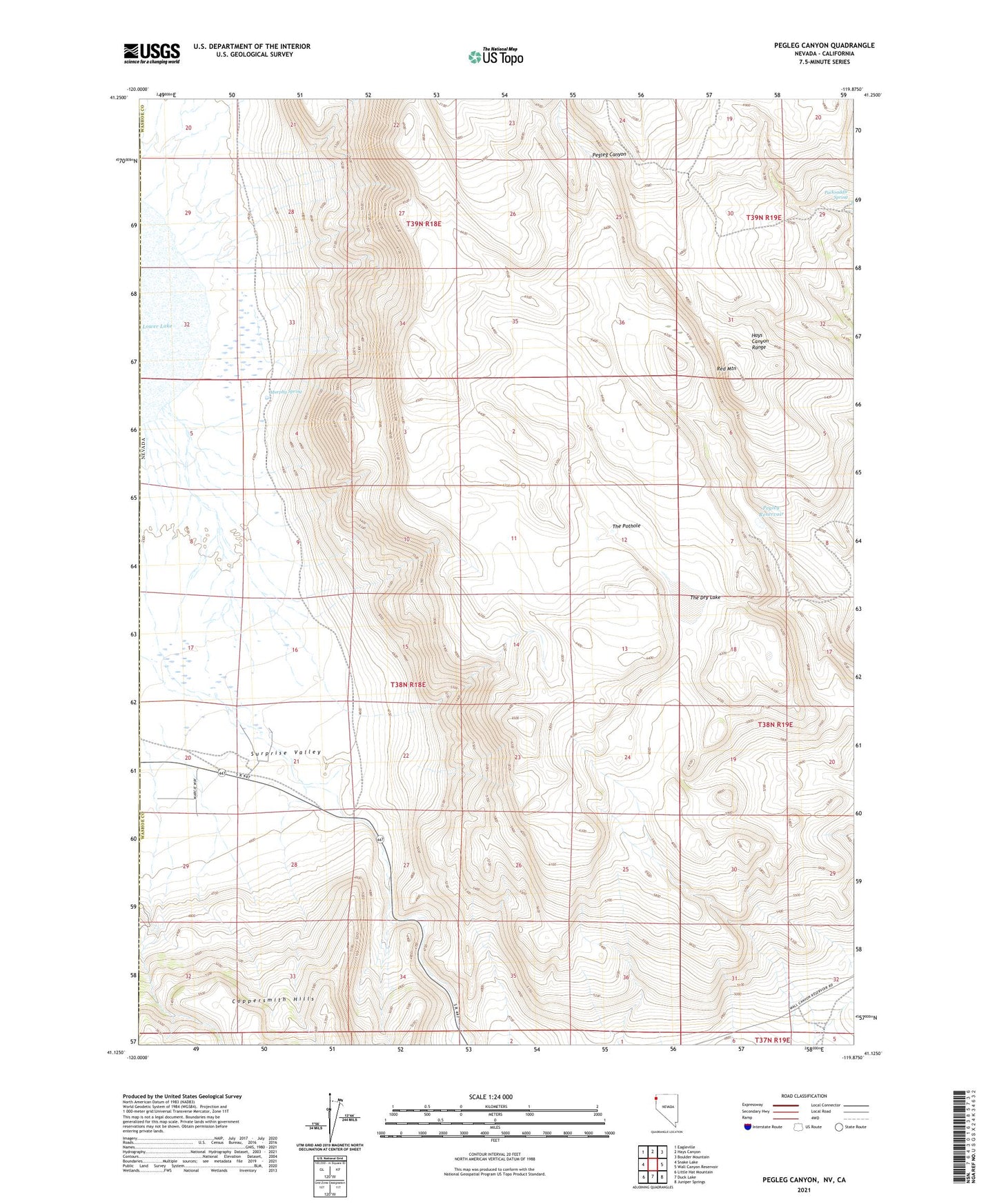
2021 topographic map quadrangle Pegleg Canyon in the state of Nevada. Scale: 1:24000. Based on the newly updated USGS 7.5' US Topo map series, this map is in the following counties: Washoe, Modoc, Lassen. The map contains contour data, water features, and other items you are used to seeing on USGS maps, but also has updated roads and other features. This is the next generation of topographic maps. Printed on high-quality waterproof paper with UV fade-resistant inks.
Quads adjacent to this one:
West: Snake Lake
Northwest: Eagleville
North: Hays Canyon
Northeast: Boulder Mountain
East: Wall Canyon Reservoir
Southeast: Juniper Springs
South: Duck Lake
Southwest: Little Hat Mountain
This map covers the same area as the classic USGS quad with code o41119b8.
Contains the following named places: Hausen, Hausen Post Office, Murphy Ranch, Murphy Spring, Packsaddle Spring, Pegleg Reservoir, Red Mountain, Reederville, Surprise Valley, The Dry Lake, The Pothole