MyTopo
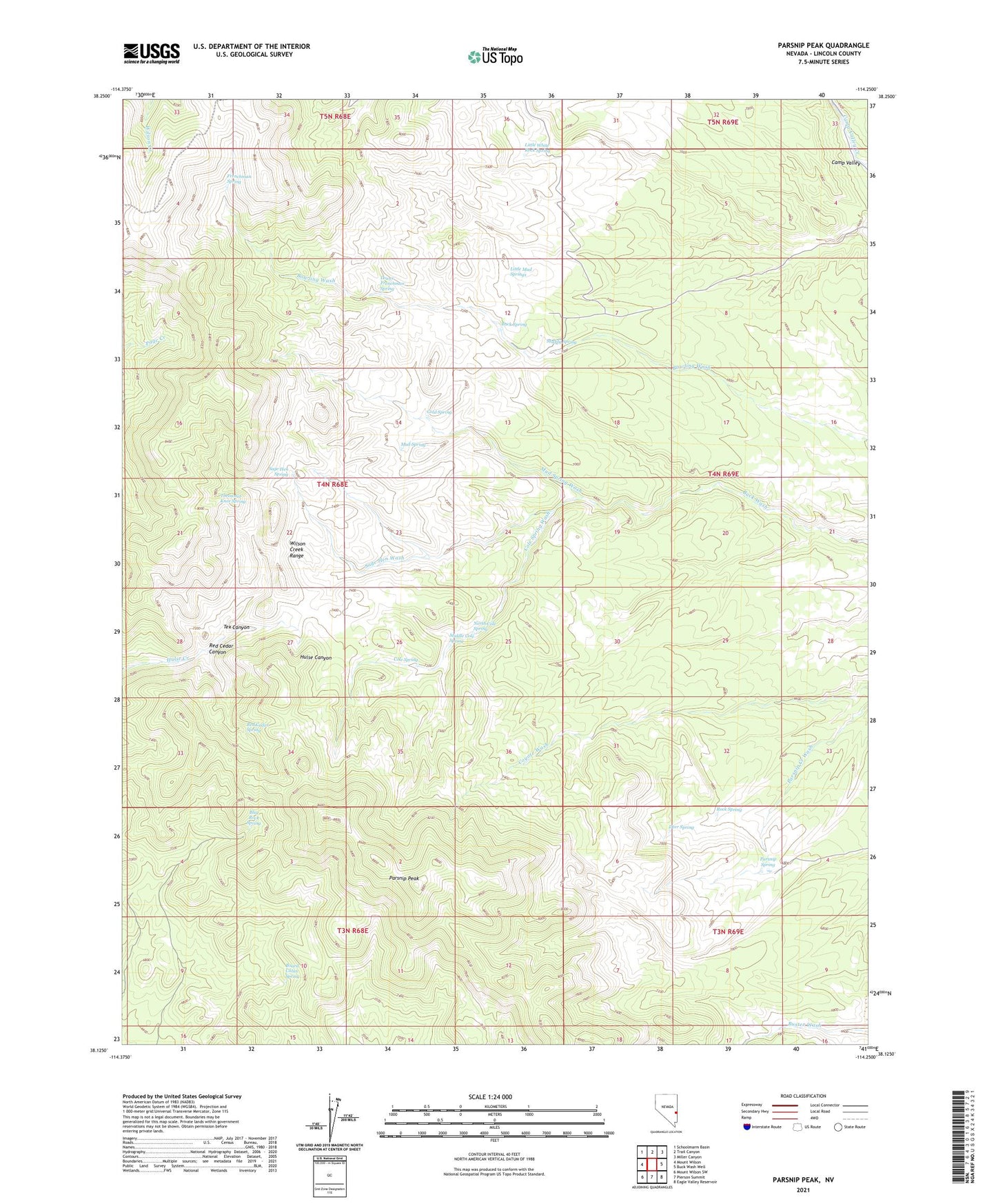
Parsnip Peak Nevada US Topo Map
Couldn't load pickup availability
2021 topographic map quadrangle Parsnip Peak in the state of Nevada. Scale: 1:24000. Based on the newly updated USGS 7.5' US Topo map series, this map is in the following counties: Lincoln. The map contains contour data, water features, and other items you are used to seeing on USGS maps, but also has updated roads and other features. This is the next generation of topographic maps. Printed on high-quality waterproof paper with UV fade-resistant inks.
Quads adjacent to this one:
West: Mount Wilson
Northwest: Schoolmarm Basin
North: Trail Canyon
Northeast: Miller Canyon
East: Buck Wash Well
Southeast: Eagle Valley Reservoir
South: Pierson Summit
Southwest: Mount Wilson SW
This map covers the same area as the classic USGS quad with code o38114b3.
Contains the following named places: Blue Rock Spring, Board Cabin Spring, Buck Spring, Buckhorn Ranch, Cold Spring, Cole Spring, Cole Spring Wash, Deer Spring, Frenchman Spring, Hollinger Mine, Little Mud Springs, Little White Rock Spring, Lower Frenchman Spring, Middle Cole Spring, Mud Spring, Mud Spring Wash, Muddy Spring, North Cole Spring, Parsnip Peak, Parsnip Peak Wilderness, Parsnip Spring, Red Cedar Canyon, Red Cedar Spring, Rock Spring, Sage Hen Spring, Sage Hen Wash, Tex Canyon, Throwout Knee Spring, Wilson Creek Range