MyTopo
Thatcher Spring Nevada US Topo Map
Couldn't load pickup availability
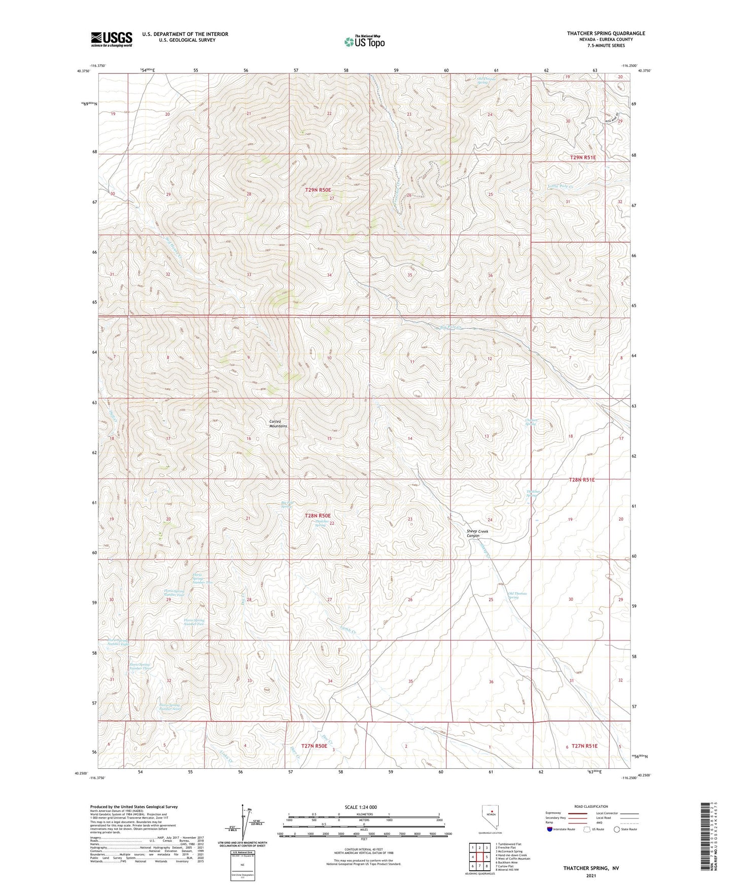
2021 topographic map quadrangle Thatcher Spring in the state of Nevada. Scale: 1:24000. Based on the newly updated USGS 7.5' US Topo map series, this map is in the following counties: Eureka. The map contains contour data, water features, and other items you are used to seeing on USGS maps, but also has updated roads and other features. This is the next generation of topographic maps. Printed on high-quality waterproof paper with UV fade-resistant inks.
Quads adjacent to this one:
West: Hand-me-down Creek
Northwest: Tumbleweed Flat
North: Frenchie Flat
Northeast: McCormack Spring
East: West of Coffin Mountain
Southeast: Mineral Hill NW
South: Curlow Flat
Southwest: Buckhorn Mine
This map covers the same area as the classic USGS quad with code o40116c3.
Contains the following named places: Big Pole Spring, Chicken Spring, Cortez Mountains, Florio Spring Number Eight, Florio Spring Number Five, Florio Spring Number Four, Florio Spring Number Seven, Florio Spring Number Three, Florio Spring Number Two, Hall Ranch, Indian Ranch, Modarelli Mines, Modarelli-Frenchie Creek Mining District, Old Thomas Spring, Sheep Creek Canyon, Sod House Ranch, Thatcher Spring