MyTopo
Fallon Nevada US Topo Map
Couldn't load pickup availability
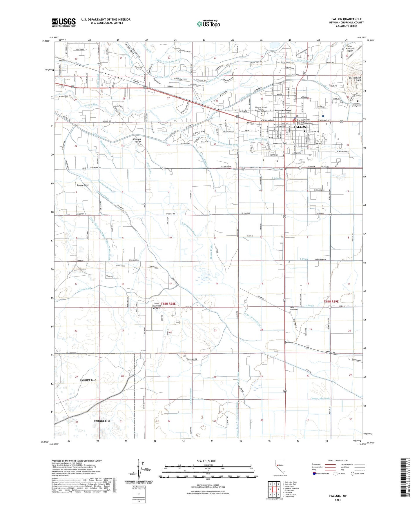
2021 topographic map quadrangle Fallon in the state of Nevada. Scale: 1:24000. Based on the newly updated USGS 7.5' US Topo map series, this map is in the following counties: Churchill. The map contains contour data, water features, and other items you are used to seeing on USGS maps, but also has updated roads and other features. This is the next generation of topographic maps. Printed on high-quality waterproof paper with UV fade-resistant inks.
Quads adjacent to this one:
West: Sheckler Reservoir
Northwest: Soda Lake West
North: Soda Lake East
Northeast: Indian Lakes
East: Grimes Point
Southeast: Carson Lake
South: South of Fallon
Southwest: Salt Cave
This map covers the same area as the classic USGS quad with code o39118d7.
Contains the following named places: A Line Canal, Banner Churchill Community Hospital, Churchill County Cemetery, Churchill County Courthouse, Churchill County High School, Churchill County Middle School, Churchill County Regional Park, Churchill County Sheriff's Office, City of Fallon, Coleman Diversion Dam, Cottage Elementary School, Darrow Field, Discovery Learning Center, E C Best Elementary School, E C Best Junior High School, E Line Canal, Fallon, Fallon / Churchill Volunteer Fire Department Station 1, Fallon / Churchill Volunteer Fire Department Station 2, Fallon / Churchill Volunteer Fire Department Station 3, Fallon City Hall, Fallon City Police Department, Fallon Division, Fallon Municipal Airport, Fallon Paiute-Shoshone Colony, Fallon Post Office, Fallon Seventh Day Adventist School, Fallon Southwest Airpark, Frontier Village Shopping Center, Gummow Drain, Island City, Island City Post Office, KVCE-FM (Fallon), KVLV-AM (Fallon), KVLV-FM (Fallon), L D Drain, L Line Canal, L2 Drain, Lahontan Elementary School, Lahontan Valley Alternative High School, Logos Christain Academy, Lone Tree School, Magee Station, Mills Drain, Nevada Highway Patrol Northern Command West Fallon, New River Extension Branch Drain, New River Township, Newland Field Station - University of Nevada, Northside Elementary School, Numa Elementary School, Oats Park, Oats Park School, Old River Station, Pony Express Post Office, Rattlesnake Hill, Saint Clair, Saint Clair Cemetery, Saint Clair Post Office, Saint Clair School, Saint Clair Station, Saint Clair Station Post Office, Sheckler 1 Drain, Sheckler Community Center, Sheckler Drain, South Upper Soda Lake Drain, Thoma Drain, Union School, Upper Soda Lake 1 Drain, Upper Soda Lake Drain, West End Elementary School, Westside Baptist Church School, Westside Drain