MyTopo
Gordon Creek Nevada US Topo Map
Couldn't load pickup availability
Also explore the Gordon Creek Forest Service Topo of this same quad for updated USFS data
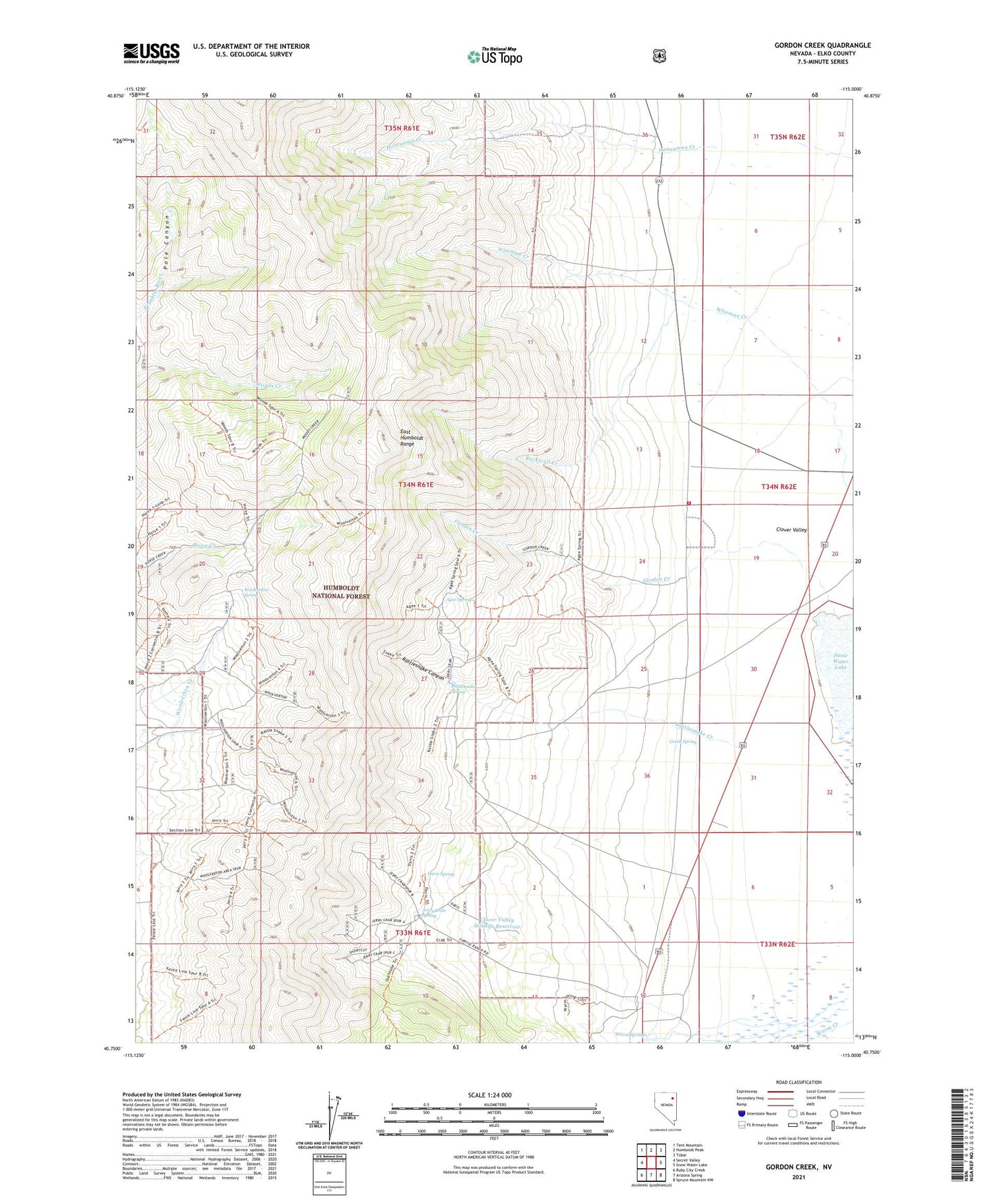
2021 topographic map quadrangle Gordon Creek in the state of Nevada. Scale: 1:24000. Based on the newly updated USGS 7.5' US Topo map series, this map is in the following counties: Elko. The map contains contour data, water features, and other items you are used to seeing on USGS maps, but also has updated roads and other features. This is the next generation of topographic maps. Printed on high-quality waterproof paper with UV fade-resistant inks.
Quads adjacent to this one:
West: Secret Valley
Northwest: Tent Mountain
North: Humboldt Peak
Northeast: Tobar
East: Snow Water Lake
Southeast: Spruce Mountain NW
South: Arizona Spring
Southwest: Ruby City Creek
This map covers the same area as the classic USGS quad with code o40115g1.
Contains the following named places: Agee Spring, Brough Ranch, Clover, Clover Valley Post Office, Clover Valley Volunteer Fire Department, Clover Valley Wildlife Reservoir, Davis Spring, Gordon Creek, Gordon Creek Fire Guard, Greek Spring, Jerry Crab Spring, Rattlesnake Canyon, Rattlesnake Creek, Rattlesnake Spring, Rockwall Creek, Steele Ranch, Warm Creek Ranch, Warm Springs, Wells Division, Woolverton Spring