
MyTopo
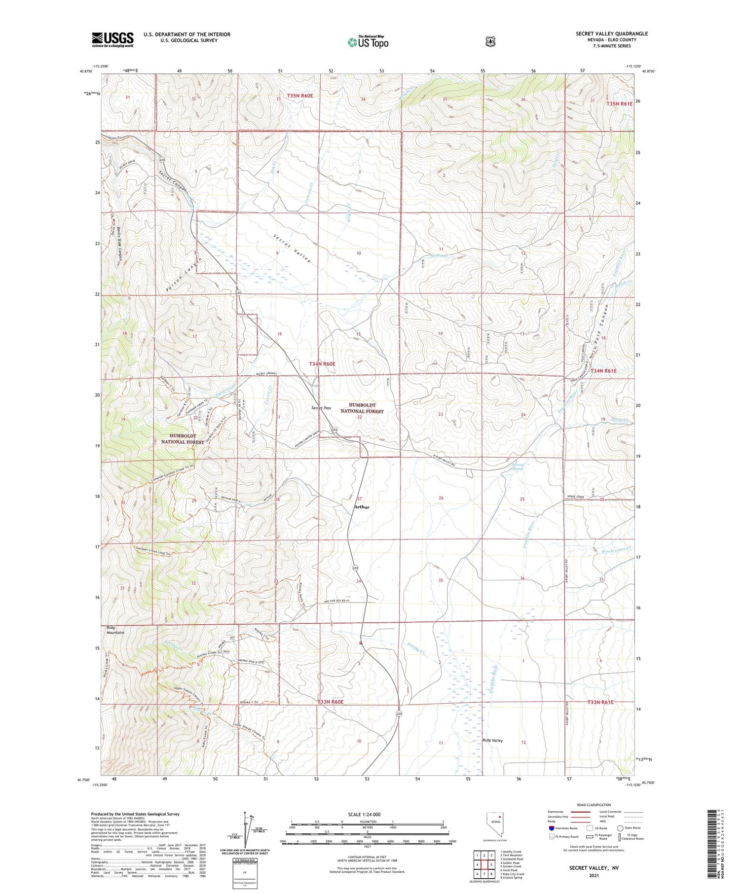
Secret Valley Nevada US Topo Map
Couldn't load pickup availability
Also explore the Secret Valley Forest Service Topo of this same quad for updated USFS data
2021 topographic map quadrangle Secret Valley in the state of Nevada. Scale: 1:24000. Based on the newly updated USGS 7.5' US Topo map series, this map is in the following counties: Elko. The map contains contour data, water features, and other items you are used to seeing on USGS maps, but also has updated roads and other features. This is the next generation of topographic maps. Printed on high-quality waterproof paper with UV fade-resistant inks.
Quads adjacent to this one:
West: Soldier Peak
Northwest: Heelfly Creek
North: Tent Mountain
Northeast: Humboldt Peak
East: Gordon Creek
Southeast: Arizona Spring
South: Ruby City Creek
Southwest: Verdi Peak
This map covers the same area as the classic USGS quad with code o40115g2.
Contains the following named places: Arthur, Arthur Post Office, Covert Creek, Cow Hollow, Devils Slide Canyon, Dry Creek, Duval Ranch, Gardner Creek, Horse Creek, Humboldt Pass, Krenka Creek, Lemons Creek, Murphy Ranch, North Ruby Valley School, Persons Spring, Poison Canyon, Pole Canyon, Ruby Valley Fire Station, Secret, Secret Pass, Secret Post Office, Secret Valley, Woods Creek, Woolverton Creek, Wright Creek


