MyTopo
Holloway Meadows Nevada US Topo Map
Couldn't load pickup availability
Also explore the Holloway Meadows Forest Service Topo of this same quad for updated USFS data
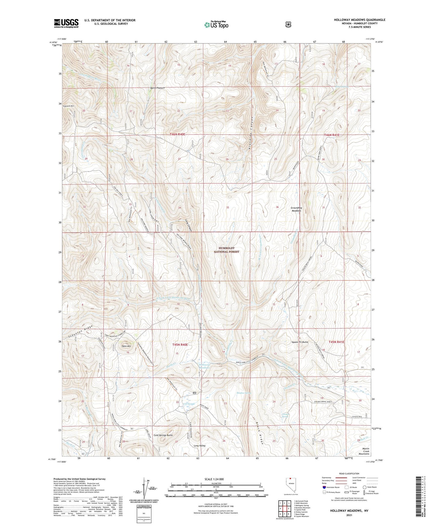
2023 topographic map quadrangle Holloway Meadows in the state of Nevada. Scale: 1:24000. Based on the newly updated USGS 7.5' US Topo map series, this map is in the following counties: Humboldt. The map contains contour data, water features, and other items you are used to seeing on USGS maps, but also has updated roads and other features. This is the next generation of topographic maps. Printed on high-quality waterproof paper with UV fade-resistant inks.
Quads adjacent to this one:
West: Buckskin Mountain
Northwest: McConnell Peak
North: Odell Mountain
Northeast: Mahogany Spring
East: Capitol Peak
Southeast: Coyote Mountain
South: Black Ridge
Southwest: Hinkey Summit
This map covers the same area as the classic USGS quad with code o41117g4.
Contains the following named places: Benard Spring, Chicken Creek, Chicken Spring, Cold Springs, Cold Springs Butte, Cottonwood Creek, Groundhog Creek, Groundhog Meadows, Holloway Meadows, Long Canyon, Meadow Spring, Quinn Pasture, Siard Cabin, Siard Creek, Squaw Tit Butte, Stocks Creek, Table Mountain, West Fork Groundhog Creek