
MyTopo
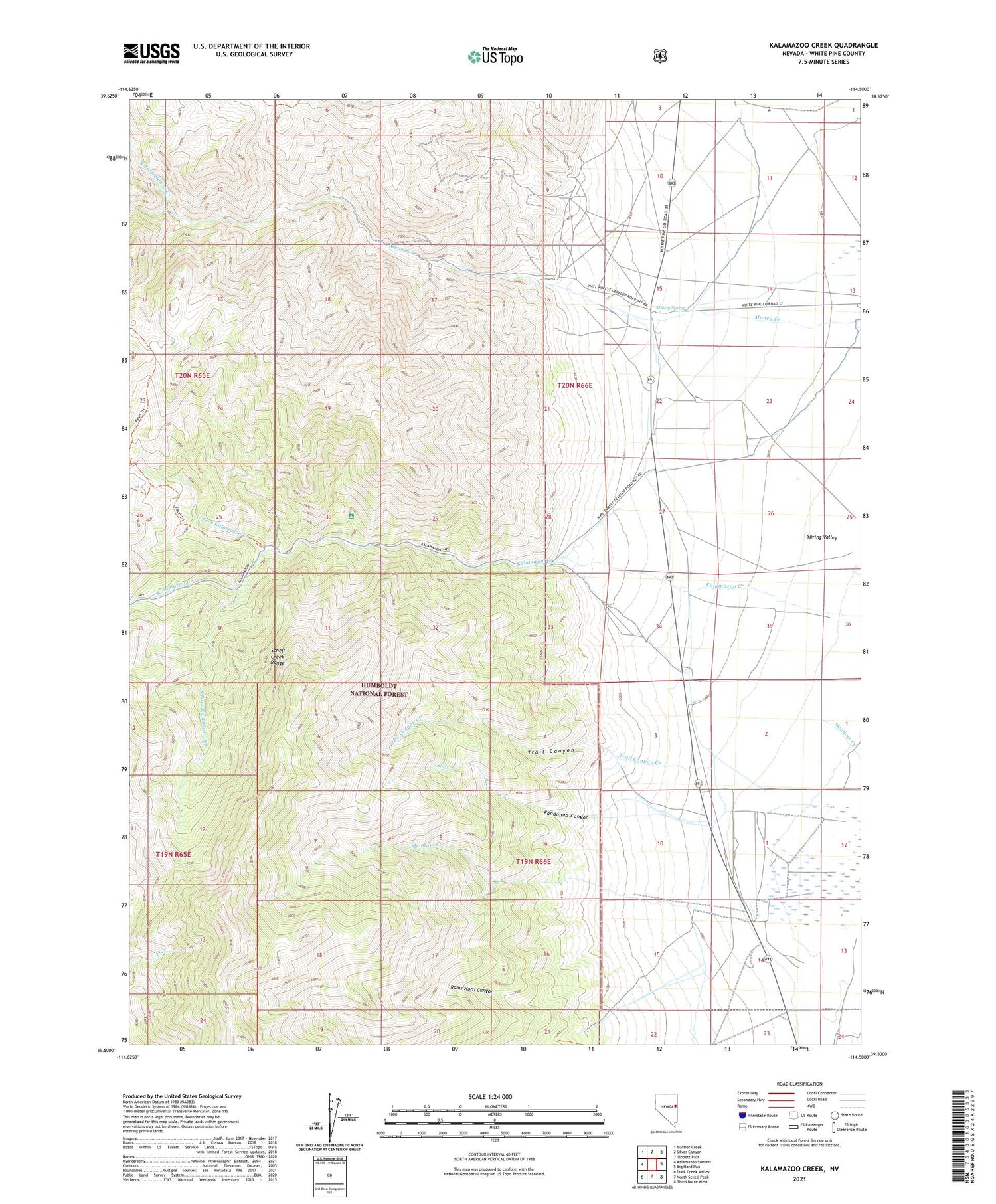
Kalamazoo Creek Nevada US Topo Map
Couldn't load pickup availability
Also explore the Kalamazoo Creek Forest Service Topo of this same quad for updated USFS data
2021 topographic map quadrangle Kalamazoo Creek in the state of Nevada. Scale: 1:24000. Based on the newly updated USGS 7.5' US Topo map series, this map is in the following counties: White Pine. The map contains contour data, water features, and other items you are used to seeing on USGS maps, but also has updated roads and other features. This is the next generation of topographic maps. Printed on high-quality waterproof paper with UV fade-resistant inks.
Quads adjacent to this one:
West: Kalamazoo Summit
Northwest: Mattier Creek
North: Silver Canyon
Northeast: Tippett Pass
East: Big Hard Pan
Southeast: Third Butte West
South: North Schell Peak
Southwest: Duck Creek Valley
This map covers the same area as the classic USGS quad with code o39114e5.
Contains the following named places: Amargosa Mine, Defiance Mine, Eldridge Ranch, Fandango Canyon, Faun Trail, Grand Deposit, Grand Deposit Mine, Kalamazoo Campground and Picnicking Site, Kansas Mine, Meadow Creek, Meadow Creek Ranch, Muncy, Muncy Creek Mine, Muncy Post Office, Muncy Spring, North Creek, North Fork Kalamazoo Creek, North Fork Muncy Creek, Rams Horn Canyon, South Fork Kalamazoo Creek, Trail Canyon, Trail Canyon Creek


