MyTopo
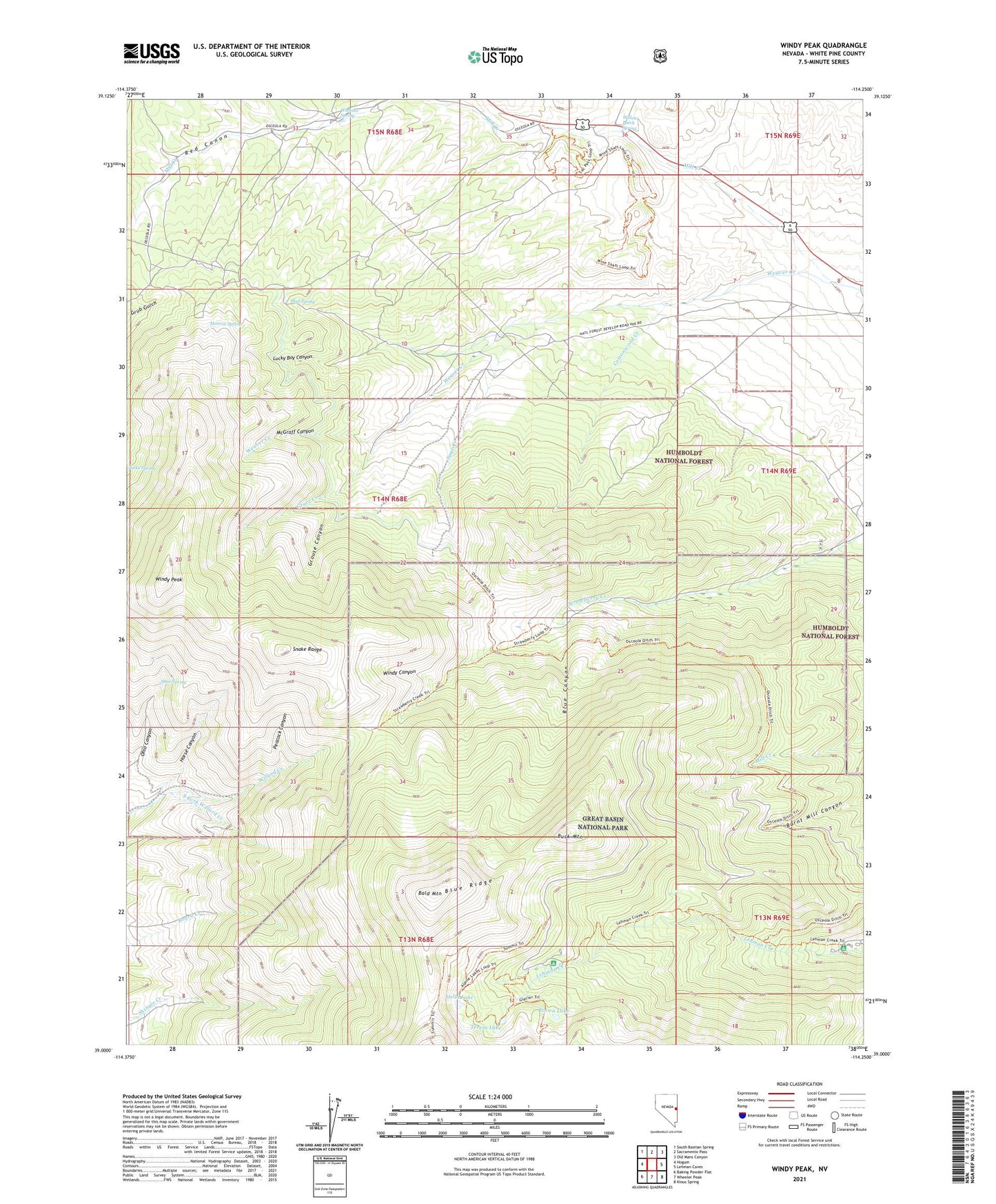
Windy Peak Nevada US Topo Map
Couldn't load pickup availability
Also explore the Windy Peak Forest Service Topo of this same quad for updated USFS data
2021 topographic map quadrangle Windy Peak in the state of Nevada. Scale: 1:24000. Based on the newly updated USGS 7.5' US Topo map series, this map is in the following counties: White Pine. The map contains contour data, water features, and other items you are used to seeing on USGS maps, but also has updated roads and other features. This is the next generation of topographic maps. Printed on high-quality waterproof paper with UV fade-resistant inks.
Quads adjacent to this one:
West: Hogum
Northwest: South Bastian Spring
North: Sacramento Pass
Northeast: Old Mans Canyon
East: Lehman Caves
Southeast: Kious Spring
South: Wheeler Peak
Southwest: Baking Powder Flat
This map covers the same area as the classic USGS quad with code o39114a3.
Contains the following named places: Bald Mountain, Black Mule Mine, Blue Canyon, Blue Ridge, Board Creek, Brown Lake, Buck Mountain, Cottonwood Creek, Crescent Mine, Cumberland Mine, Dirty Shirt Mine, Exchange Mine, Grace Creek, Grouse Canyon, Horse Canyon, Lehman Creek Campground and Trailhead, Lucky Boy Canyon, Mathis Ranch, McGraff Canyon, Mill Creek, Monroe Spring, Mud Spring, Ohio Canyon, Ohio Spring, Osceola Ditch Point of Interest, Osceola Mining District, Pea Ridge Mine, Peacock Canyon, Peak View Point, Red Canon, Sage Creek, San Pedro, Sanpedro Post Office, Seren View Point, Solace Loop, South Fork Willard Creek, Star Mine, Stella Lake, Summit Diggings, Teresa Lake, The Willows, Three Sisters Mine, Time Check Mine, Watkins Spring, Wheeler Peak Campground, Willow Patch Spring, Windy Canyon, Windy Peak