MyTopo
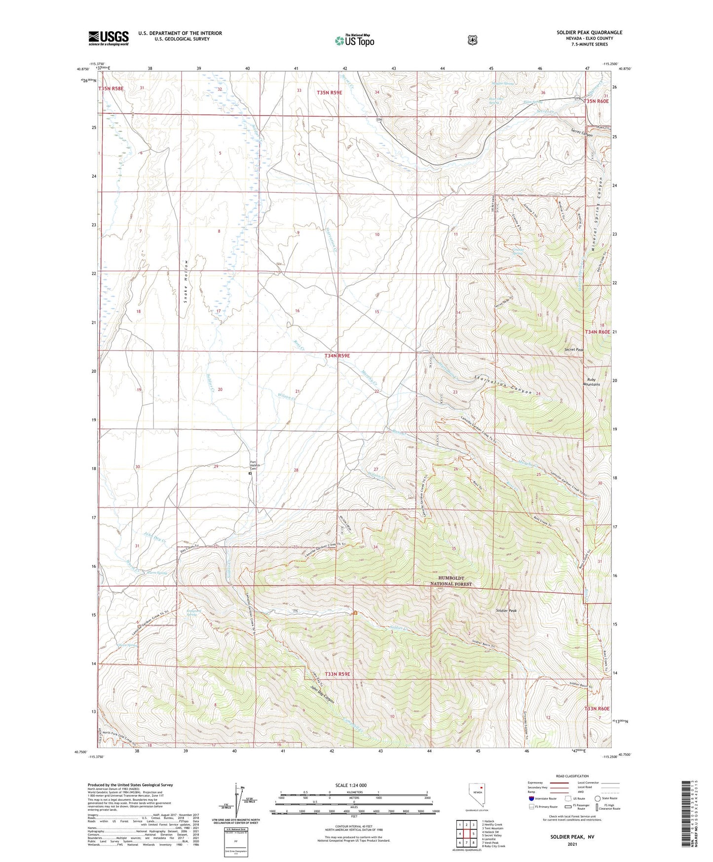
Soldier Peak Nevada US Topo Map
Couldn't load pickup availability
Also explore the Soldier Peak Forest Service Topo of this same quad for updated USFS data
2021 topographic map quadrangle Soldier Peak in the state of Nevada. Scale: 1:24000. Based on the newly updated USGS 7.5' US Topo map series, this map is in the following counties: Elko. The map contains contour data, water features, and other items you are used to seeing on USGS maps, but also has updated roads and other features. This is the next generation of topographic maps. Printed on high-quality waterproof paper with UV fade-resistant inks.
Quads adjacent to this one:
West: Halleck SW
Northwest: Halleck
North: Heelfly Creek
Northeast: Tent Mountain
East: Secret Valley
Southeast: Ruby City Creek
South: Verdi Peak
Southwest: Lamoille
This map covers the same area as the classic USGS quad with code o40115g3.
Contains the following named places: Camp Halleck, Campbell Creek, Chevallier Ranch, Dorsey Creek, Emigrant Spring, Fort Halleck Cemetery, Fort Halleck Historical Marker, Fort Halleck Post Office, Gheen Spring, Granite Spring, Hoot Owl Spring, John Day Canyon, Magpie Spring, Middle Fork Cold Creek, Mineral Spring Canyon, Mineral Springs Creek, Murphy Creek, North Fork Cold Creek, Old Camp Halleck Military Reservation, Ross Creek, Ryan Spring, Secret Canyon, Secret Peak, Snake Hollow, Soldier Peak, South Fork Cold Creek, Starvation Canyon, Starvation Creek, Success School, Warm Creek, Warm Spring, Wilson Creek, ZIP Code: 89828