MyTopo
Boyd Reservoir Nevada US Topo Map
Couldn't load pickup availability
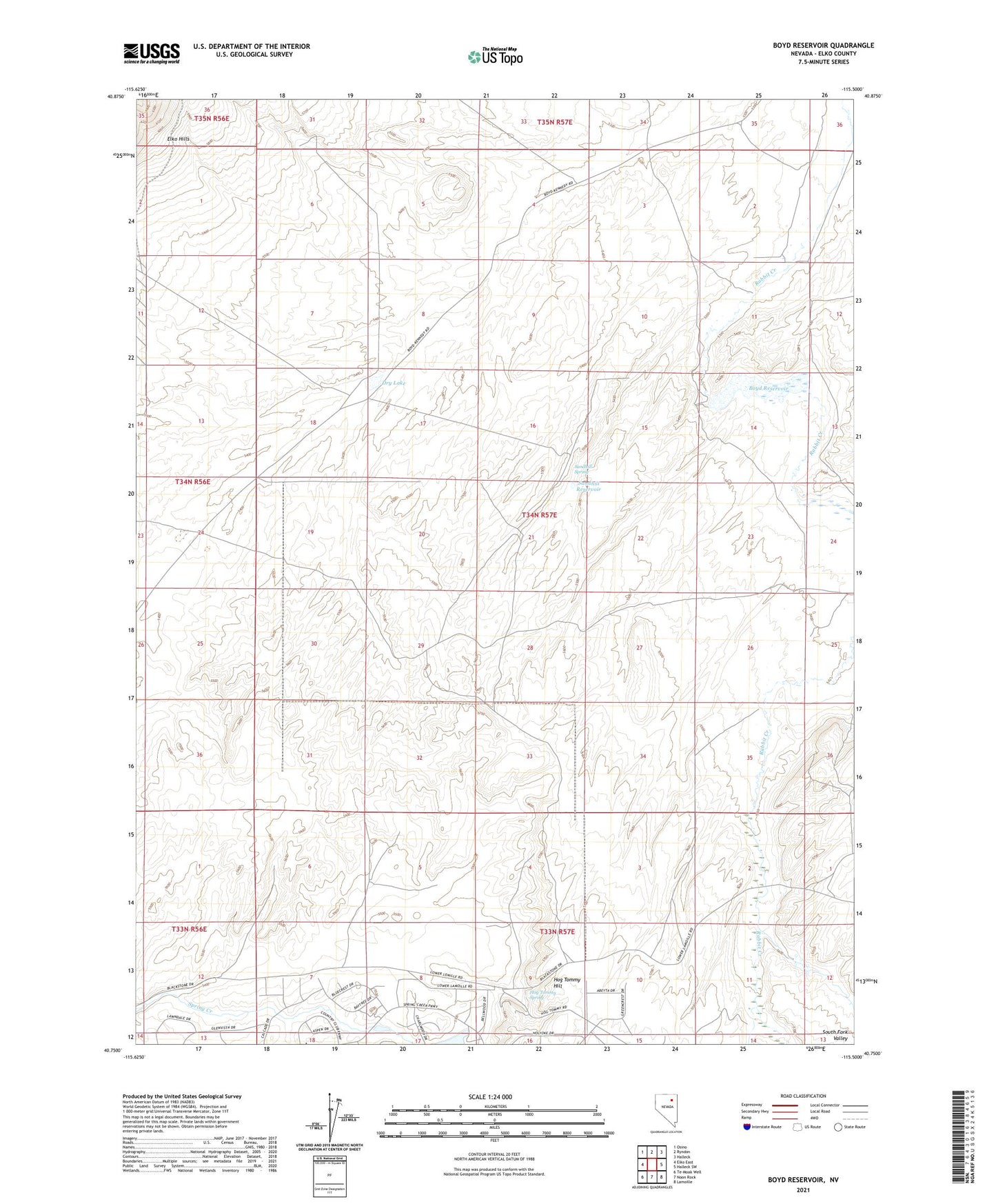
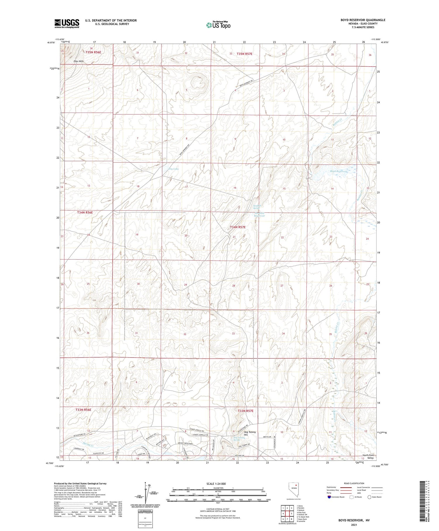
2021 topographic map quadrangle Boyd Reservoir in the state of Nevada. Scale: 1:24000. Based on the newly updated USGS 7.5' US Topo map series, this map is in the following counties: Elko. The map contains contour data, water features, and other items you are used to seeing on USGS maps, but also has updated roads and other features. This is the next generation of topographic maps. Printed on high-quality waterproof paper with UV fade-resistant inks.
Quads adjacent to this one:
West: Elko East
Northwest: Osino
North: Ryndon
Northeast: Halleck
East: Halleck SW
Southeast: Lamoille
South: Noon Rock
Southwest: Te-Moak Well
This map covers the same area as the classic USGS quad with code o40115g5.
Contains the following named places: Boyd Reservoir, Boyd Reservoir Dam, Dry Lake, Hog Tommy Hill, Hog Tommy Spring, Leberski Ranch, Little Rabbit Creek, Sandhill Reservoir, Sandhill Spring, Sustacha Well