MyTopo
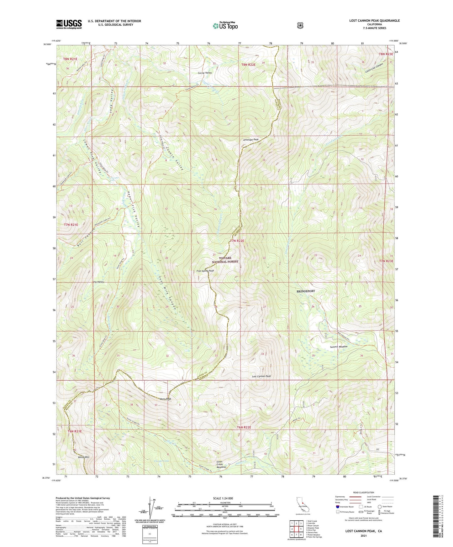
Lost Cannon Peak California US Topo Map
Couldn't load pickup availability
Also explore the Lost Cannon Peak Forest Service Topo of this same quad for updated USFS data
2021 topographic map quadrangle Lost Cannon Peak in the state of California. Scale: 1:24000. Based on the newly updated USGS 7.5' US Topo map series, this map is in the following counties: Mono, Alpine. The map contains contour data, water features, and other items you are used to seeing on USGS maps, but also has updated roads and other features. This is the next generation of topographic maps. Printed on high-quality waterproof paper with UV fade-resistant inks.
Quads adjacent to this one:
West: Disaster Peak
Northwest: Wolf Creek
North: Coleville
Northeast: Risue Canyon
East: Chris Flat
Southeast: Fales Hot Springs
South: Pickel Meadow
Southwest: Sonora Pass
This map covers the same area as the classic USGS quad with code o38119d5.
Contains the following named places: Antelope Peak, Bull Canyon, Chango Lake, Connells Cow Camp, Corral Valley, Corral Valley Creek, Corral Valley Trail, Coyote Valley, Coyote Valley Creek, Early Emigrant and Indian Trail, Fish Valley Peak, Fly Valley, Four Mile Canyon, Little Lost Canyon, Llewellyn Falls, Long Valley, Lost Cannon Peak, Lower Fish Valley, Silver Creek Meadows, Silver King Trail, Summit Meadow, Tamarack Creek, Upper Fish Valley, Wells Peak, White Mountain