MyTopo
Round Mountain Nevada US Topo Map
Couldn't load pickup availability
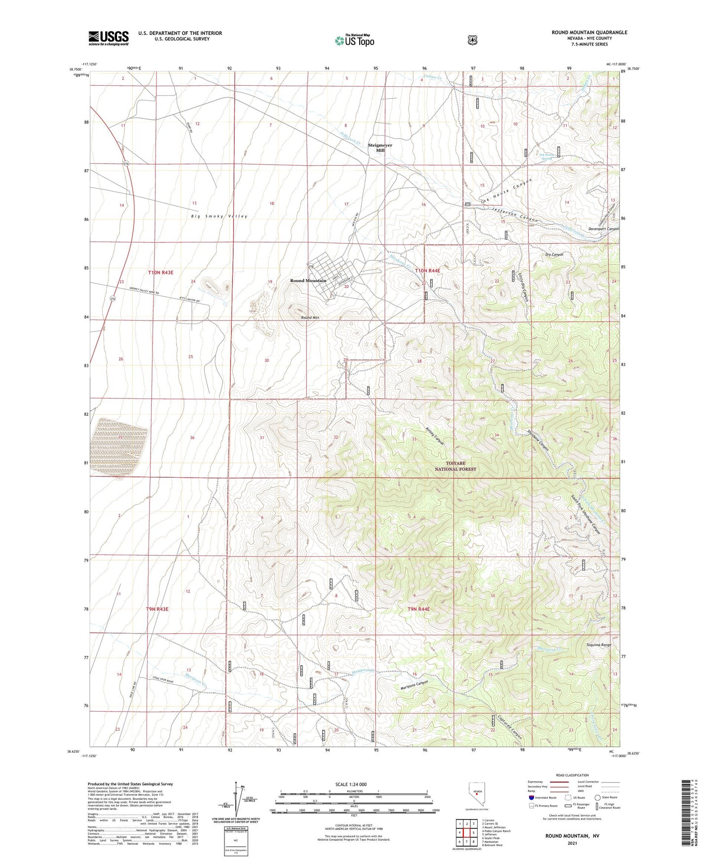
2021 topographic map quadrangle Round Mountain in the state of Nevada. Scale: 1:24000. Based on the newly updated USGS 7.5' US Topo map series, this map is in the following counties: Nye. The map contains contour data, water features, and other items you are used to seeing on USGS maps, but also has updated roads and other features. This is the next generation of topographic maps. Printed on high-quality waterproof paper with UV fade-resistant inks.
Quads adjacent to this one:
West: Pablo Canyon Ranch
Northwest: Carvers
North: Carvers SE
Northeast: Mount Jefferson
East: Jefferson
Southeast: Belmont West
South: Manhattan
Southwest: Seyler Peak
Contains the following named places: Captured Canyon, Dry Canyon, Fairview Mine, Gordon Shaft, Great Western Tunnel, Ink House Canyon, Ink House Spring, Jefferson Canyon, Kelsey Canyon, Little Dry Canyon, Mariposa Canyon, Mariposa Creek, Number Four Shaft, Number Two Shaft, Rattlesnake Shaft, Red Bird Mill, Red Bird Mine, Round Mountain, Round Mountain Elementary School, Round Mountain Gold Mine Emergency Services, Round Mountain Jr/Sr High School, Round Mountain Mining District, Says Ranch, Senator Mine, Shamrock Mine, Shoshone, Shoshone Canyon, Slaughterhouse Canyon, Smoky Valley Mine Landing Strip, South Fork Shoshone Canyon, South Fork Shoshone Creek, Sphinx Glory Hole, Stebbins Mill, Steigmeyer Mill, Sunnyside Shaft, Wilson Shaft