MyTopo
Wall Canyon Reservoir Nevada US Topo Map
Couldn't load pickup availability
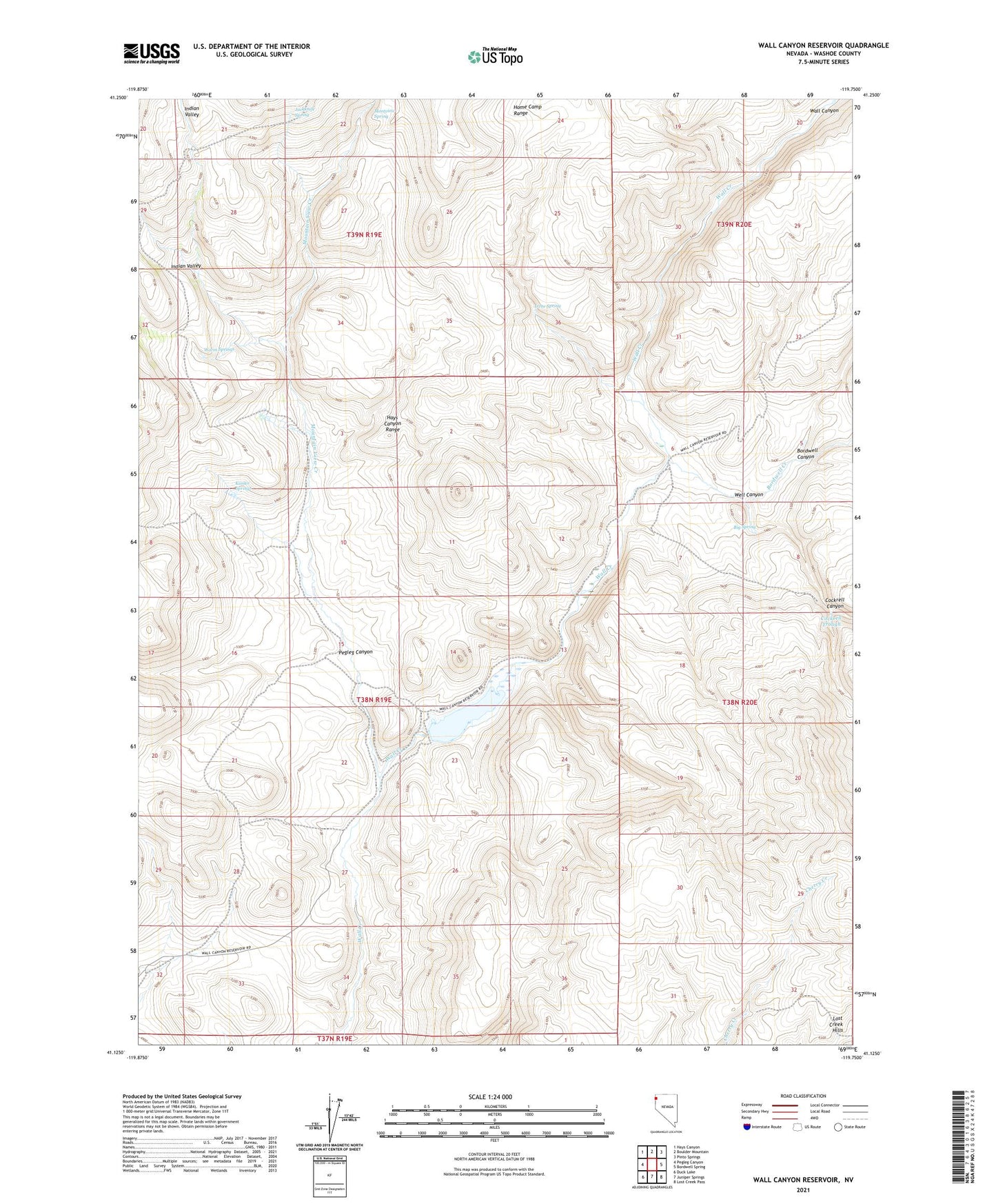
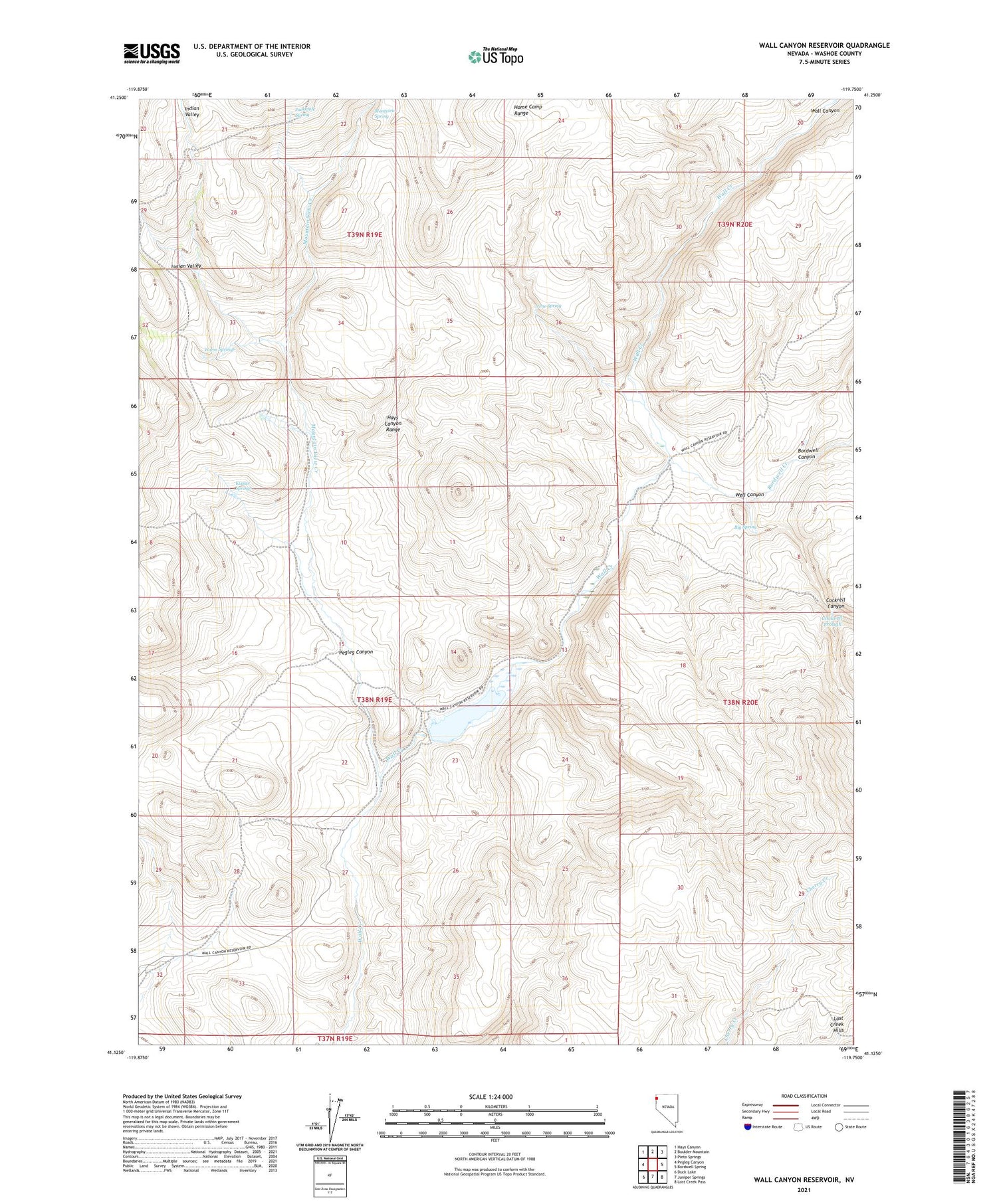
2021 topographic map quadrangle Wall Canyon Reservoir in the state of Nevada. Scale: 1:24000. Based on the newly updated USGS 7.5' US Topo map series, this map is in the following counties: Washoe. The map contains contour data, water features, and other items you are used to seeing on USGS maps, but also has updated roads and other features. This is the next generation of topographic maps. Printed on high-quality waterproof paper with UV fade-resistant inks.
Quads adjacent to this one:
West: Pegleg Canyon
Northwest: Hays Canyon
North: Boulder Mountain
Northeast: Pinto Springs
East: Bordwell Spring
Southeast: Lost Creek Pass
South: Juniper Springs
Southwest: Duck Lake
Contains the following named places: Big Spring, Bordwell Canyon, Bordwell Creek, Cockrell Canyon, Cockrell Trough, Indian Valley, Irene Spring, Jackknife Spring, Kissler Springs, Montview Spring, Mountain View Creek, Pegleg Canyon, The Dip, Wall Canyon Reservoir, Wall Creek Dam Number Two, Warm Springs, Well Canyon