MyTopo
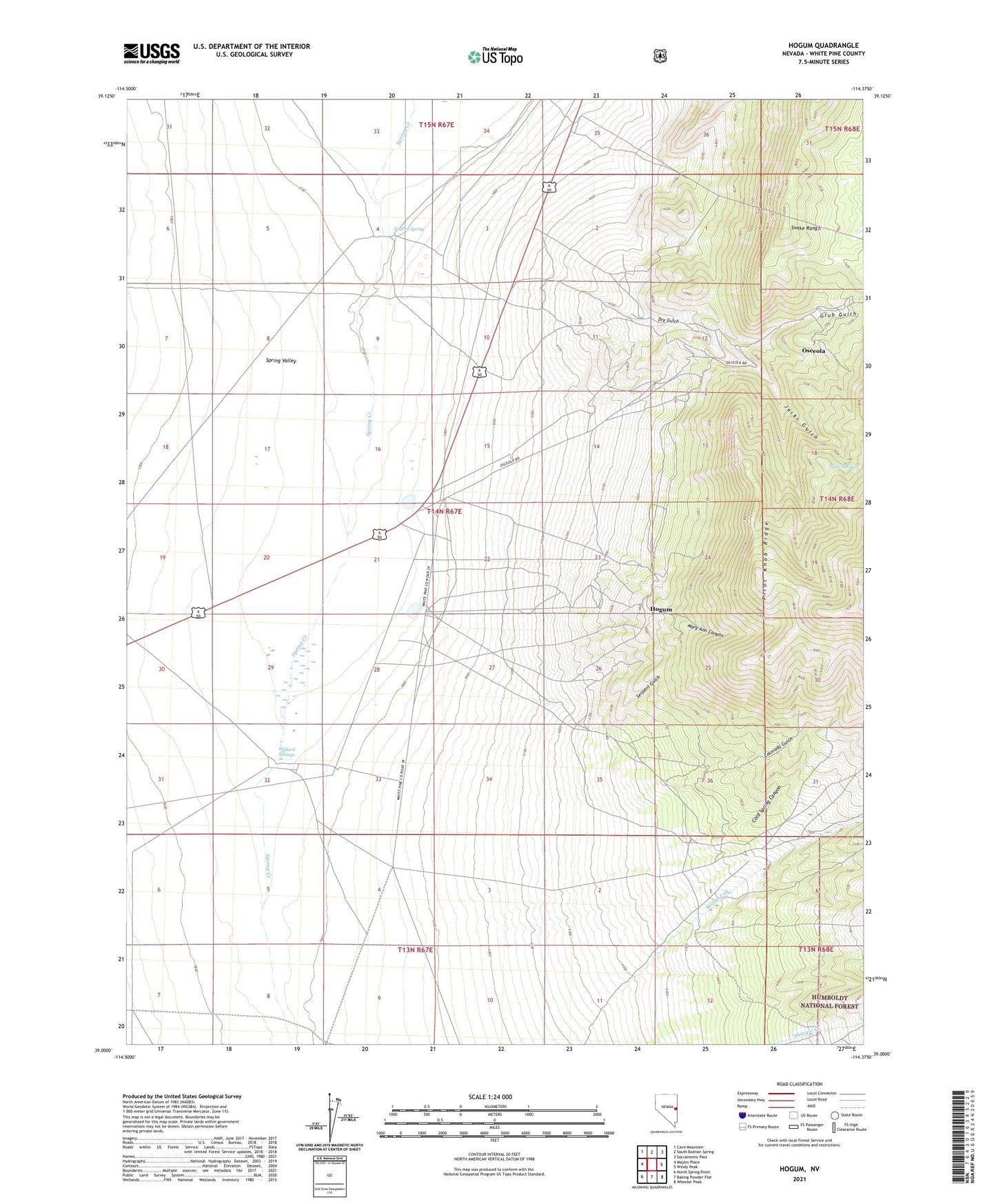
Hogum Nevada US Topo Map
Couldn't load pickup availability
Also explore the Hogum Forest Service Topo of this same quad for updated USFS data
2021 topographic map quadrangle Hogum in the state of Nevada. Scale: 1:24000. Based on the newly updated USGS 7.5' US Topo map series, this map is in the following counties: White Pine. The map contains contour data, water features, and other items you are used to seeing on USGS maps, but also has updated roads and other features. This is the next generation of topographic maps. Printed on high-quality waterproof paper with UV fade-resistant inks.
Quads adjacent to this one:
West: Majors Place
Northwest: Cave Mountain
North: South Bastian Spring
Northeast: Sacramento Pass
East: Windy Peak
Southeast: Wheeler Peak
South: Baking Powder Flat
Southwest: North Spring Point
This map covers the same area as the classic USGS quad with code o39114a4.
Contains the following named places: Black Mule Mine, Cold Spring Canyon, Colorado Gulch, Crystal Queen Mine, Dry Gulch, Dry Gulch Pilot Knob Mines, Grub Gulch, Hogum, Hogum Mines, Jacks Gulch, Jacks Spring, Lassie Jean Mine, Layton Spring, Mary Ann Canyon, Osceola, Osceola Mine, Osceola Post Office, Pilot Knob Ridge, Serpent Gulch, Swallow Well, Willard Creek, Willard Creek Ranch, Willard Springs