MyTopo
Gilsum New Hampshire US Topo Map
Couldn't load pickup availability
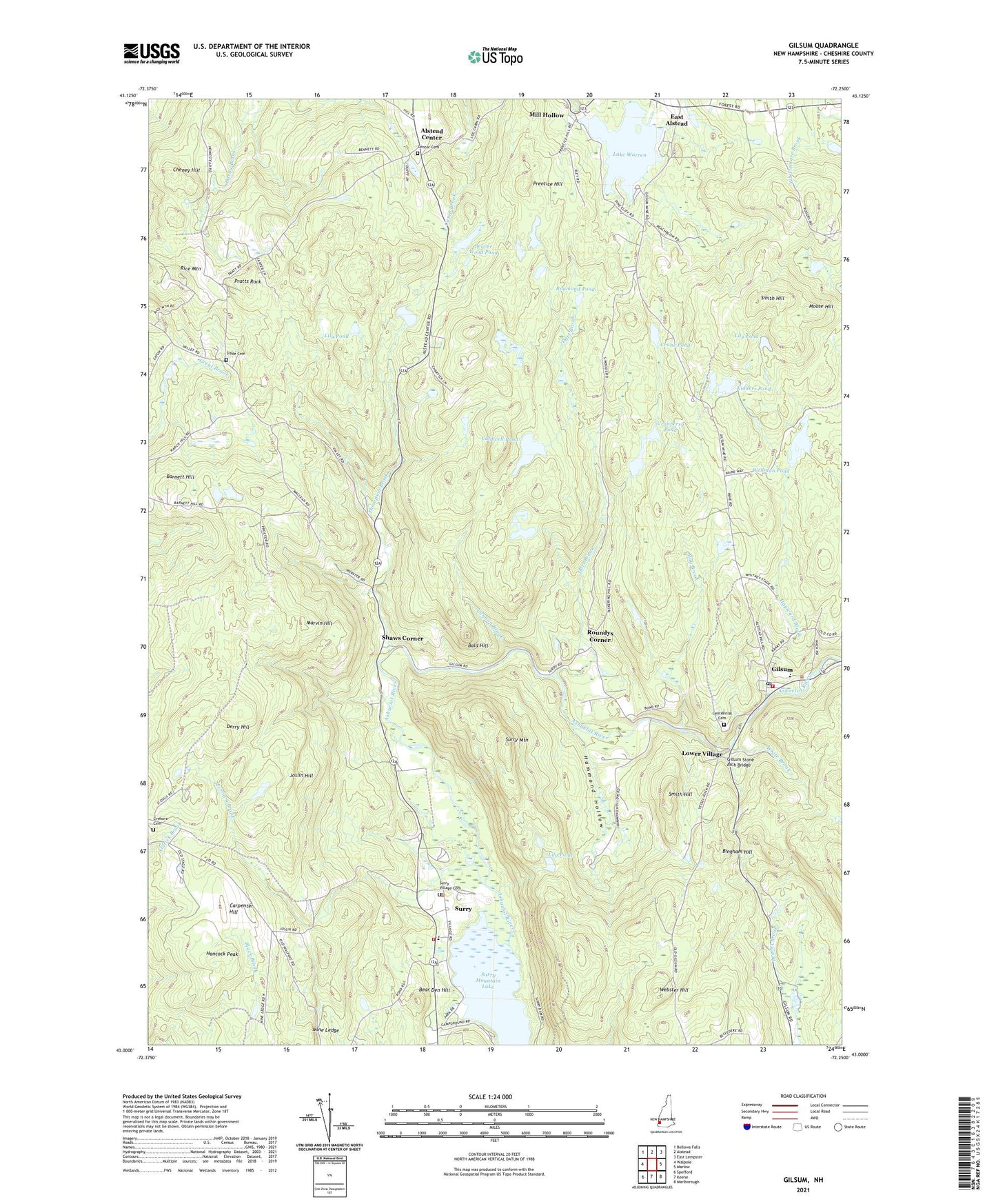
2021 topographic map quadrangle Gilsum in the state of New Hampshire. Scale: 1:24000. Based on the newly updated USGS 7.5' US Topo map series, this map is in the following counties: Cheshire. The map contains contour data, water features, and other items you are used to seeing on USGS maps, but also has updated roads and other features. This is the next generation of topographic maps. Printed on high-quality waterproof paper with UV fade-resistant inks.
Quads adjacent to this one:
West: Walpole
North: Alstead
Northeast: East Lempster
East: Marlow
Southeast: Marlborough
South: Keene
Southwest: Spofford
Contains the following named places: Alstead Center, Alstead Center Congregational Church, Bald Hill, Barnett Hill, Bear Den Hill, Beaver Wood Pond, Beth-el Bible Church, Bingham Hill, Caldwell Pond, Cannon Brook, Carpenter Hill, Centennial Cemetery, Center Cemetery, Cheney Hill, Cranberry Pond, Cranberry Pond Dam, Crane Pond, Crehore Cemetery, Dart Brook, Derry Hill, East Alstead, Gilsum, Gilsum Congregational Church, Gilsum Elementary School, Gilsum Post Office, Gilsum Stone Arch Bridge, Gilsum Volunteer Fire Department and Rescue Squad, Hale Brook, Hammond Hollow, Hancock Peak, Hayward Brook, Joslin Hill, Kidders Pond, Lake Warren, Lake Warren Dam, Lily Pond, Lower Village, Marvin Hill, May Brook, Merriam Brook, Mill Hollow, Monadnock Community Connections School, Moose Hill, Pot Holes and Bears Den State Forest, Pratts Rock, Prentice Hill, Raymond Pond, Rice Mountain, Roundys Corner, Shaws Corner, Slade Cemetery, Smith Hill, Surry, Surry Mountain, Surry Mountain Gold Mine, Surry Mountain Lake, Surry Police Department, Surry Village Cemetery, Surry Volunteer Fire Department, Thompson Brook, Town of Alstead, Town of Gilsum, Town of Surry, Webster Hill, WEKW-TV (Keene), Wellman Pond, White Brook, WKNE-FM (Keene), ZIP Code: 03448