MyTopo
Marlow New Hampshire US Topo Map
Couldn't load pickup availability
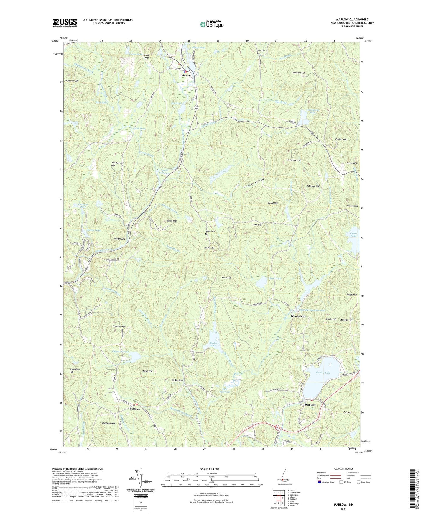
2024 topographic map quadrangle Marlow in the state of New Hampshire. Scale: 1:24000. Based on the newly updated USGS 7.5' US Topo map series, this map is in the following counties: Cheshire. The map contains contour data, water features, and other items you are used to seeing on USGS maps, but also has updated roads and other features. This is the next generation of topographic maps. Printed on high-quality waterproof paper with UV fade-resistant inks.
Quads adjacent to this one:
West: Gilsum
Northwest: Alstead
North: East Lempster
Northeast: Washington
East: Stoddard
Southeast: Dublin
South: Marlborough
Southwest: Keene
Contains the following named places: Abbott Brook, Ashuelot Ridge Golf Course, Big Pond, Bolster Brook, Bolster Pond, Boynton Hill, Brooks Hill, Butler Brook, Center Pond, Chandler Meadow, Chandler Meadow Pond, Chandler Meadow Pond Dam, Chapel by the Lake United Methodist Church, Chapman Pond, Cold Spring Pond, Cold Spring Pond Dam, Converse Pond, Dakin Hill, Davis Brook, Duck Hole, Eaton Hill, Ellis Reservoir, Ellisville, Emerson Brook, Felt Hill, Fox Brook, Frost Hill, Gould Pond, Granite Lake, Granite Lake Dam, Grassy Brook, Great Brook, Hodgeman Hill, Hubbard Hill, Jefts Brook, Jefts Cemetery, Joslin Cemetery, Joslin Hill, Kinson State Wildlife Management Area, Leominster Corner, Locke Hill, Lower Stillwater, Mack Hill, Marlow, Marlow Fire Department, Marlow Police Dept, Marlow United Methodist Church, Meetinghouse Brook, Melville Hill, Munsonville, Nelson Fire and Rescue Substation, Nelson School, Parker Hill, Pitcher Mountain, Pitcher Mountain State Forest, Pumpkin Hill, Robinson Brook, Robinson Hill, Seward Brook, Shedd Hill, Spaulding Brook, Spaulding Hill, Spoons Pond, Spoons Pond Dam, Spruceland Camps, Sullivan, Sullivan Elementary School, Sullivan Fire and Rescue Department, Sullivan Police Department, Sullivan Post Office, Taylor Pond, Thompson Brook, Tinker Pond, Town of Sullivan, Towne Hill, Trout Brook, United Congregational Church, Village Pond, Village Pond Dam, Whittemore Brook, Whittemore Hill, Wildcat Hollow, Winch Hill, Woods Mill, Wright Hill, ZIP Codes: 03445, 03464