
MyTopo
La Joya New Mexico US Topo Map
Couldn't load pickup availability
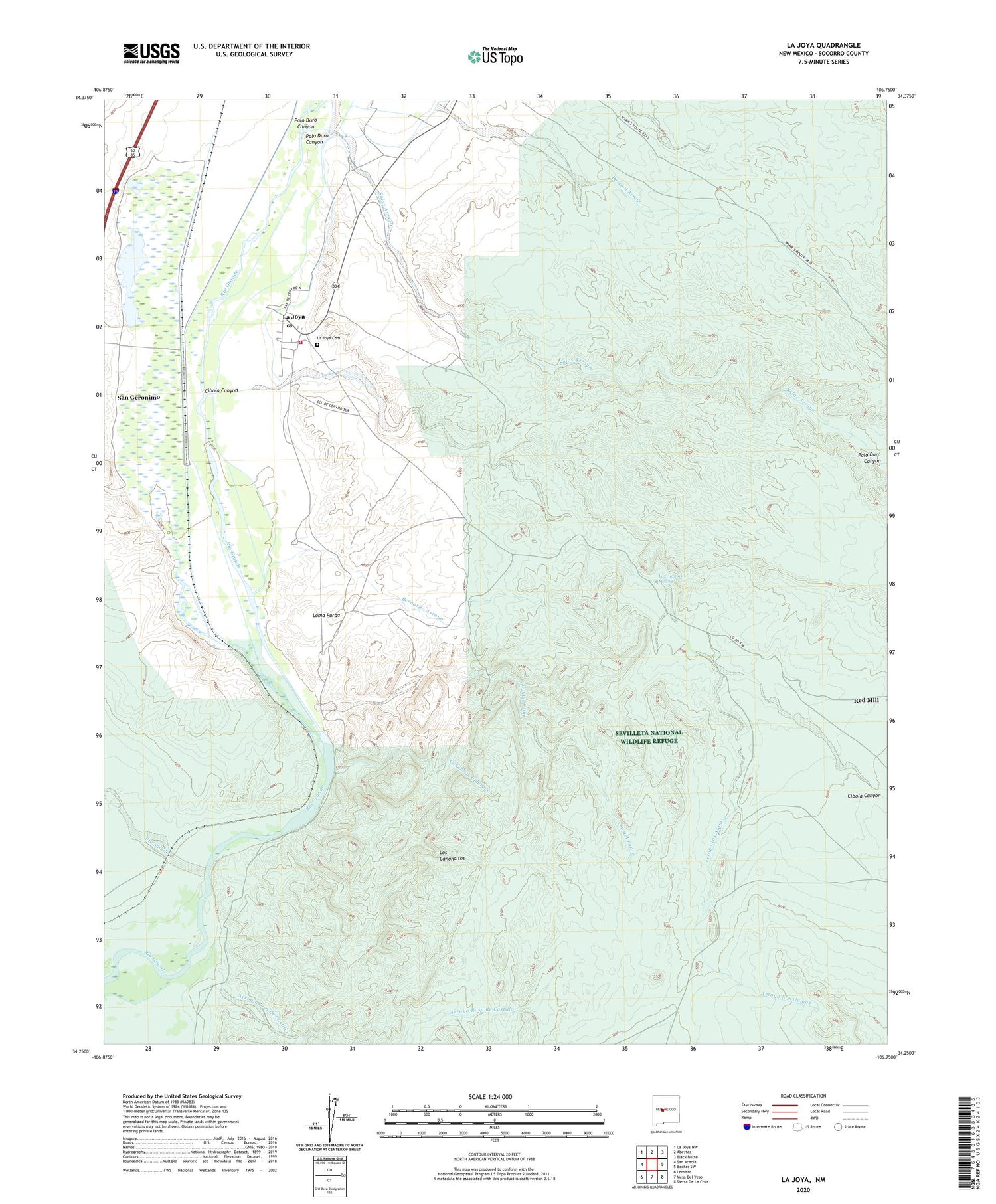
2023 topographic map quadrangle La Joya in the state of New Mexico. Scale: 1:24000. Based on the newly updated USGS 7.5' US Topo map series, this map is in the following counties: Socorro. The map contains contour data, water features, and other items you are used to seeing on USGS maps, but also has updated roads and other features. This is the next generation of topographic maps. Printed on high-quality waterproof paper with UV fade-resistant inks.
Quads adjacent to this one:
West: San Acacia
Northwest: La Joya NW
North: Abeytas
Northeast: Black Butte
East: Becker SW
Southeast: Sierra De La Cruz
South: Mesa Del Yeso
Southwest: Lemitar
This map covers the same area as the classic USGS quad with code o34106c7.
Contains the following named places: Arroyo los Alamos, Arroyo Rosa de Castillo, Bachelder Everheart Mine, Bernardo Arroyo, Canada Ancha, Canoncito Colorado, Cibola Canyon, Dewey, Dewey Mine, Diamond T Ranch, El Valle de la Joya, Joyita Mine, La Joya, La Joya Cemetery, La Joya Census Designated Place, La Joya Post Office, La Joya Volunteer Fire Department, La Joyita, Loma Parda, Los Alamos Spring, Los Canoncitos, Ojo del Padre, Our Lady of Sorrows Catholic Church, Palo Duro Canyon, Pascual Arroyo, Red Mill, Rio Puerco, Rio Salado, Salas Arroyo, San Geronimo, Sevilleta Grant, Sevilleta National Wildlife Refuge


