MyTopo
Taylor Mountain New Mexico US Topo Map
Couldn't load pickup availability
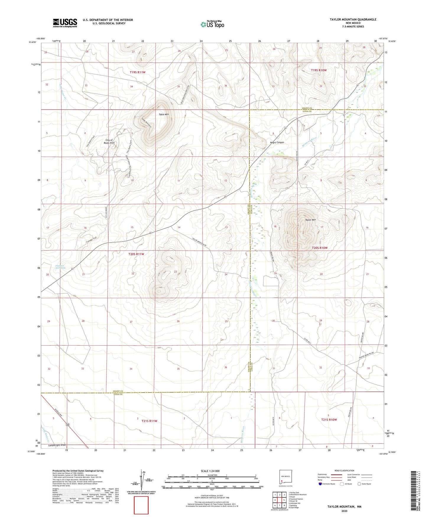
2023 topographic map quadrangle Taylor Mountain in the state of New Mexico. Scale: 1:24000. Based on the newly updated USGS 7.5' US Topo map series, this map is in the following counties: Grant, Luna. The map contains contour data, water features, and other items you are used to seeing on USGS maps, but also has updated roads and other features. This is the next generation of topographic maps. Printed on high-quality waterproof paper with UV fade-resistant inks.
Quads adjacent to this one:
West: Faywood Station
Northwest: Hurley East
North: Whitehorse Mountain
Northeast: Dwyer
East: Dwyer SE
Southeast: Goat Ridge
South: Spalding
Southwest: Antelope Hill
This map covers the same area as the classic USGS quad with code o32107e8.
Contains the following named places: 01488 Water Well, 01489 Water Well, 01490 Water Well, 01491 Water Well, 01492 Water Well, 01495 Water Well, 01497 Water Well, 01529 Water Well, 01530 Water Well, 01536 Water Well, 01537 Water Well, 01540 Water Well, 01541 Water Well, 01543 Water Well, 01549 Water Well, 01550 Water Well, 01553 Water Well, 01555 Water Well, 01556 Water Well, 01560 Water Well, 01562 Water Well, 01563 Water Well, 10022 Water Well, 10023 Water Well, 10024 Water Well, 88034, City of Rocks Arch, City of Rocks State Park, Faywood Hot Spring, Faywood Hot Springs, Faywood Weather Station, Mimbres Tank, Negro Canyon, Old Town, Old Town Census Designated Place, San Jose Church, Table Mountain, Taylor Mountain, Tigner Ranch