MyTopo
Archuleta New Mexico US Topo Map
Couldn't load pickup availability
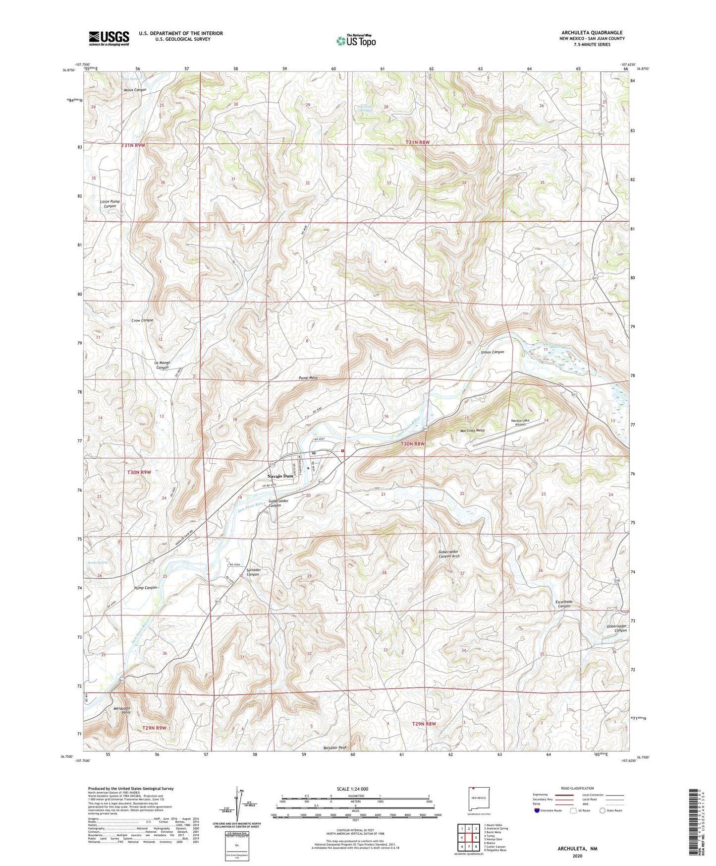
2023 topographic map quadrangle Archuleta in the state of New Mexico. Scale: 1:24000. Based on the newly updated USGS 7.5' US Topo map series, this map is in the following counties: San Juan. The map contains contour data, water features, and other items you are used to seeing on USGS maps, but also has updated roads and other features. This is the next generation of topographic maps. Printed on high-quality waterproof paper with UV fade-resistant inks.
Quads adjacent to this one:
West: Turley
Northwest: Mount Nebo
North: Anastacio Spring
Northeast: Burnt Mesa
East: Navajo Dam
Southeast: Delgadita Mesa
South: Cutter Canyon
Southwest: Blanco
This map covers the same area as the classic USGS quad with code o36107g6.
Contains the following named places: Archuleta, Baltazar Peak, Crow Canyon, Escarbada Canyon, Gobernador Canyon, Gobernador Canyon Arch, La Manga Canyon, Little Pump Canyon, Martinez Mesa, Melquadis Point, Minix Canyon, Minix Spring, Navajo Dam Census Designated Place, Navajo Dam Post Office, Navajo Lake Airport, Navajo Lake State Park, Our Lady of Guadalupe Cemetery, Prado Spring, Pump Canyon, Pump Mesa, Quintana Spring, Salvador Canyon, San Juan Basin Field, San Juan County Fire District 10 - Navajo Dam, Simon Canyon