MyTopo
Anastacio Spring New Mexico US Topo Map
Couldn't load pickup availability
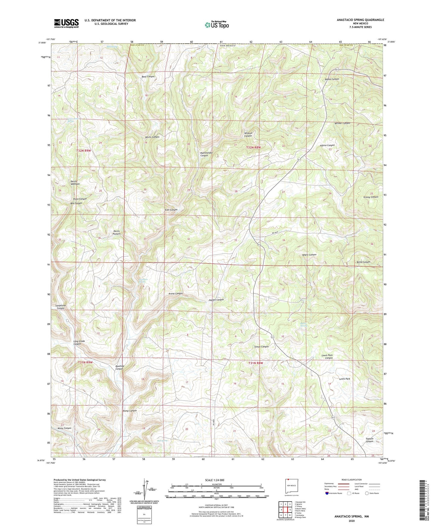
2023 topographic map quadrangle Anastacio Spring in the state of New Mexico. Scale: 1:24000. Based on the newly updated USGS 7.5' US Topo map series, this map is in the following counties: San Juan. The map contains contour data, water features, and other items you are used to seeing on USGS maps, but also has updated roads and other features. This is the next generation of topographic maps. Printed on high-quality waterproof paper with UV fade-resistant inks.
Quads adjacent to this one:
West: Mount Nebo
Northwest: Bondad Hill
North: Ignacio
Northeast: Tiffany
East: Burnt Mesa
Southeast: Navajo Dam
South: Archuleta
Southwest: Turley
This map covers the same area as the classic USGS quad with code o36107h6.
Contains the following named places: Anastacio Spring, Arena Canyon, Barrel Spriing, Beef Canyon, Beef Spring, Box Canyon, Bull Spring, Devils Canyon, Devils Pockets, Devils Washpan, Jaquez Canyon, Lewis Park, Long Glade Canyon, Lower Pinto Spring, Pinto Canyon, Rattlesnake Canyon, Rawhide Canyon, Sandstone Canyon, Trail Canyon, Wildcat Canyon