MyTopo
Ares Peak New Mexico US Topo Map
Couldn't load pickup availability
Also explore the Ares Peak Forest Service Topo of this same quad for updated USFS data
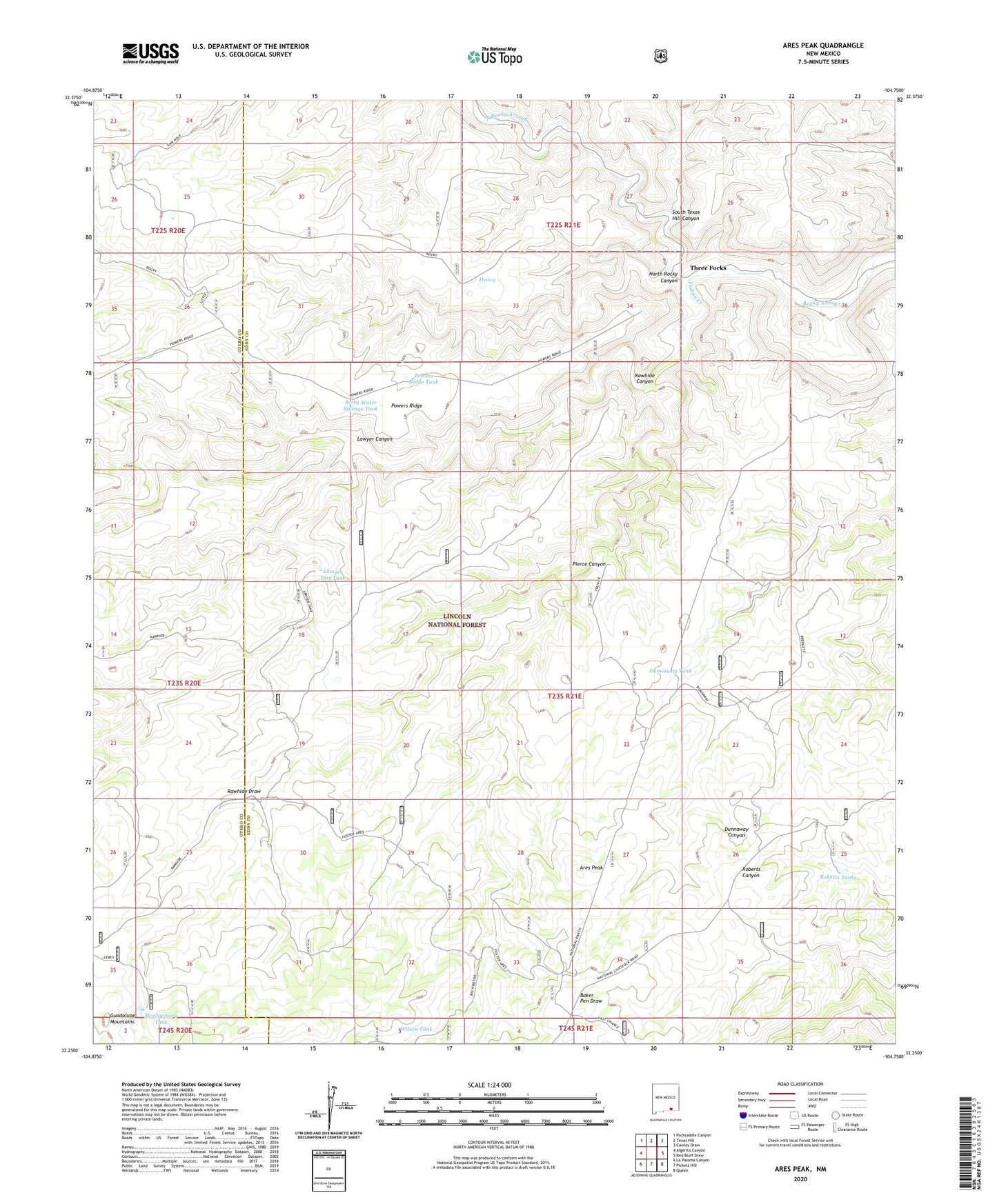
2023 topographic map quadrangle Ares Peak in the state of New Mexico. Scale: 1:24000. Based on the newly updated USGS 7.5' US Topo map series, this map is in the following counties: Eddy, Otero. The map contains contour data, water features, and other items you are used to seeing on USGS maps, but also has updated roads and other features. This is the next generation of topographic maps. Printed on high-quality waterproof paper with UV fade-resistant inks.
Quads adjacent to this one:
West: Algerita Canyon
Northwest: Packsaddle Canyon
North: Texas Hill
Northeast: Cawley Draw
East: Red Bluff Draw
Southeast: Queen
South: Pickett Hill
Southwest: La Paloma Canyon
This map covers the same area as the classic USGS quad with code o32104c7.
Contains the following named places: Acrey Water Storage Tank, Ares Peak, Black Water Storage Tank, B-Storage Tank, Clark Well, Dunnaway Tank, Foster Water Storage Tank, Guadalupe Mountains Historical Marker, Heard Storage Tank, Hearn, Indian Creek, Joyce Water Storage Tank, Lawyer Canyon, Lawyer Dirt Tank, Middle Rocky Arroyo, Montgomery Tank, Montgomery Water Storage Tank, National Ranch, North Rocky Arroyo, North Rocky Canyon, Pierce Canyon, Powers Ridge, Powers Ridge Tank, Rawhide Canyon, Rawhide Draw, Rawhide Water Storage Tank, Roberts Tanks, Sandia, South Texas Hill Canyon, Three Forks, Wilson Tank