MyTopo
La Paloma Canyon New Mexico US Topo Map
Couldn't load pickup availability
Also explore the La Paloma Canyon Forest Service Topo of this same quad for updated USFS data
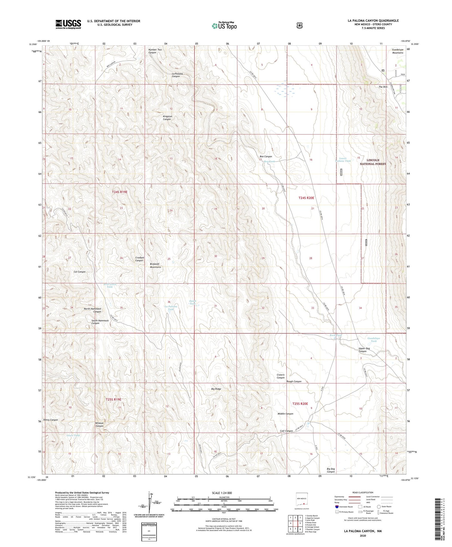
2023 topographic map quadrangle La Paloma Canyon in the state of New Mexico. Scale: 1:24000. Based on the newly updated USGS 7.5' US Topo map series, this map is in the following counties: Otero. The map contains contour data, water features, and other items you are used to seeing on USGS maps, but also has updated roads and other features. This is the next generation of topographic maps. Printed on high-quality waterproof paper with UV fade-resistant inks.
Quads adjacent to this one:
West: Sheep Draw
Northwest: Gowdy Ranch
North: Algerita Canyon
Northeast: Ares Peak
East: Pickett Hill
Southeast: El Paso Gap
South: Panther Canyon
Southwest: Cienega School
This map covers the same area as the classic USGS quad with code o32104b8.
Contains the following named places: Arch Lewis Tank, Box Tank, Calf Canyon, Cistern Canyon, Dutch Tank, Guadalupe Tank, Hepler Ranch, Kingston Canyon, La Paloma Canyon, La Paloma Tank, Lewis Tank, Lower Irabane Tank, Middle Canyon, Number Two Canyon, Rock Tank, Rough Canyon, Trick Tank, Upper Dog Canyon, Wildcat Canyon