MyTopo
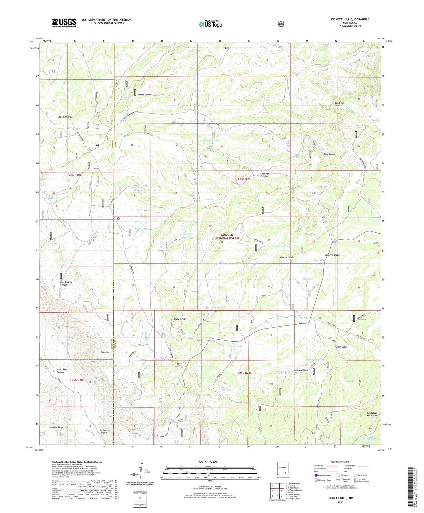
Pickett Hill New Mexico US Topo Map
Couldn't load pickup availability
Also explore the Pickett Hill Forest Service Topo of this same quad for updated USFS data
2023 topographic map quadrangle Pickett Hill in the state of New Mexico. Scale: 1:24000. Based on the newly updated USGS 7.5' US Topo map series, this map is in the following counties: Eddy, Otero. The map contains contour data, water features, and other items you are used to seeing on USGS maps, but also has updated roads and other features. This is the next generation of topographic maps. Printed on high-quality waterproof paper with UV fade-resistant inks.
Quads adjacent to this one:
West: La Paloma Canyon
Northwest: Algerita Canyon
North: Ares Peak
Northeast: Red Bluff Draw
East: Queen
Southeast: Gunsight Canyon
South: El Paso Gap
Southwest: Panther Canyon
This map covers the same area as the classic USGS quad with code o32104b7.
Contains the following named places: Anderson Tank, Anderson Water Storage Tank, Big Boy Tank, Bradley Tank, Brister Tank, Coats Lake, Coats Water Storage Tank, El Paso Gap, Game Department Cabin, Gordon Tank, Hamm Draw, Hamm Tank, Hamm Well, Hamm Well Storage Tank, Helper Tank, Irabarne Tank, Irabarne Water Storage Tank, Keller Tank, Knee Deep, Last Chance Water Storage Tank, Locklear Canyon, Locklear Tank, Locklear Water Storage Tank, Mail Box, Middleton Storage Tank, Middleton Well, North Well, Pickett Hill, Pickett Tanks, Pine Canyon, Polk Tank, Polk Water Storage Tank, Poor House, Prairie Dog Tank, Price Water Storage Tank, Road Tank, Sandrock Canyon, Shattuck Well, Shattuck West Tank, Sixshooter Canyon, Stone Water Storage Tank, Thayer Place, Thayer Well, West Water Storage Tank, Wildcat Draw