MyTopo
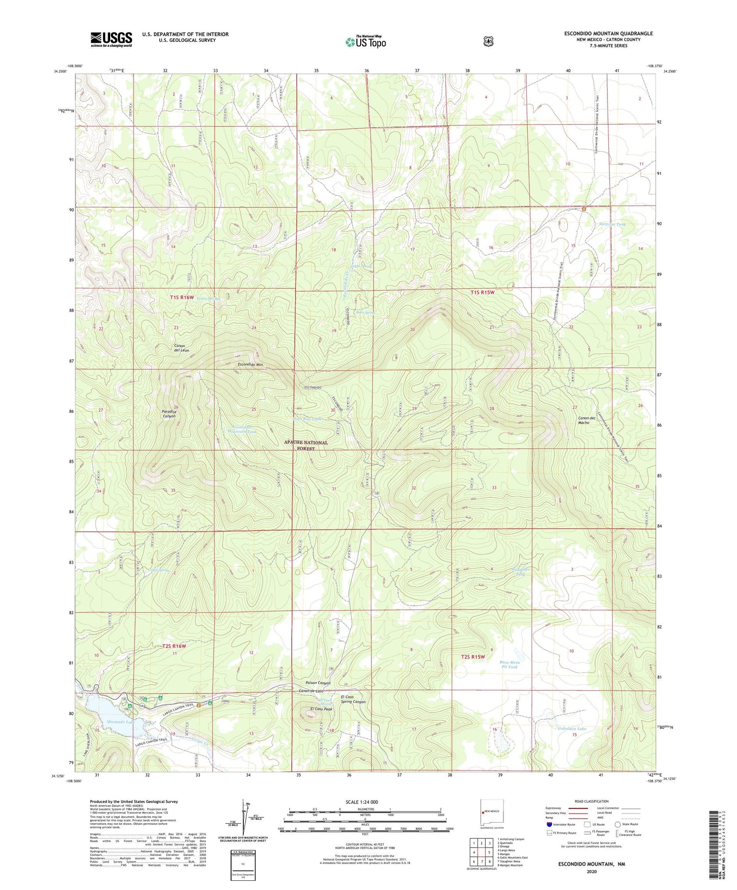
Escondido Mountain New Mexico US Topo Map
Couldn't load pickup availability
Also explore the Escondido Mountain Forest Service Topo of this same quad for updated USFS data
2023 topographic map quadrangle Escondido Mountain in the state of New Mexico. Scale: 1:24000. Based on the newly updated USGS 7.5' US Topo map series, this map is in the following counties: Catron. The map contains contour data, water features, and other items you are used to seeing on USGS maps, but also has updated roads and other features. This is the next generation of topographic maps. Printed on high-quality waterproof paper with UV fade-resistant inks.
Quads adjacent to this one:
West: Largo Mesa
Northwest: Armstrong Canyon
North: Quemado
Northeast: Omega
East: Mangas
Southeast: Mangas Mountain
South: Slaughter Mesa
Southwest: Gallo Mountains East
Contains the following named places: Baca Mesa Pit Tank, Baca Spring, Baca Tank, Calley Spring, Canon de Lolo, Deer Tank, East Tank, El Caso Peak, El Caso Spring, El Caso Spring Canyon, Escondido Mountain, Escondido Mountain Tank, Escondido Tank, Escondido Trail, Fish Pond Tank, Gabaldon Lake, Giles, High Rim Tank, Leyba Spring, North Tank, Pine Lake, Poison Canyon, Quemado Dam, Quemado Lake, Quemado Lake Campground, Slaughter Tank, Surprise Tank, Turkey Spring