MyTopo
Quemado New Mexico US Topo Map
Couldn't load pickup availability
Also explore the Quemado Forest Service Topo of this same quad for updated USFS data
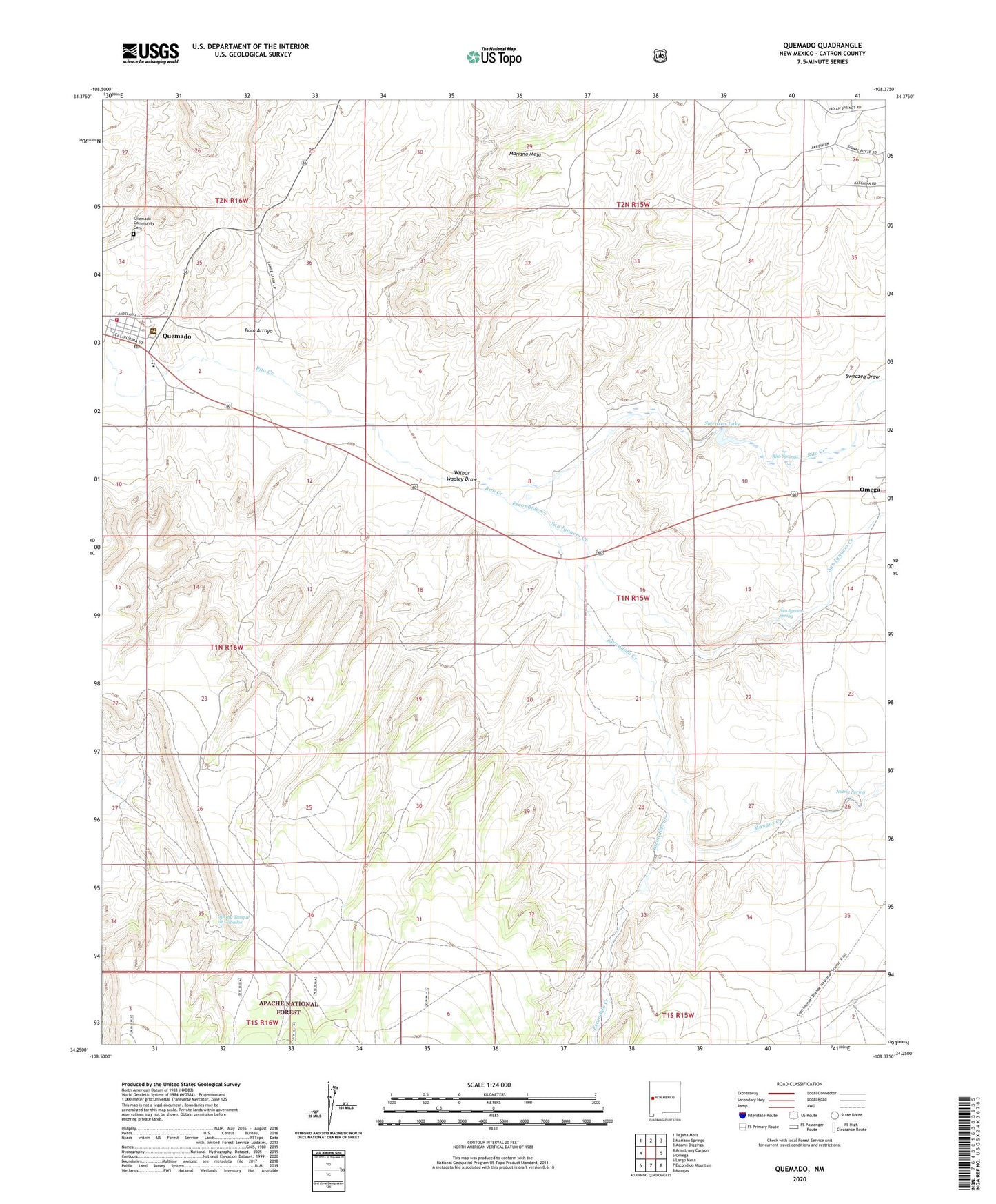
2023 topographic map quadrangle Quemado in the state of New Mexico. Scale: 1:24000. Based on the newly updated USGS 7.5' US Topo map series, this map is in the following counties: Catron. The map contains contour data, water features, and other items you are used to seeing on USGS maps, but also has updated roads and other features. This is the next generation of topographic maps. Printed on high-quality waterproof paper with UV fade-resistant inks.
Quads adjacent to this one:
West: Armstrong Canyon
Northwest: Tejana Mesa
North: Mariano Springs
Northeast: Adams Diggings
East: Omega
Southeast: Mangas
South: Escondido Mountain
Southwest: Largo Mesa
This map covers the same area as the classic USGS quad with code o34108c4.
Contains the following named places: Baca Arroyo, Catron County Ambulance Service Quemado, Escondido Creek, First Baptist Church, Mangas Creek, North Well, Nutria Spring, Quemado, Quemado Community Cemetery, Quemado District Ranger Office, Quemado Elementary School, Quemado Fire Department, Quemado High School, Quemado Post Office, Quemado Weather Station, Rito Spring, Sacred Heart Catholic Church Cemetery, San Ignacio Creek, San Ignacio Spring, Spring Tanque de Caballos, Stevenson, Sweazea Draw, Sweazea Lake, Wadley Well, Wilbur Wadley Draw