MyTopo
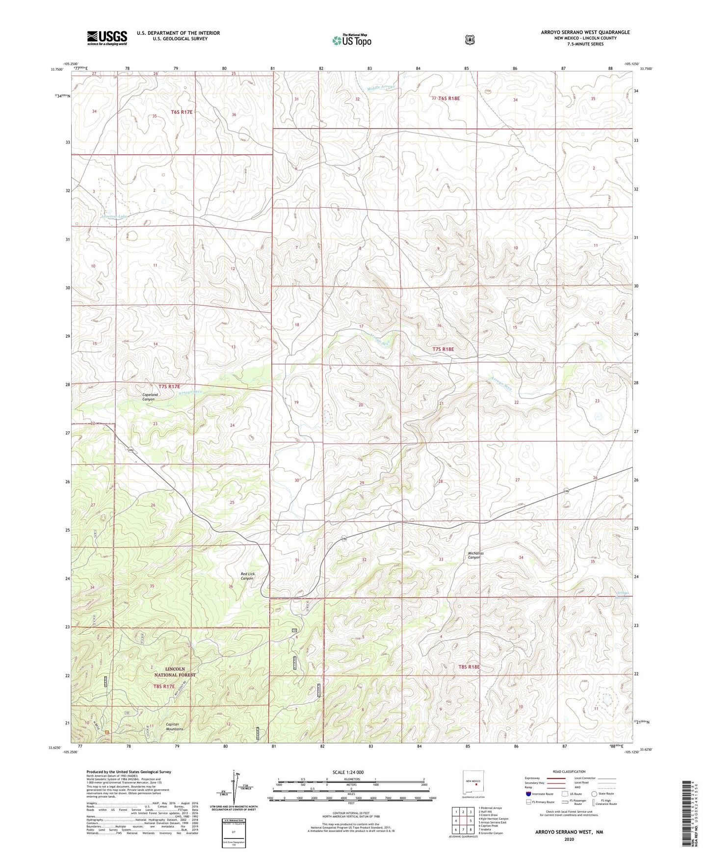
Arroyo Serrano West New Mexico US Topo Map
Couldn't load pickup availability
Also explore the Arroyo Serrano West Forest Service Topo of this same quad for updated USFS data
2023 topographic map quadrangle Arroyo Serrano West in the state of New Mexico. Scale: 1:24000. Based on the newly updated USGS 7.5' US Topo map series, this map is in the following counties: Lincoln. The map contains contour data, water features, and other items you are used to seeing on USGS maps, but also has updated roads and other features. This is the next generation of topographic maps. Printed on high-quality waterproof paper with UV fade-resistant inks.
Quads adjacent to this one:
West: Kyle Harrison Canyon
Northwest: Pedernal Arroyo
North: Huff Hill
Northeast: Cistern Draw
East: Arroyo Serrano East
Southeast: Granville Canyon
South: Arabela
Southwest: Capitan Peak
This map covers the same area as the classic USGS quad with code o33105f2.
Contains the following named places: Ajax Mine, Armstrong Ranch, Brills Ranch, Brills Upper Ranch, Copeland Canyon, Lonetree Lake, Lowes Ranch, Major Mine, Michallas Canyon, Oslo Mine, Plainview School, Purcella Ranch, Red Lick Canyon, Red Wing Number Four Mine, Red Wing Number Three Mine, Roberts Ranch, Smoot Pit