MyTopo
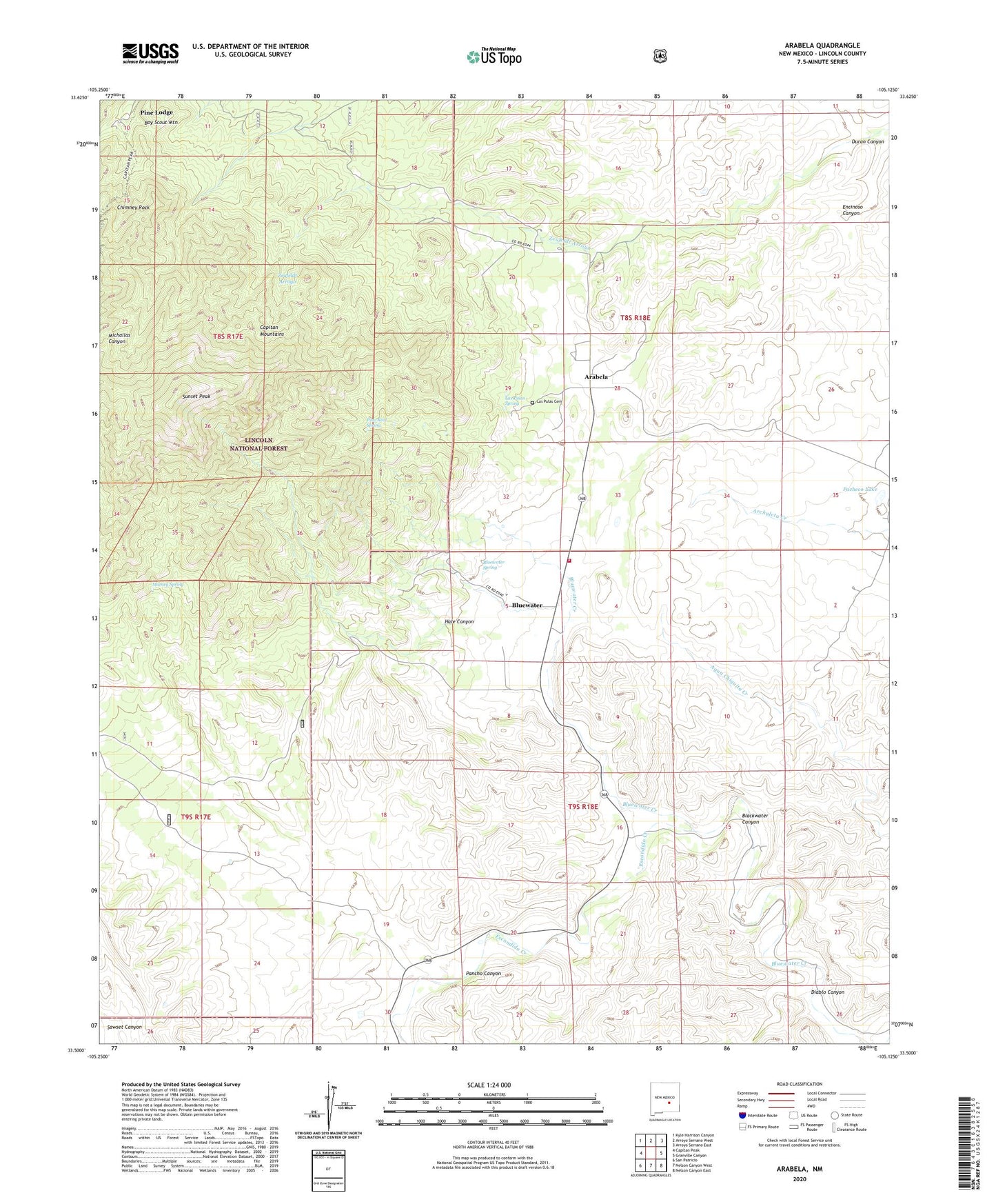
Arabela New Mexico US Topo Map
Couldn't load pickup availability
Also explore the Arabela Forest Service Topo of this same quad for updated USFS data
2023 topographic map quadrangle Arabela in the state of New Mexico. Scale: 1:24000. Based on the newly updated USGS 7.5' US Topo map series, this map is in the following counties: Lincoln. The map contains contour data, water features, and other items you are used to seeing on USGS maps, but also has updated roads and other features. This is the next generation of topographic maps. Printed on high-quality waterproof paper with UV fade-resistant inks.
Quads adjacent to this one:
West: Capitan Peak
Northwest: Kyle Harrison Canyon
North: Arroyo Serrano West
Northeast: Arroyo Serrano East
East: Granville Canyon
Southeast: Nelson Canyon East
South: Nelson Canyon West
Southwest: San Patricio
This map covers the same area as the classic USGS quad with code o33105e2.
Contains the following named places: 10133 Water Well, Arabela, Arabela Fire Department, Arabela Mines Incorporated Prospect, Arabela Post Office, Arabela Weather Station, Bluewater, Bluewater Elementary School, Bluewater Spring, Boy Scout Mountain, Chimney Rock, Diablo Canyon, Duran Canyon, Encinoso Canyon, Escondido Creek, Hale Canyon, Las Palas Cemetery, Las Palas Spring, Matney Spring, Pacheco Lake, Pancho Canyon, Pine Lodge, Pine Lodge Post Office, Pino Real Spring, Sunset Peak, Whitaker Ranch