
MyTopo
Sheridan Canyon New Mexico US Topo Map
Couldn't load pickup availability
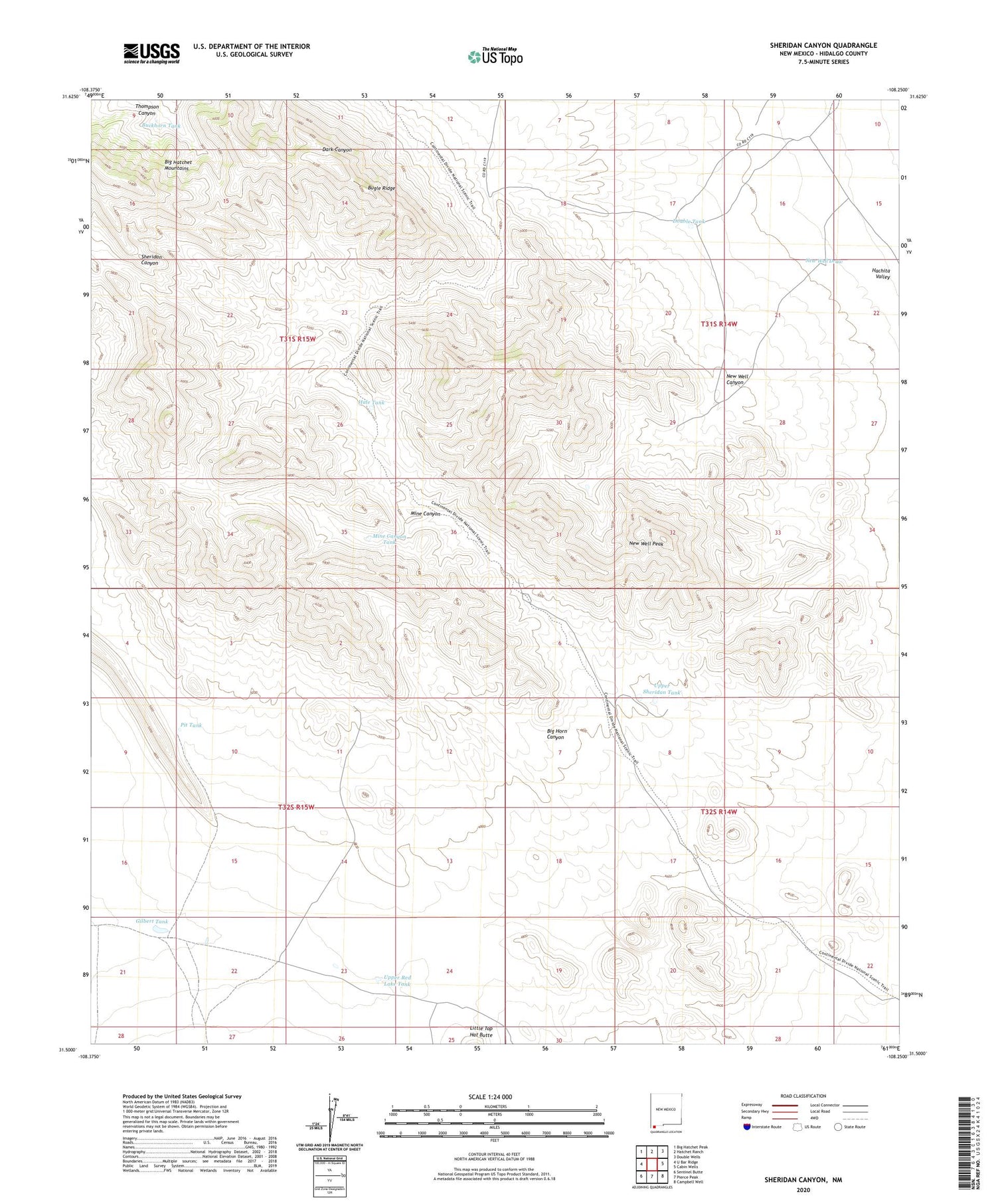
2023 topographic map quadrangle Sheridan Canyon in the state of New Mexico. Scale: 1:24000. Based on the newly updated USGS 7.5' US Topo map series, this map is in the following counties: Hidalgo. The map contains contour data, water features, and other items you are used to seeing on USGS maps, but also has updated roads and other features. This is the next generation of topographic maps. Printed on high-quality waterproof paper with UV fade-resistant inks.
Quads adjacent to this one:
West: U Bar Ridge
Northwest: Big Hatchet Peak
North: Hatchet Ranch
Northeast: Double Wells
East: Cabin Wells
Southeast: Campbell Well
South: Pierce Peak
Southwest: Sentinel Butte
This map covers the same area as the classic USGS quad with code o31108e3.
Contains the following named places: Big Hatchet Mountains, Big Horn Canyon, Buckhorn Tank, Bugle Ridge, Carbonate Group, Double Tank, Gilbert Tank, Hale Tank, Hell to Finish Tank, Hell to Get to Tank, Lead Queen, Mine Canyon, Mine Canyon Tank, New Well Canyon, New Well Draw, New Well Peak, Pit Tank, Red Lake Tank, Sheridan Tank, Sheridan Wells, Upper Red Lake Tank, Upper Sheridan Tank, ZIP Code: 88040


