MyTopo
Bluewater New Mexico US Topo Map
Couldn't load pickup availability
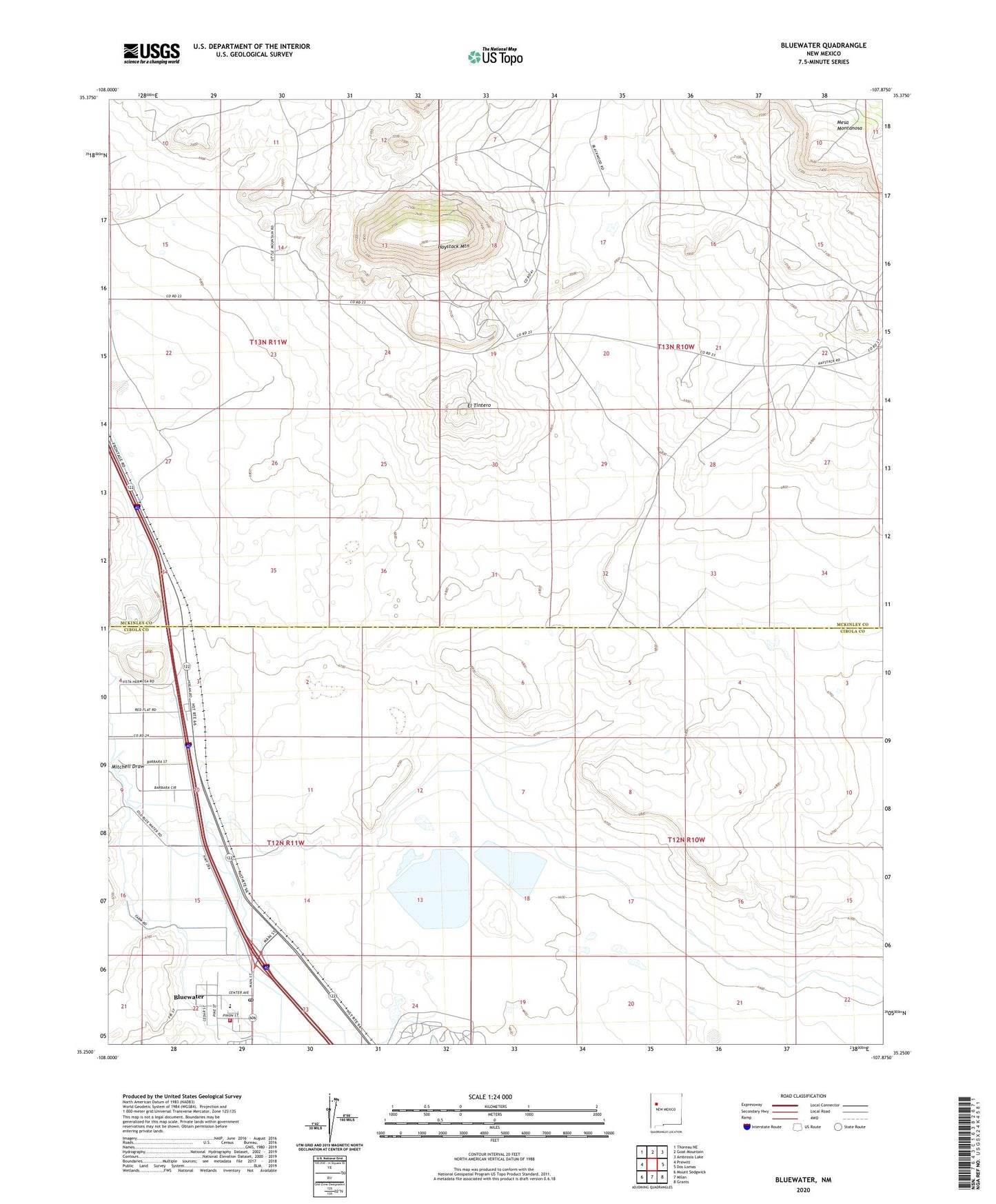
2023 topographic map quadrangle Bluewater in the state of New Mexico. Scale: 1:24000. Based on the newly updated USGS 7.5' US Topo map series, this map is in the following counties: Cibola, McKinley. The map contains contour data, water features, and other items you are used to seeing on USGS maps, but also has updated roads and other features. This is the next generation of topographic maps. Printed on high-quality waterproof paper with UV fade-resistant inks.
Quads adjacent to this one:
West: Prewitt
Northwest: Thoreau NE
North: Goat Mountain
Northeast: Ambrosia Lake
East: Dos Lomas
Southeast: Grants
South: Milan
Southwest: Mount Sedgwick
This map covers the same area as the classic USGS quad with code o35107c8.
Contains the following named places: 10088 Water Well, 10090 Water Well, 10091 Water Well, 10092 Water Well, 10098 Water Well, 10099 Water Well, 16T-552 Water Well, 87005, Anaconda Bluewater Mill, Baca Chapter, Bluewater, Bluewater Creek, Bluewater Post Office, Bluewater Siding, Bluewater Village Fire Department, East Ditch, El Tintero, Elkins Prewitt Pit, Federal Mine, Haystack Census Designated Place, Haystack Mine, Haystack Mountain, Haystack Open Pit, Haystack Underground Mine, Hoskins and Robinson Pit, Main Ditch, Mesa Montanosa, Mitchell Draw, Prop Canyon Site One Dam, Tchalchuitl Mines Historic Site, Uranium Deposit, Uranium Prospects