MyTopo
Thoreau NE New Mexico US Topo Map
Couldn't load pickup availability
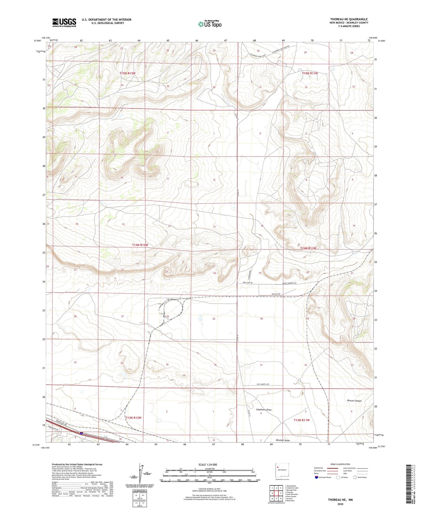
2023 topographic map quadrangle Thoreau NE in the state of New Mexico. Scale: 1:24000. Based on the newly updated USGS 7.5' US Topo map series, this map is in the following counties: McKinley. The map contains contour data, water features, and other items you are used to seeing on USGS maps, but also has updated roads and other features. This is the next generation of topographic maps. Printed on high-quality waterproof paper with UV fade-resistant inks.
Quads adjacent to this one:
West: Thoreau
Northwest: Hosta Butte
North: Casamero Lake
Northeast: Borrego Pass
East: Goat Mountain
Southeast: Bluewater
South: Prewitt
Southwest: Pine Canyon
This map covers the same area as the classic USGS quad with code o35108d1.
Contains the following named places: Andrews Ranch, Casamero Draw, Elkins Ranch, Elkins Thoreau Pit Number 3, Evelyn mine, Francis, Glenn and Edith Mine, Glover Claim, Haystack Butte District Mine, Marinelli Pit, Mine Number Five, Moe Mine, Red Rock Ranch, Red Rock Ranch Census Designated Place, Rincon Canyon, Tom Elkins Mine, Uranium Deposit, Yucca Number Two Mine