MyTopo
Goat Mountain New Mexico US Topo Map
Couldn't load pickup availability
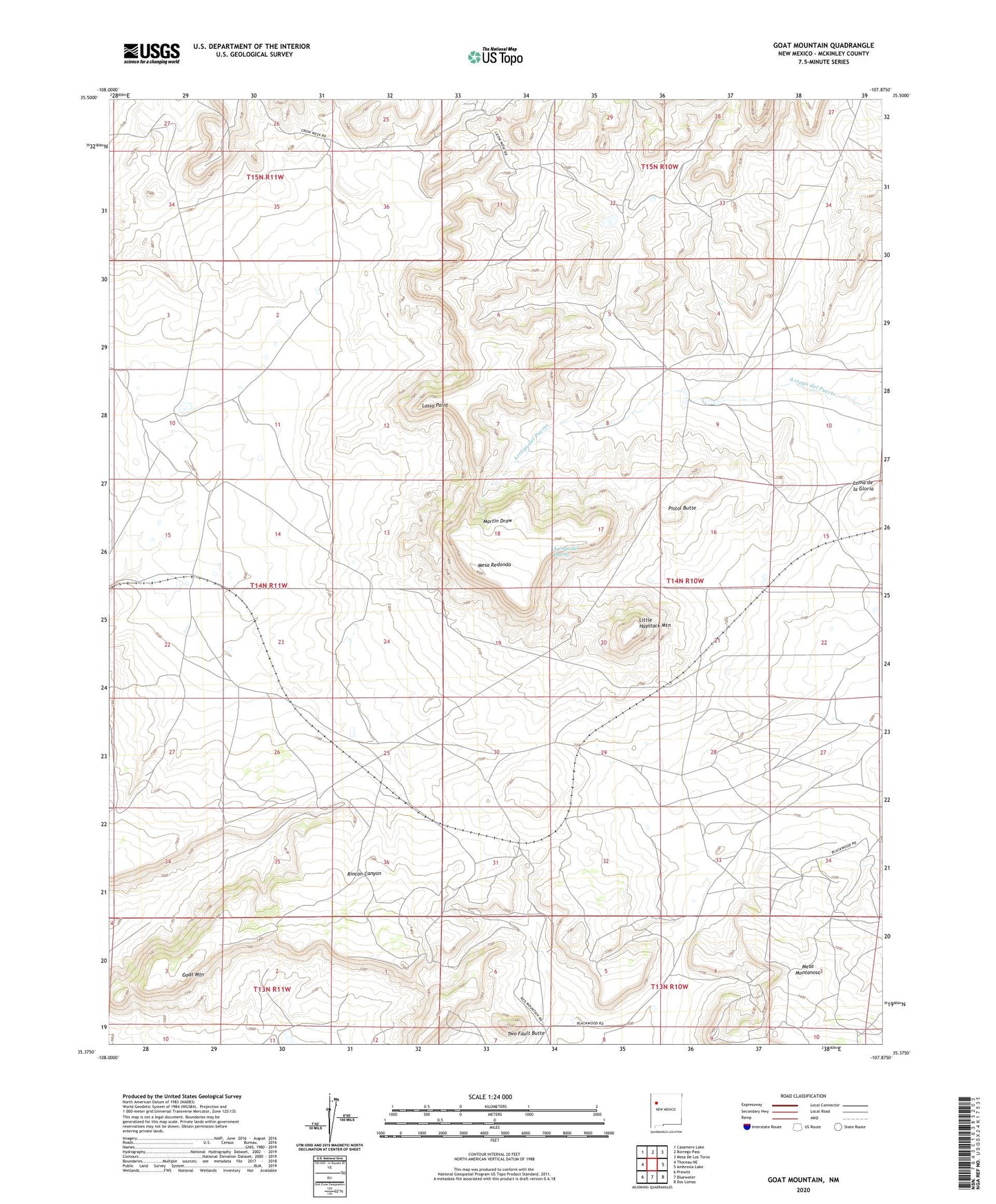
2023 topographic map quadrangle Goat Mountain in the state of New Mexico. Scale: 1:24000. Based on the newly updated USGS 7.5' US Topo map series, this map is in the following counties: McKinley. The map contains contour data, water features, and other items you are used to seeing on USGS maps, but also has updated roads and other features. This is the next generation of topographic maps. Printed on high-quality waterproof paper with UV fade-resistant inks.
Quads adjacent to this one:
West: Thoreau NE
Northwest: Casamero Lake
North: Borrego Pass
Northeast: Mesa De Los Toros
East: Ambrosia Lake
Southeast: Dos Lomas
South: Bluewater
Southwest: Prewitt
This map covers the same area as the classic USGS quad with code o35107d8.
Contains the following named places: Berryhill Ranch, Dakota Mine, Febco Tunnel Number 1, Goat Mountain, Homestake-Sapin Mine Number 15, Junior Mine, Kermac Mine Number 22, Kermac Number 10 Mine, Kerr-Mac Water Well, Lassa Point, Little Haystack Mountain, Martinez Mine, Mesa Redonda, Navarre Ranch, Nite Group, Pistol Butte, Silver Spur Mine, Two Fault Butte, Willcoxson Ranch