MyTopo
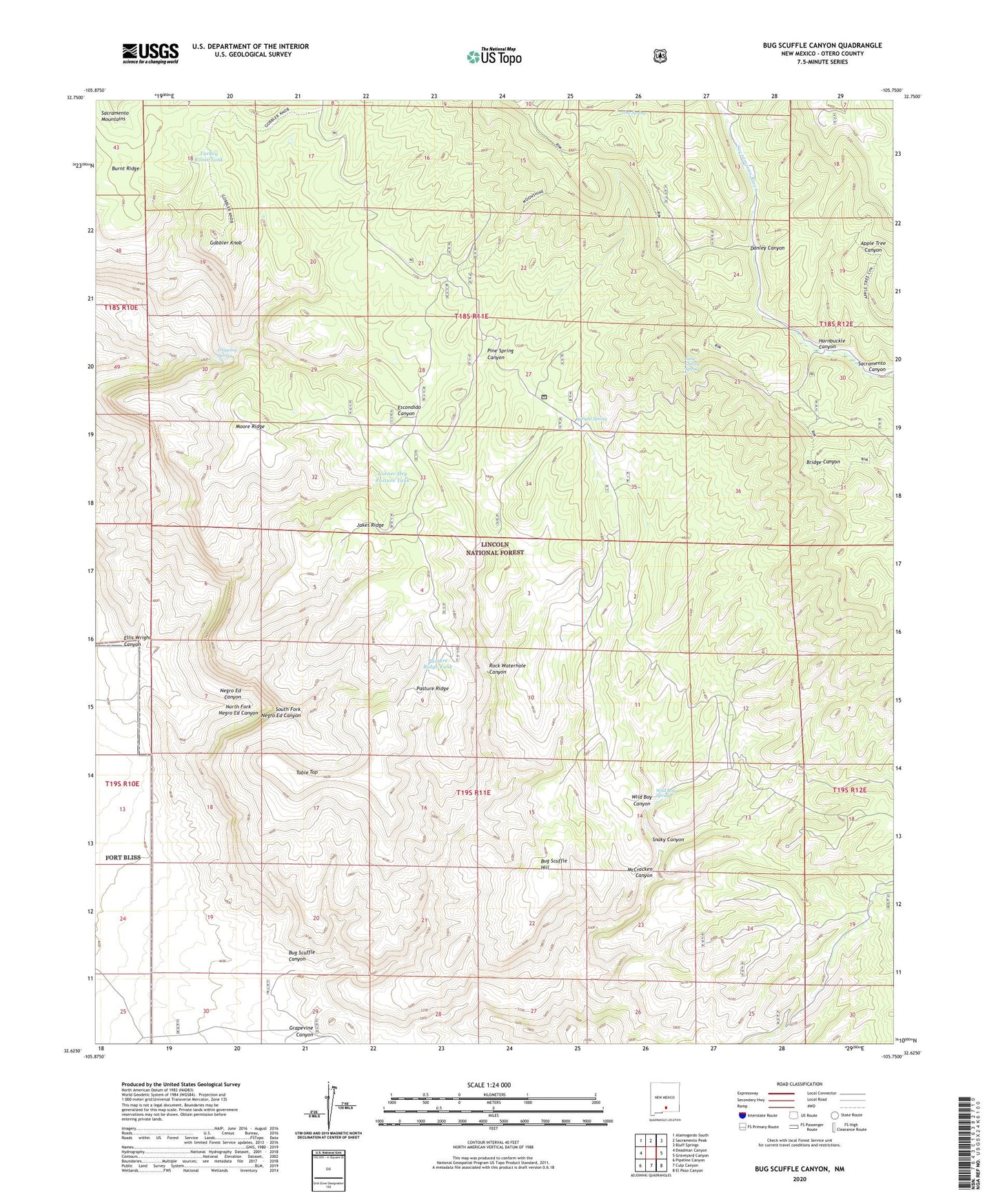
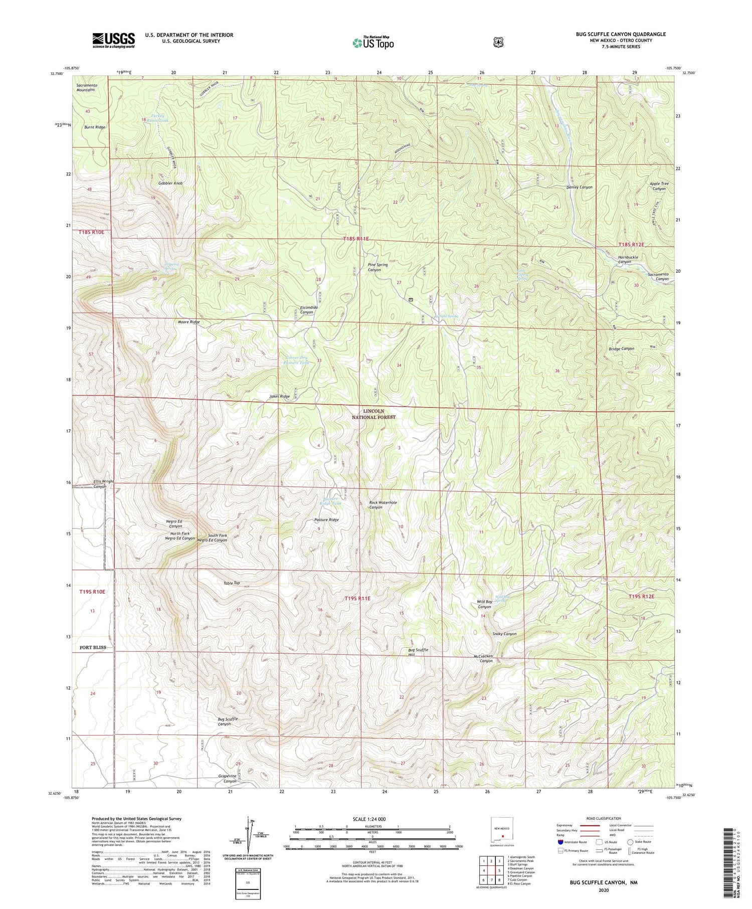
Bug Scuffle Canyon New Mexico US Topo Map
Couldn't load pickup availability
Also explore the Bug Scuffle Canyon Forest Service Topo of this same quad for updated USFS data
2023 topographic map quadrangle Bug Scuffle Canyon in the state of New Mexico. Scale: 1:24000. Based on the newly updated USGS 7.5' US Topo map series, this map is in the following counties: Otero. The map contains contour data, water features, and other items you are used to seeing on USGS maps, but also has updated roads and other features. This is the next generation of topographic maps. Printed on high-quality waterproof paper with UV fade-resistant inks.
Quads adjacent to this one:
West: Deadman Canyon
Northwest: Alamogordo South
North: Sacramento Peak
Northeast: Bluff Springs
East: Graveyard Canyon
Southeast: El Paso Canyon
South: Culp Canyon
Southwest: Pipeline Canyon
This map covers the same area as the classic USGS quad with code o32105f7.
Contains the following named places: Bug Scuffle Canyon, Bug Scuffle Hill, Bug Scuffle Ranch, Burnt Ridge, Corner Dry Pasture Tank, Danley Canyon, Dripping Spring, Ellis Wright Canyon, Gobbler Knob, Grapevine Canyon, Hornbuckle Canyon, Jake Tank, Jakes Ridge, Little Cherry Spring, McCracken Canyon, Moore Ridge, Moore Tank, Negro Ed Canyon, North Fork Negro Ed Canyon, Pasture Ridge, Pasture Ridge Tank, Pine Spring, Pine Spring Canyon, Rock Waterhole Canyon, Sacramento Lookout Tower, Sacramento Side Camp, Snaky Canyon, South Fork Negro Ed Canyon, Table Top, Turkey Roost Tank, Wild Boy Canyon, Wild Boy Spring, Wright Spring