MyTopo
Alamogordo South New Mexico US Topo Map
Couldn't load pickup availability
Also explore the Alamogordo South Forest Service Topo of this same quad for updated USFS data
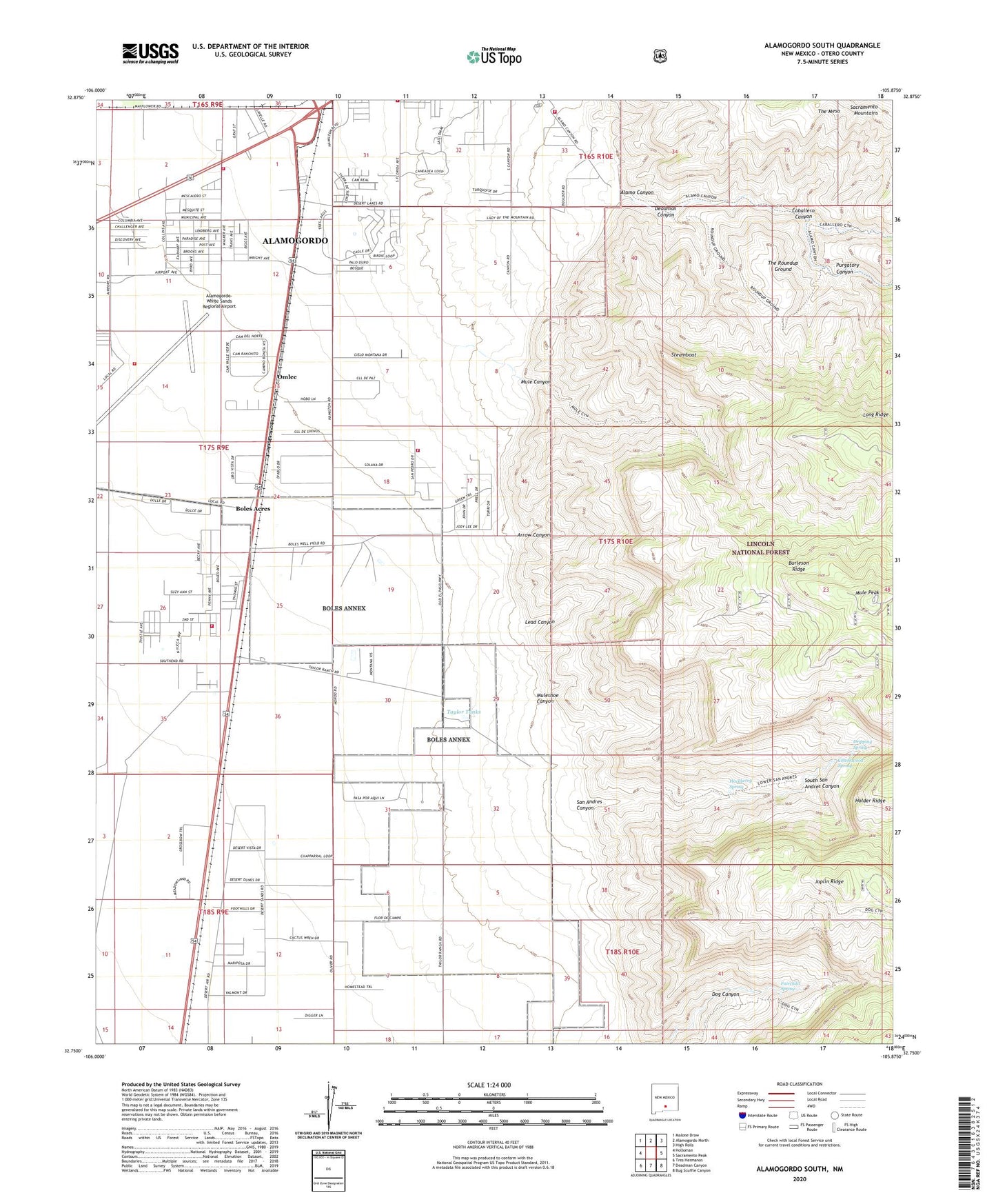
2023 topographic map quadrangle Alamogordo South in the state of New Mexico. Scale: 1:24000. Based on the newly updated USGS 7.5' US Topo map series, this map is in the following counties: Otero. The map contains contour data, water features, and other items you are used to seeing on USGS maps, but also has updated roads and other features. This is the next generation of topographic maps. Printed on high-quality waterproof paper with UV fade-resistant inks.
Quads adjacent to this one:
West: Holloman
Northwest: Malone Draw
North: Alamogordo North
Northeast: High Rolls
East: Sacramento Peak
Southeast: Bug Scuffle Canyon
South: Deadman Canyon
Southwest: Tres Hermanos
This map covers the same area as the classic USGS quad with code o32105g8.
Contains the following named places: 10047 Water Well, 10050 Water Well, 10051 Water Well, 10053 Water Well, 10054 Water Well, 10055 Water Well, 10171 Water Well, 10618 Water Well, 10619 Water Well, 88311, Alamo Canyon, Alamo Midway Airport, Alamo Number Two Pit, Alamogordo Fire Department - Station 3, Alamogordo Fire Department Station 2, Alamogordo Fire Department Station 5, Alamogordo-White Sands Regional Airport, Arrow Canyon, Boles Acres, Boles Acres Census Designated Place, Boles Acres Volunteer Fire Department, Burleson Ridge, Caballero Canyon, Cottonwood Spring, Deadman Canyon, Dripping Spring, Fairchild Spring, Field Number 32 Water Well, Hackberry Spring, Joplin Ridge, KINN-FM (Alamogordo), Lead Canyon, Long Ridge, Long Ridge Electronic Site, Mule Canyon, Mule Peak, Muleshoe Canyon, Omlee, Oro Vista Volunteer Fire and Rescue, Oro Vista Volunteer Fire and Rescue Station 2, Prther Number 1 Water Well, Purgatory Canyon, San Andres Canyon, South San Andres Canyon, Steamboat, Taylor Tanks, The Mesa, The Roundup Ground