MyTopo
Graveyard Canyon New Mexico US Topo Map
Couldn't load pickup availability
Also explore the Graveyard Canyon Forest Service Topo of this same quad for updated USFS data
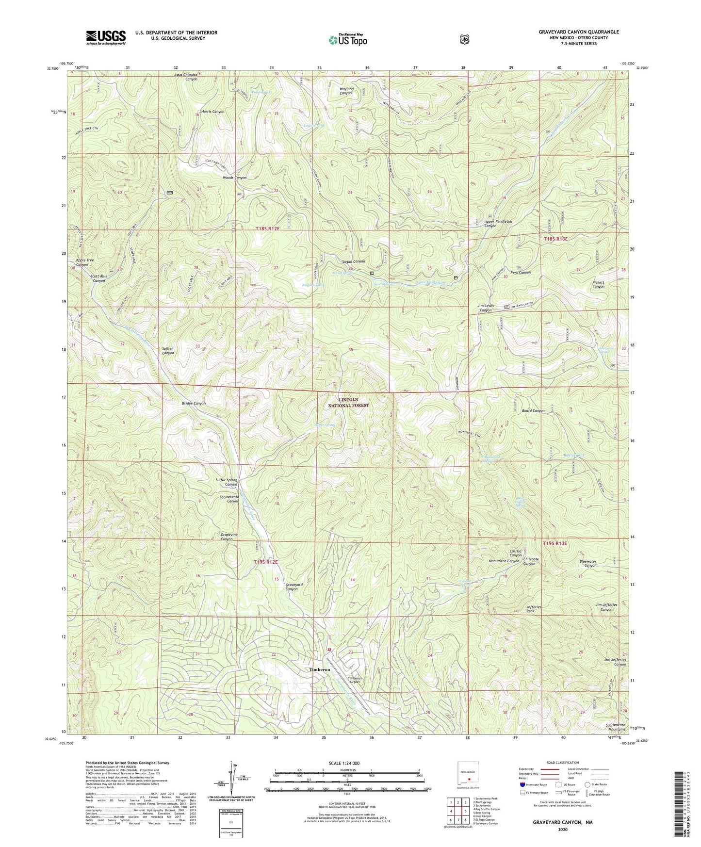
2023 topographic map quadrangle Graveyard Canyon in the state of New Mexico. Scale: 1:24000. Based on the newly updated USGS 7.5' US Topo map series, this map is in the following counties: Otero. The map contains contour data, water features, and other items you are used to seeing on USGS maps, but also has updated roads and other features. This is the next generation of topographic maps. Printed on high-quality waterproof paper with UV fade-resistant inks.
Quads adjacent to this one:
West: Bug Scuffle Canyon
Northwest: Sacramento Peak
North: Bluff Springs
Northeast: Sacramento
East: Bear Spring
Southeast: Surveyors Canyon
South: El Paso Canyon
Southwest: Culp Canyon
Contains the following named places: Apple Tree Canyon, Barrel Spring, Bear Wallow Spring, Board Tank, Bridge Canyon, Carrisa Spring, Chilcoote Canyon, Circle Cross Ranch, Crisp, Crisp Ranch, Fairchild Ranch, Four H Camp, Graveyard Canyon, Harris Canyon, Holcomb Ranch, Jefferies Peak, Jim Lewis Spring, Logan Canyon, Logan Tank, Monument Canyon, Monument Overlook, Monument Spring, Moss Ranch, Rogers Ruins, Rogers Tank, Sacramento Canyon, Sand Springs, Scott Able Canyon, Spiller Canyon, Sulfur Spring, Sulfur Spring Canyon, Timberon Airport, Timberon Census Designated Place, Timberon Lodge, Timberon Volunteer Fire Department Station 1, Timberon Volunteer Fire Department Station 2, Upper Pendleton Canyon, Wood Tank, Woods Canyon, ZIP Code: 88350