MyTopo
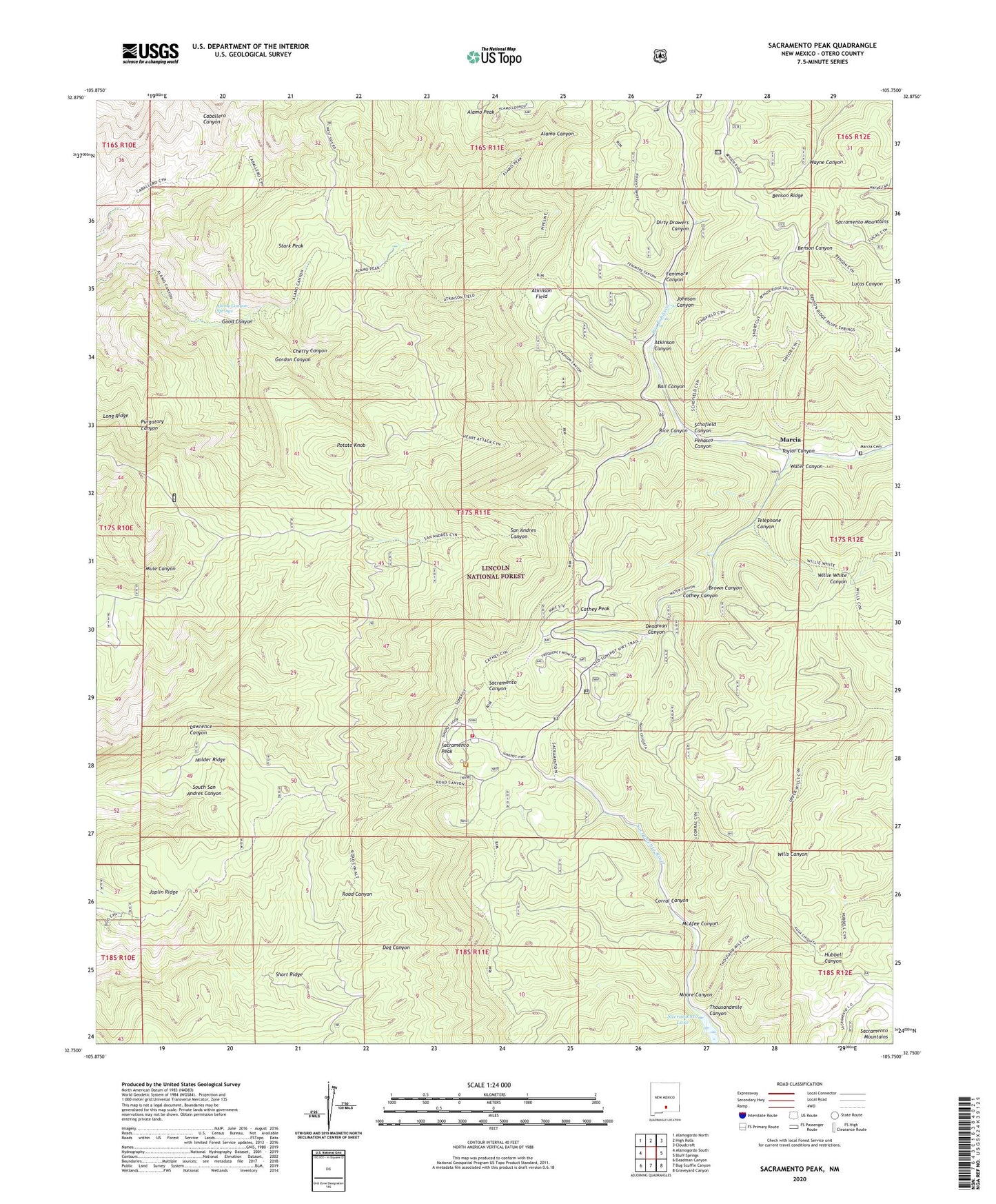
Sacramento Peak New Mexico US Topo Map
Couldn't load pickup availability
Also explore the Sacramento Peak Forest Service Topo of this same quad for updated USFS data
2023 topographic map quadrangle Sacramento Peak in the state of New Mexico. Scale: 1:24000. Based on the newly updated USGS 7.5' US Topo map series, this map is in the following counties: Otero. The map contains contour data, water features, and other items you are used to seeing on USGS maps, but also has updated roads and other features. This is the next generation of topographic maps. Printed on high-quality waterproof paper with UV fade-resistant inks.
Quads adjacent to this one:
West: Alamogordo South
Northwest: Alamogordo North
North: High Rolls
Northeast: Cloudcroft
East: Bluff Springs
Southeast: Graveyard Canyon
South: Bug Scuffle Canyon
Southwest: Deadman Canyon
This map covers the same area as the classic USGS quad with code o32105g7.
Contains the following named places: Ady, Alamo Canyon Springs, Alamo Lookout Tower, Alamo Peak, Apache Point Observatory, Atkinson Canyon, Atkinson Field, Ball Canyon, Brown Canyon, Cathey Canyon, Cathey Peak, Cathey Vista, Cherry Canyon, Corral Canyon, Deadman Canyon, Dirty Drawers Canyon, Fenimore Canyon, Good Canyon, Gordon Canyon, Holder Ridge, Johnson Canyon, Joplin Ridge, Lamalone Lodge, Lawrence Canyon, Marcia, Marcia Cemetery, Marcia Post Office, McAfee Canyon, Moore Canyon, Mountain Laboratory, Penasco Canyon, Potato Knob, Rice Canyon, Road Canyon, Sacramento Lake, Sacramento Peak, Schofield Canyon, Short Ridge, Stark Peak, Sunspot, Sunspot Post Office, Sunspot Volunteer Fire Department, Taylor Canyon, Telephone Canyon, Thousandmile Canyon, Water Canyon, Well Number One, Well Number Two, ZIP Codes: 88325, 88349