MyTopo
Deadman Canyon New Mexico US Topo Map
Couldn't load pickup availability
Also explore the Deadman Canyon Forest Service Topo of this same quad for updated USFS data
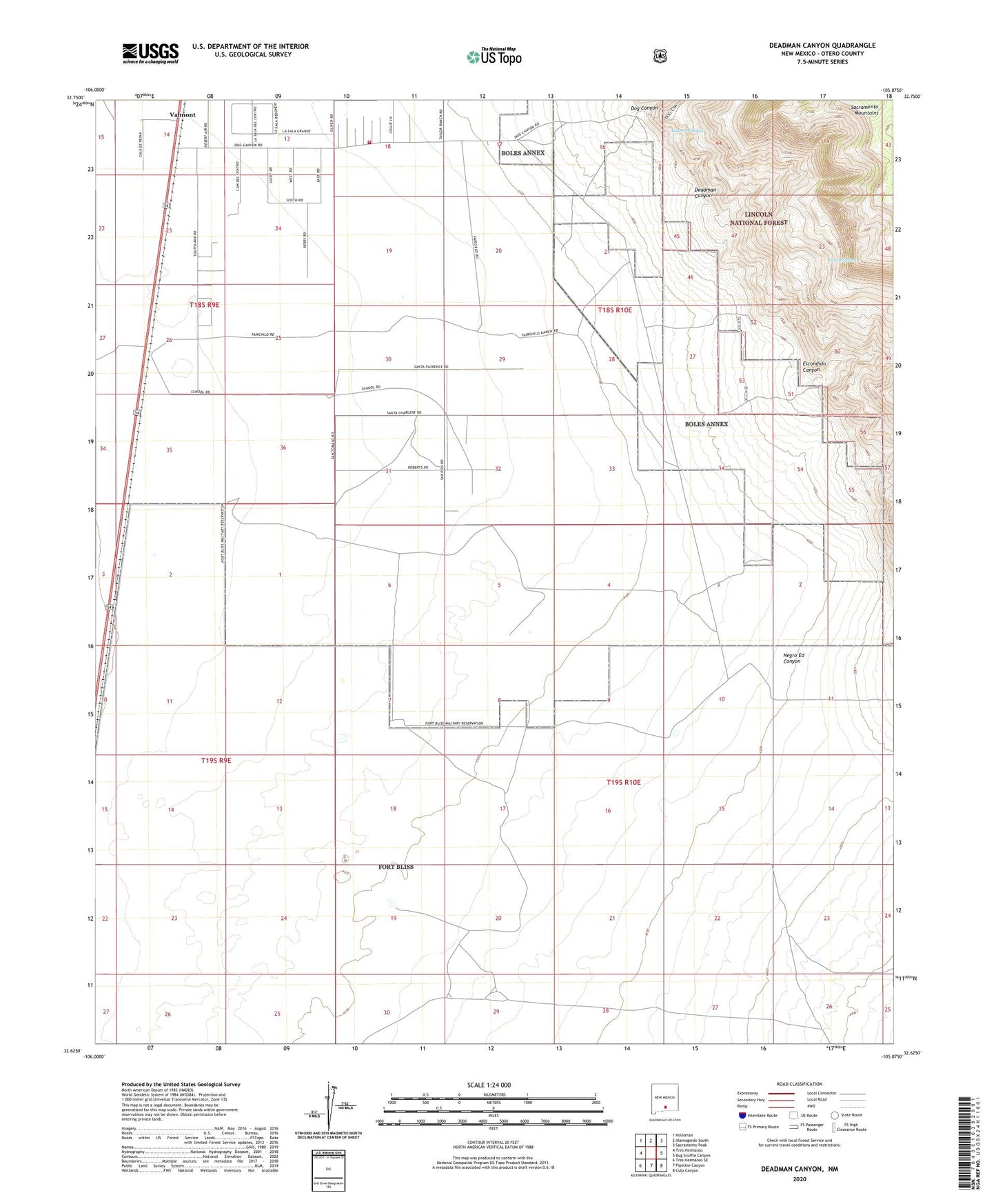
2023 topographic map quadrangle Deadman Canyon in the state of New Mexico. Scale: 1:24000. Based on the newly updated USGS 7.5' US Topo map series, this map is in the following counties: Otero. The map contains contour data, water features, and other items you are used to seeing on USGS maps, but also has updated roads and other features. This is the next generation of topographic maps. Printed on high-quality waterproof paper with UV fade-resistant inks.
Quads adjacent to this one:
West: Tres Hermanos
Northwest: Holloman
North: Alamogordo South
Northeast: Sacramento Peak
East: Bug Scuffle Canyon
Southeast: Culp Canyon
South: Pipeline Canyon
Southwest: Tres Hermanos SE
This map covers the same area as the classic USGS quad with code o32105f8.
Contains the following named places: Boles Acres Volunteer Fire Department Dog Canyon Road Station, Deadman Canyon, Dog Canyon, Dog Canyon Estates, Dunes, Escondido Canyon, Fairchild Well, Fish Tank, Laney Spring, Langford Windmill, Lawson Spring, Oliver Lee Campground, Oliver Lee State Park, Sacramento City, Sand Tank, Tony Tank, Valmont, Valmont Post Office