MyTopo
Bull Canyon New Mexico US Topo Map
Couldn't load pickup availability
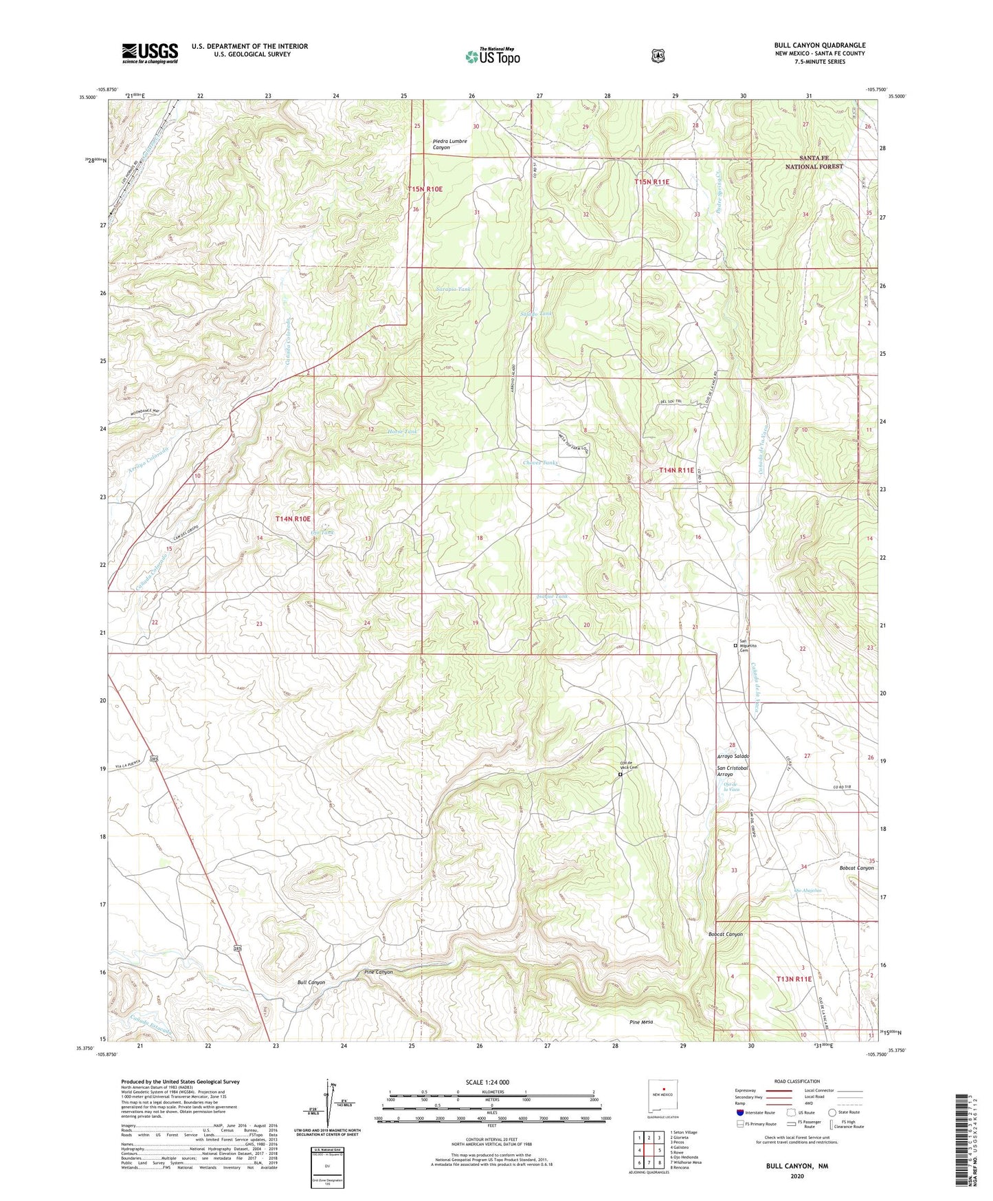
2020 topographic map quadrangle Bull Canyon in the state of New Mexico. Scale: 1:24000. Based on the newly updated USGS 7.5' US Topo map series, this map is in the following counties: Santa Fe. The map contains contour data, water features, and other items you are used to seeing on USGS maps, but also has updated roads and other features. This is the next generation of topographic maps. Printed on high-quality waterproof paper with UV fade-resistant inks.
Quads adjacent to this one:
West: Galisteo
Northwest: Seton Village
North: Glorieta
Northeast: Pecos
East: Rowe
Southeast: Rencona
South: Wildhorse Mesa
Southwest: Ojo Hedionda
Contains the following named places: Arroyo Salado, Bar S Ranch, Bishop John Lamy Grant, Bobcat Canyon, Bull Canyon, Bull Canyon Well, Bull Canyon Windmill, Canada Colorado, Canada de la Vaca, Chavez Tanks, Cow Spring Water Well, Cow Spring Well, Cow Spring Windmill, Elsie Well, Elsie Windmill, Horse Tank, Isaque Tank, Ojo Abajenos, Ojo de la Vaca, Ojo de la Vaca Windmill, Ojo de Vaca Cemetery, Ojo Tank, Ortega Creek, Padre Spring Creek, Piedra Lumbre Windmill, Pine Canyon, Pueblo San Cristoval, Salado Tank, San Miguelito Cemetery, Sarapio Tank, Water Well 10207