MyTopo
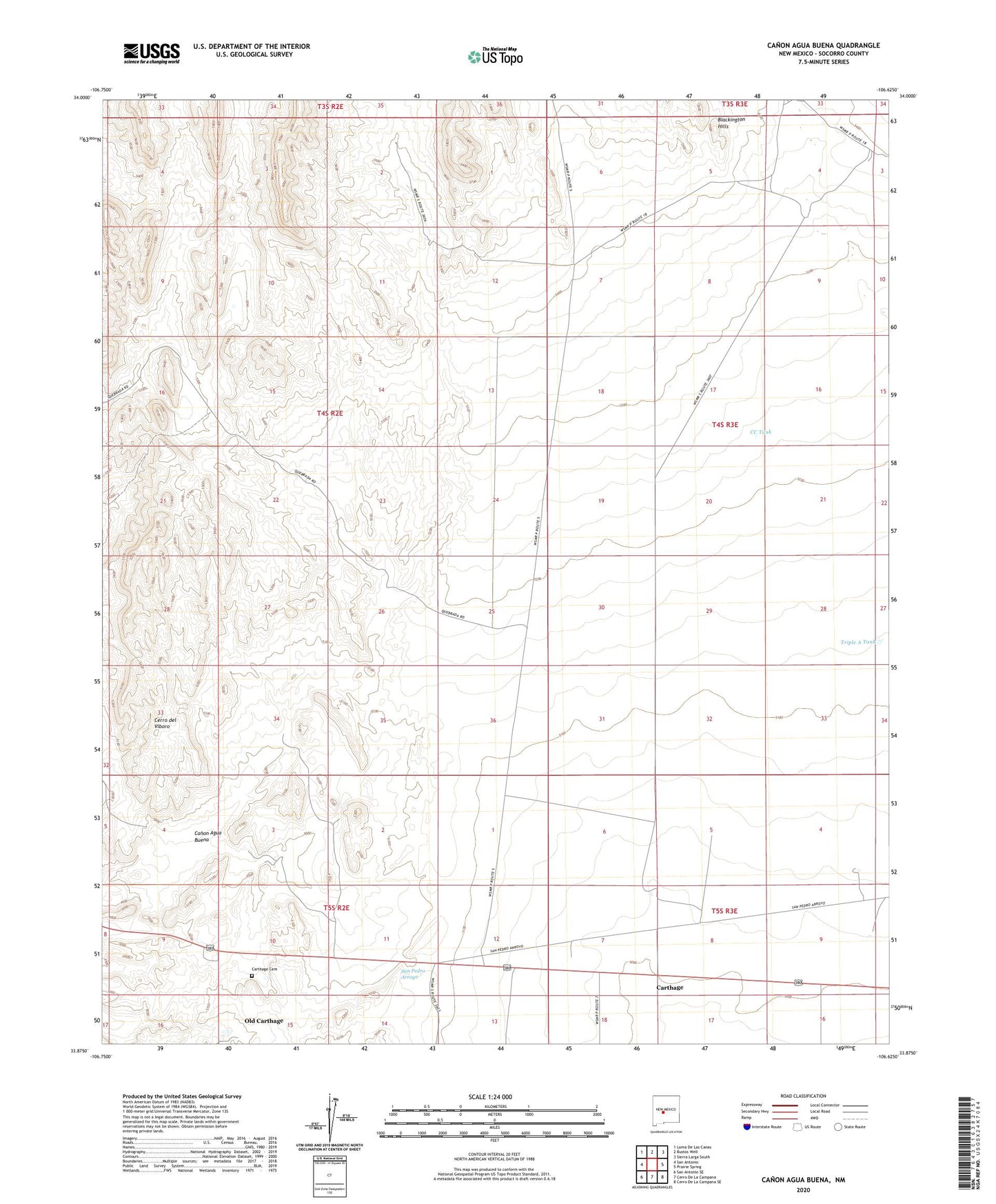
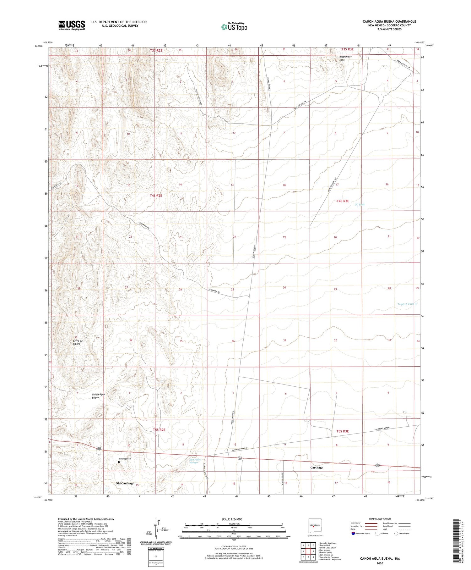
Canon Agua Buena New Mexico US Topo Map
Couldn't load pickup availability
2023 topographic map quadrangle Canon Agua Buena in the state of New Mexico. Scale: 1:24000. Based on the newly updated USGS 7.5' US Topo map series, this map is in the following counties: Socorro. The map contains contour data, water features, and other items you are used to seeing on USGS maps, but also has updated roads and other features. This is the next generation of topographic maps. Printed on high-quality waterproof paper with UV fade-resistant inks.
Quads adjacent to this one:
West: San Antonio
Northwest: Loma De Las Canas
North: Bustos Well
Northeast: Sierra Larga South
East: Prairie Spring
Southeast: Cerro De La Campana SE
South: Cerro De La Campana
Southwest: San Antonio SE
This map covers the same area as the classic USGS quad with code o33106h6.
Contains the following named places: Araya Well, Blackington Hills, Canon Agua Buena, Carthage, Carthage Cemetery, Carthage Post Office, CC Tank, Cerro del Viboro, Del Curto Ranch, Fernandez Ranch, Gonzales Well, Hart Coal Mine, Hart Mine, Law Mine, Muncy Ranch, Old Carthage, Padilla Ranch, Ranchito Windmill, Taylor Tank, Triple A Tank