MyTopo
San Antonio New Mexico US Topo Map
Couldn't load pickup availability
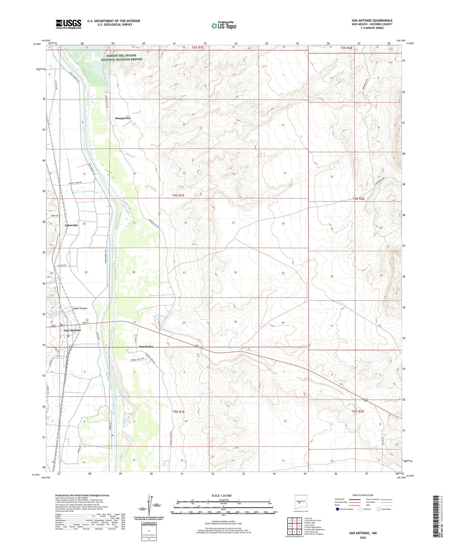
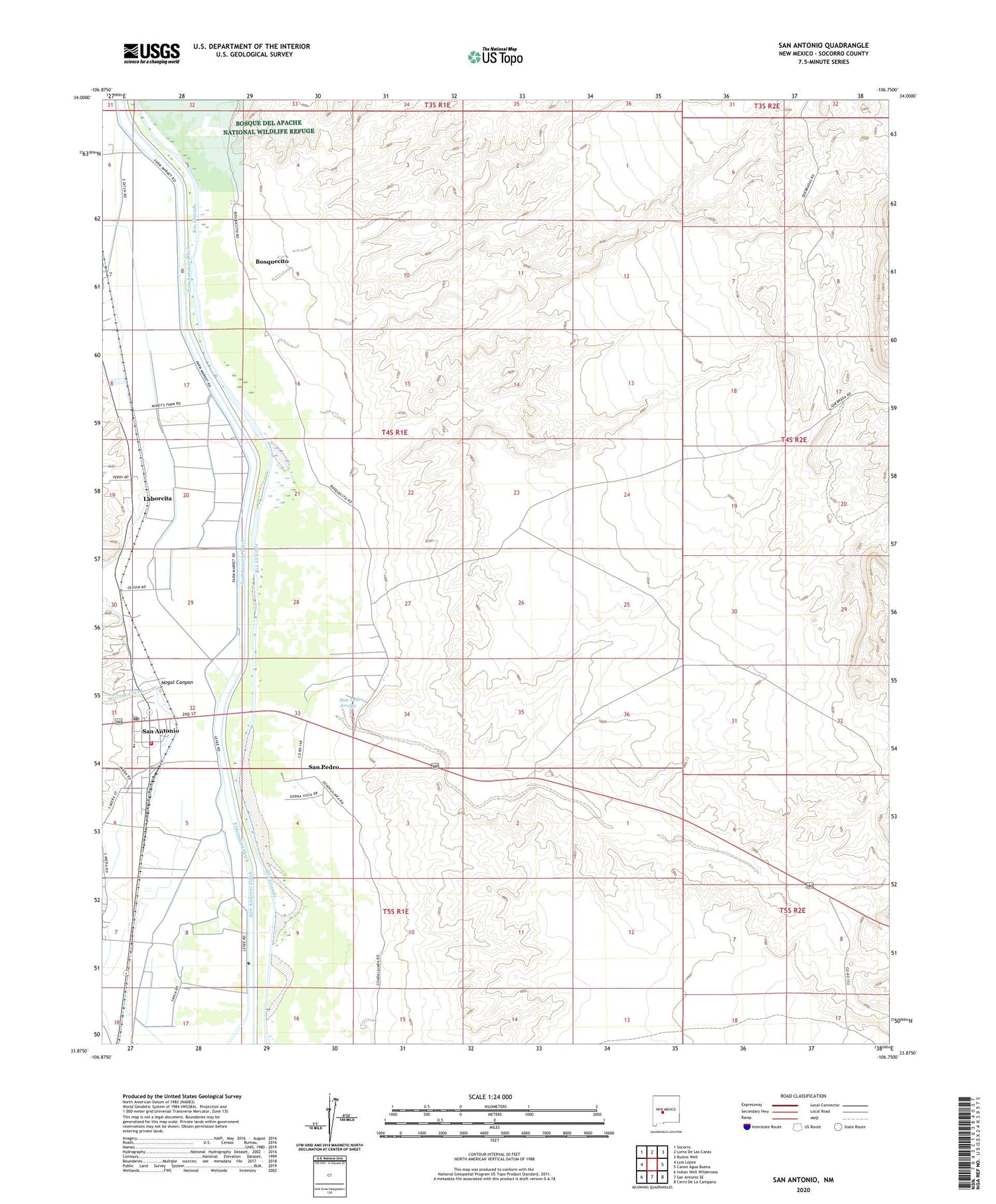
2023 topographic map quadrangle San Antonio in the state of New Mexico. Scale: 1:24000. Based on the newly updated USGS 7.5' US Topo map series, this map is in the following counties: Socorro. The map contains contour data, water features, and other items you are used to seeing on USGS maps, but also has updated roads and other features. This is the next generation of topographic maps. Printed on high-quality waterproof paper with UV fade-resistant inks.
Quads adjacent to this one:
West: Luis Lopez
Northwest: Socorro
North: Loma De Las Canas
Northeast: Bustos Well
East: Canon Agua Buena
Southeast: Cerro De La Campana
South: San Antonio SE
Southwest: Indian Well Wilderness
This map covers the same area as the classic USGS quad with code o33106h7.
Contains the following named places: Bosquecito, Carthage Tokay Farley Historical Marker, Duncan Farms, Espaejos Expedition on the Camino Real Historical Marker, Eutimio Montoyo House, Fort Craig Historical Marker, Fort Craig Rest Area Historical Marker, Gallegos Well, Laborcita, Mesa de Contadero Historical Marker, Miera-Baca House Historic Site, O Six Windmill, Padilla Ranch, Padilla Well, Ray Hunter Ranch, San Antonio, San Antonio Census Designated Place, San Antonio de Acuinas Mission, San Antonio Ditch, San Antonio Fire and Rescue, San Antonio on the Camino Real Historic Marker, San Antonio Post Office, San Antonito, San Pedro, San Pedro Arroyo, Tony, Valverde Battlefield Historical Marker, Vasquez de Coronados Route Historical Marker, Vigil Brothers Well, Walnut Creek