MyTopo
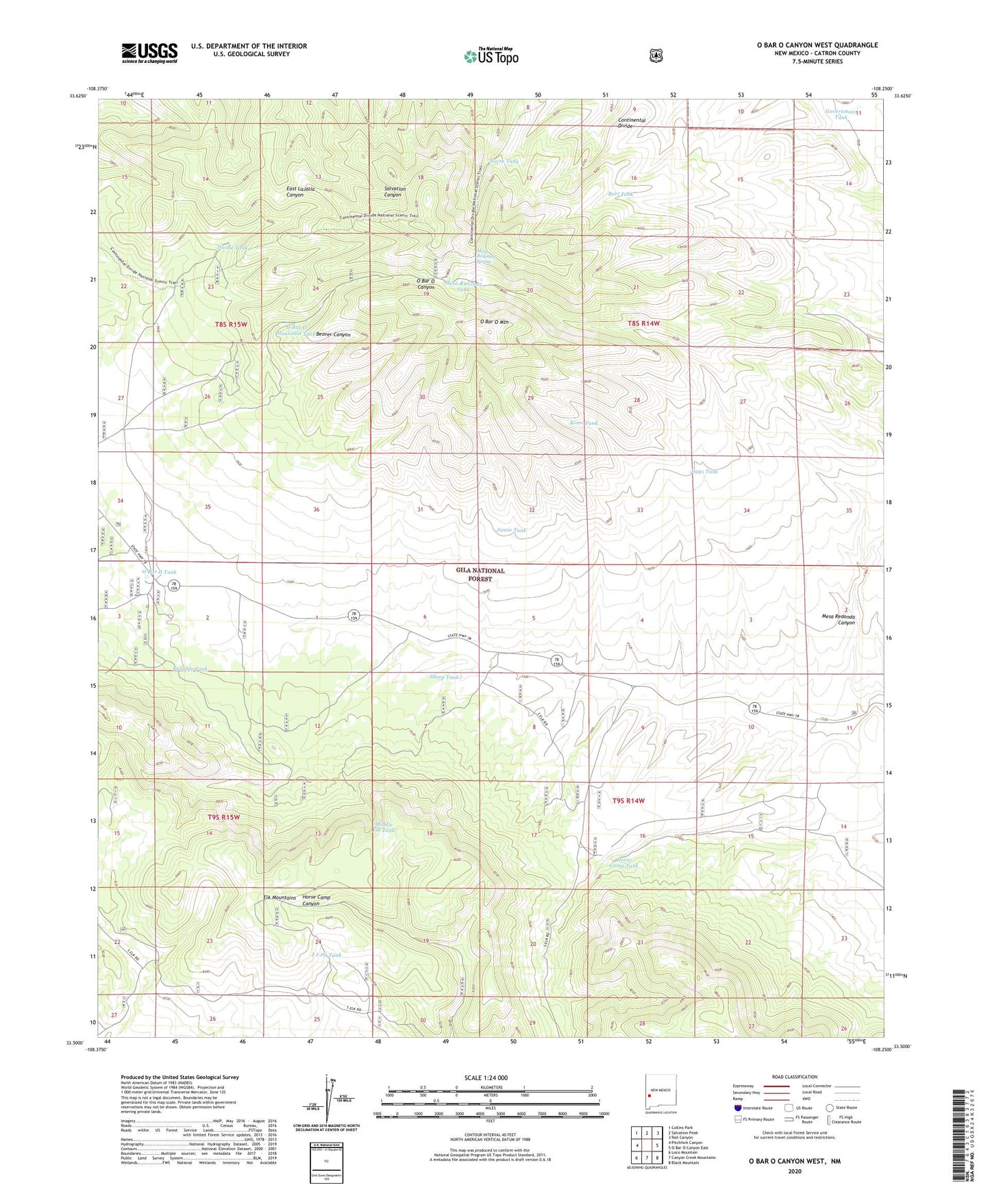
O Bar O Canyon West New Mexico US Topo Map
Couldn't load pickup availability
Also explore the O Bar O Canyon West Forest Service Topo of this same quad for updated USFS data
2023 topographic map quadrangle O Bar O Canyon West in the state of New Mexico. Scale: 1:24000. Based on the newly updated USGS 7.5' US Topo map series, this map is in the following counties: Catron. The map contains contour data, water features, and other items you are used to seeing on USGS maps, but also has updated roads and other features. This is the next generation of topographic maps. Printed on high-quality waterproof paper with UV fade-resistant inks.
Quads adjacent to this one:
West: Pitchfork Canyon
Northwest: Collins Park
North: Salvation Peak
Northeast: Rail Canyon
East: O Bar O Canyon East
Southeast: Black Mountain
South: Canyon Creek Mountains
Southwest: Loco Mountain
This map covers the same area as the classic USGS quad with code o33108e3.
Contains the following named places: Brushy Tank, Burl Tank, Continental Divide National Scenic Trail, Deer Tank, Divide Tank, Government Tank, Horse Camp Tank, J J Pit Tank, Jamie Tank, Jiggs Tank, Kimo Tank, Mesa Redonda Canyon, Mesa Redonda Spring, Mesa Redonda Tank, Middle Elk Tank, North Tank, O Bar O Mountain, O Bar O Mountain Tank, O Bar O Tank, Reliable Tank, Sheep Tank, Water Well Tank